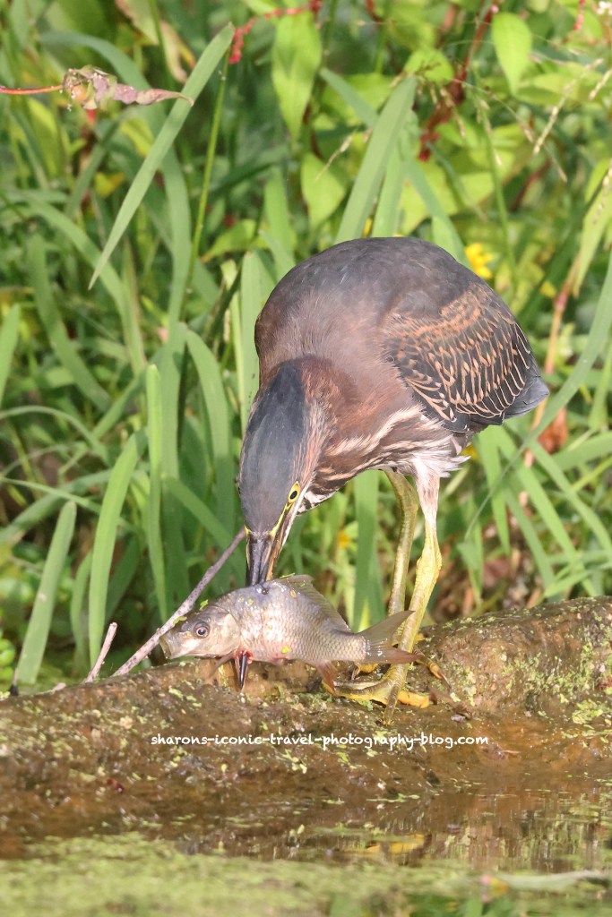
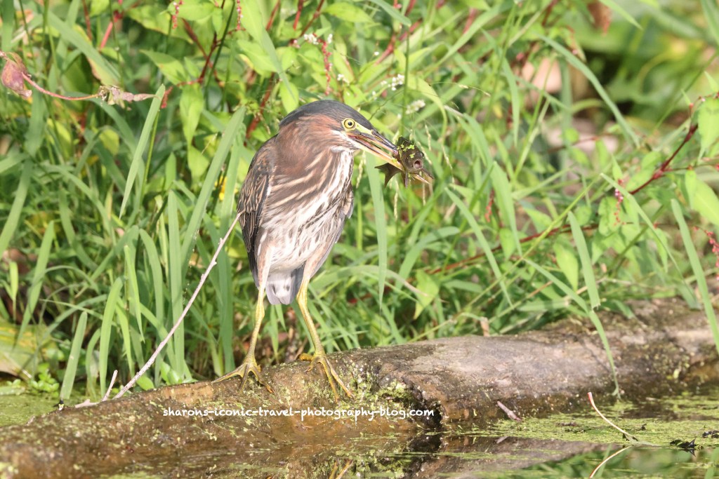
This green heron I was lucky enough to see kayaking a lake after work. At times you can see multiple green herons. I took these pictures before sunset. It almost looks like the heron is playing with its food, but it takes time to manoeuvre the fish from spearing it to getting it in its mouth.
Right after this picture another green heron swooped in and appeared to grab the fish.
Don’t discount the time before sunset. These pictures were taken at 12800 ISO. I expected these to end up grainier than they were. Get out and enjoy the sunny days. Colder days are on the way.
I have seen a lot of different set ups for outdoor seating in NYC. I made a post about some of them 1-2 years ago. This one that I came across a few months ago is my favourite one.
They put this one inside an old bus. I guess this may be easier than constructing one out of wood that you would have to eventually remove. When the time comes, they can drive this one away to another location. Having this inside a bus negates having to put up barriers.
This was nice to see despite the dreary, rainy day.
I believe this was on 8th Avenue north of 34th Street and south of Times Square. It could have been on a different avenue though.
I think this was a creative take on outdoor seating that made the dining experience more unique. What do you think?
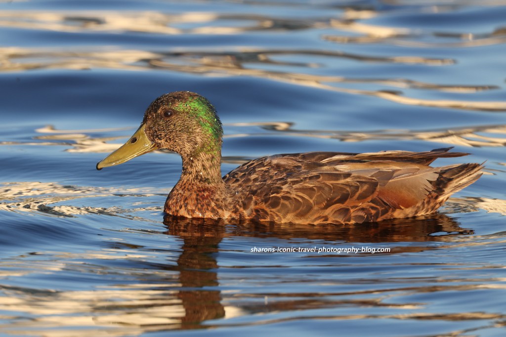
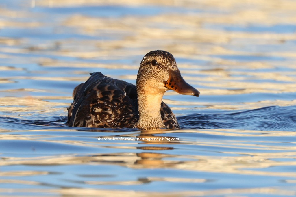
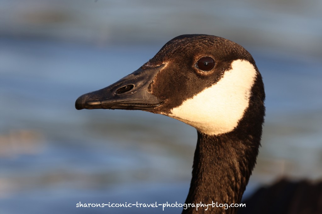
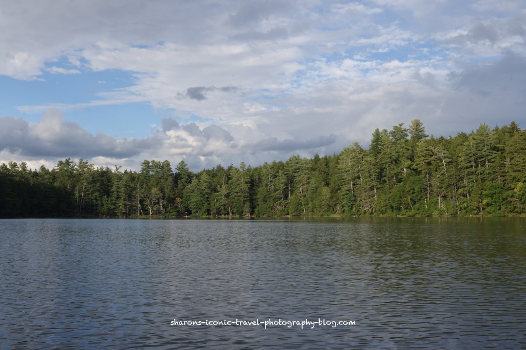
Remember the old game you played in Kindergarten, Duck, Duck, Goose? While paddling a kayak around sunset on Lake Flower this summer, this is what I thought of.
Immature Mallard?
Lake Flower can be accessed from the boat launch in the village of Saranac Lake, New York. I made this trip during the summer.
Female Mallard?
The ducks hung out with the geese. I am guessing they felt protected from the eagles by doing so. Maybe in their minds an eagle would go after a goose instead.
The geese seemed okay with me, although I know they have a reputation of being cantankerous.
All of these were taken with a zoom lens and heavily cropped. Enjoy what’s left of summer.
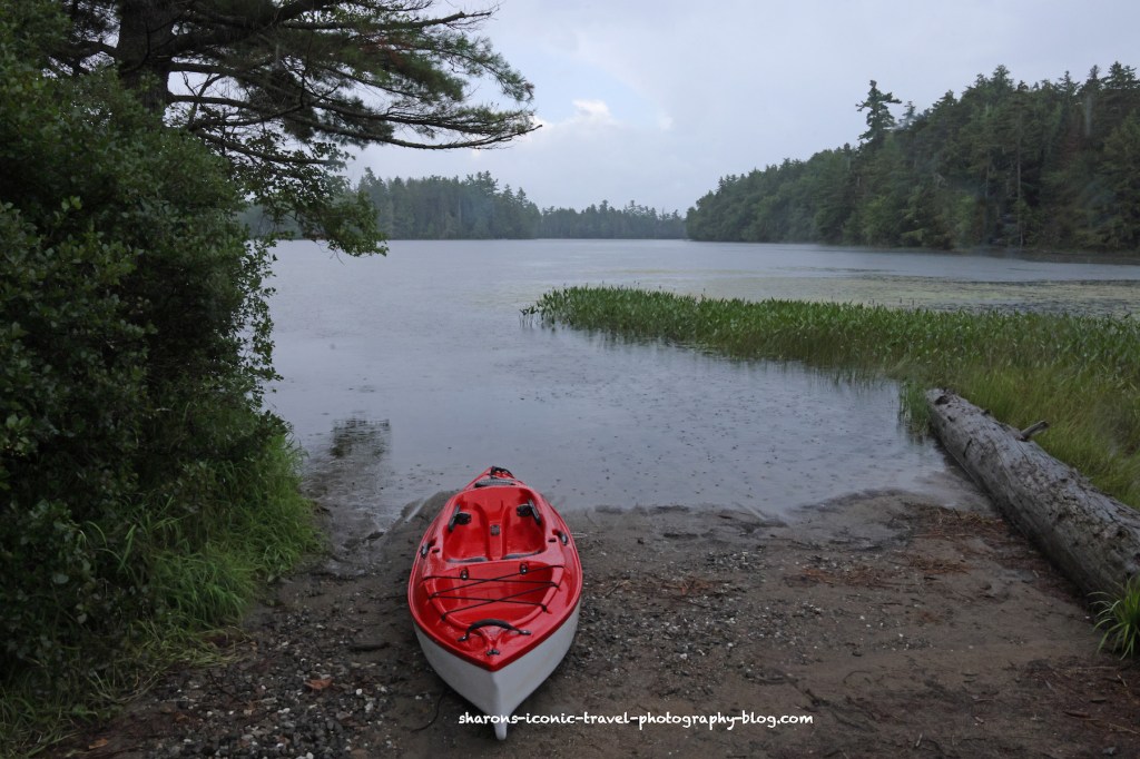
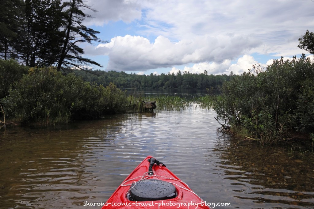
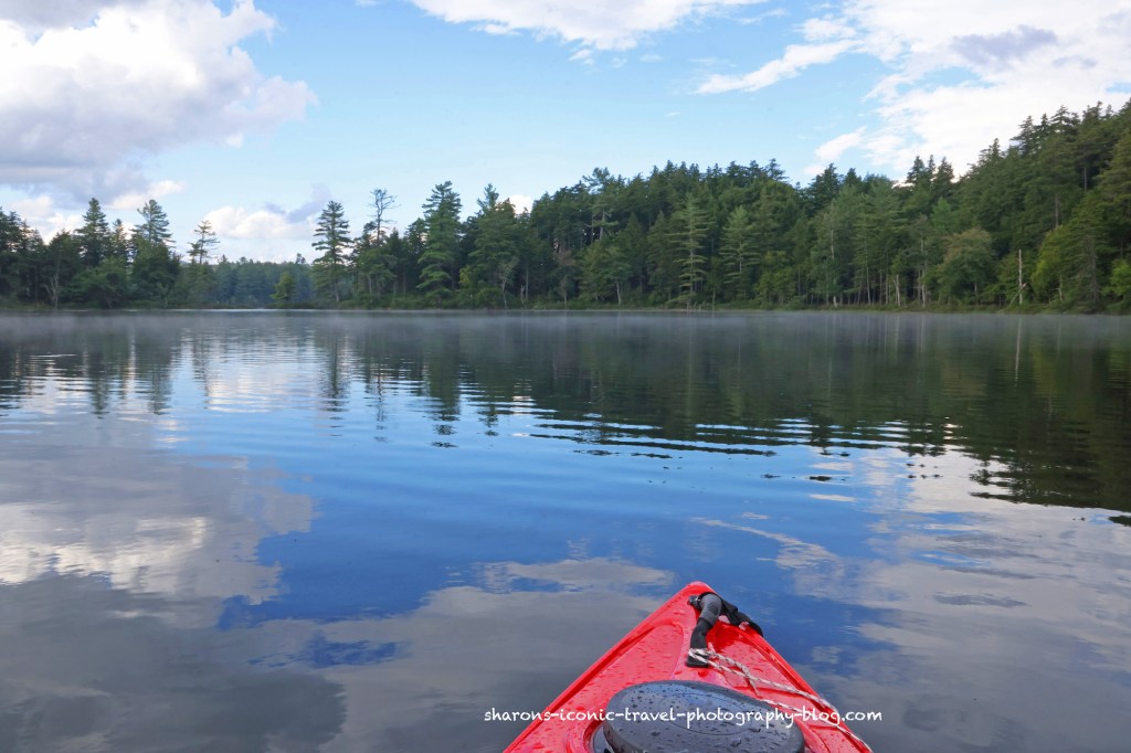
How much can the skies change during a kayak trip? A lot. I had to wait before I started this trip as it was raining and thundering nearby. It was getting late in the day and I wanted to get this in before dark.
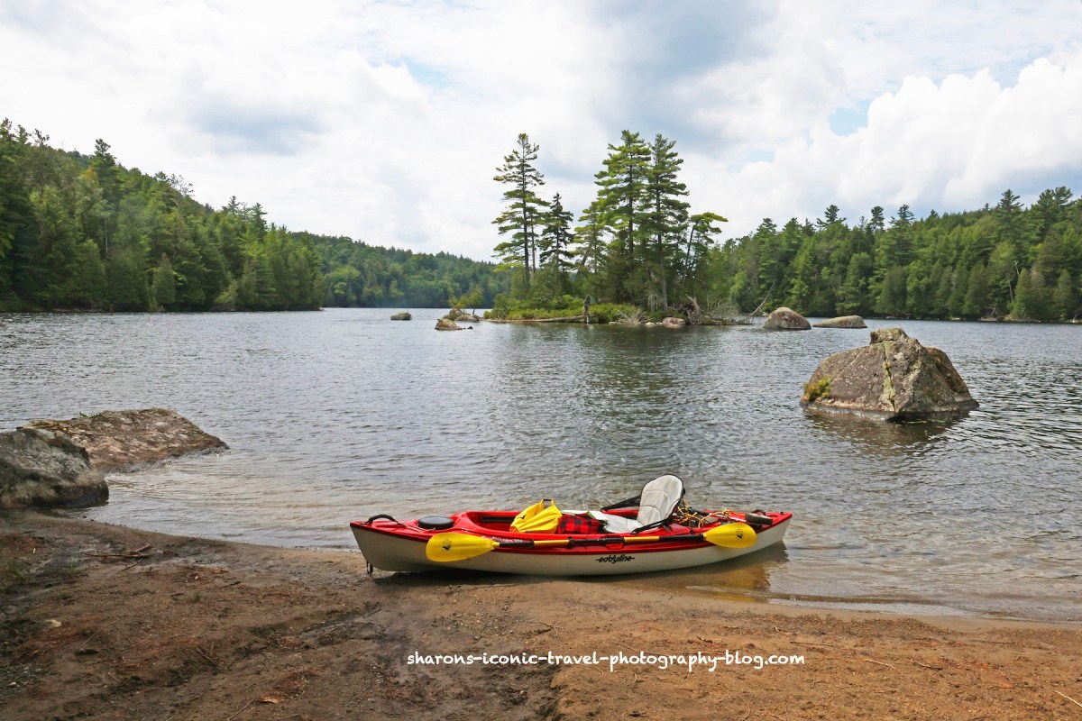
Pollywog Pond can be accessed from other ponds by canoe carries or your can drive to Floodwood Road off of 30 near Upper Saranac Lake. Floodwood Road turns into a dirt/gravel road when the campsites start. Incidentally this body of water seems to be popular to camp along as most of the sites were taken. I am guessing it has to do with the ability to drive to the sites along Floodwood Road whereas other places you had to canoe/kayak to access them.
Launch
There is not a marked launch site on the map. However, I drove along Floodwood Road until I reached what looked like a good boat launch next to campsite 5 on the map. The road in that are near the launch has a wide shoulder so I felt it was safe to park my car there.
Waiting for the storm to pass
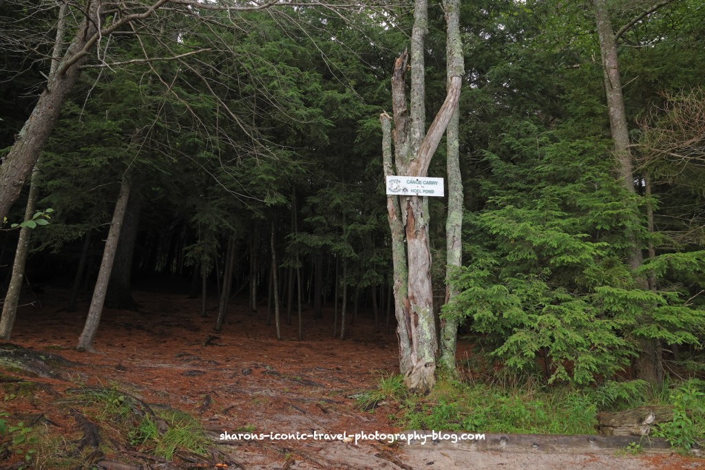
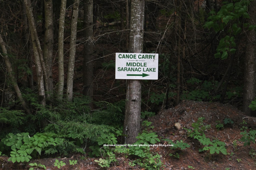
Canoe Carry to Hoel Pond
This entrance to the canoe carry is easy to spot from the pond.
The canoe carry to Hoel Pond is on the northeast corner of the pond. The exit from the lake where you would catch the canoe carry to Hoel Pond is a gradual ascent to land. It is good for kayaks on this end.
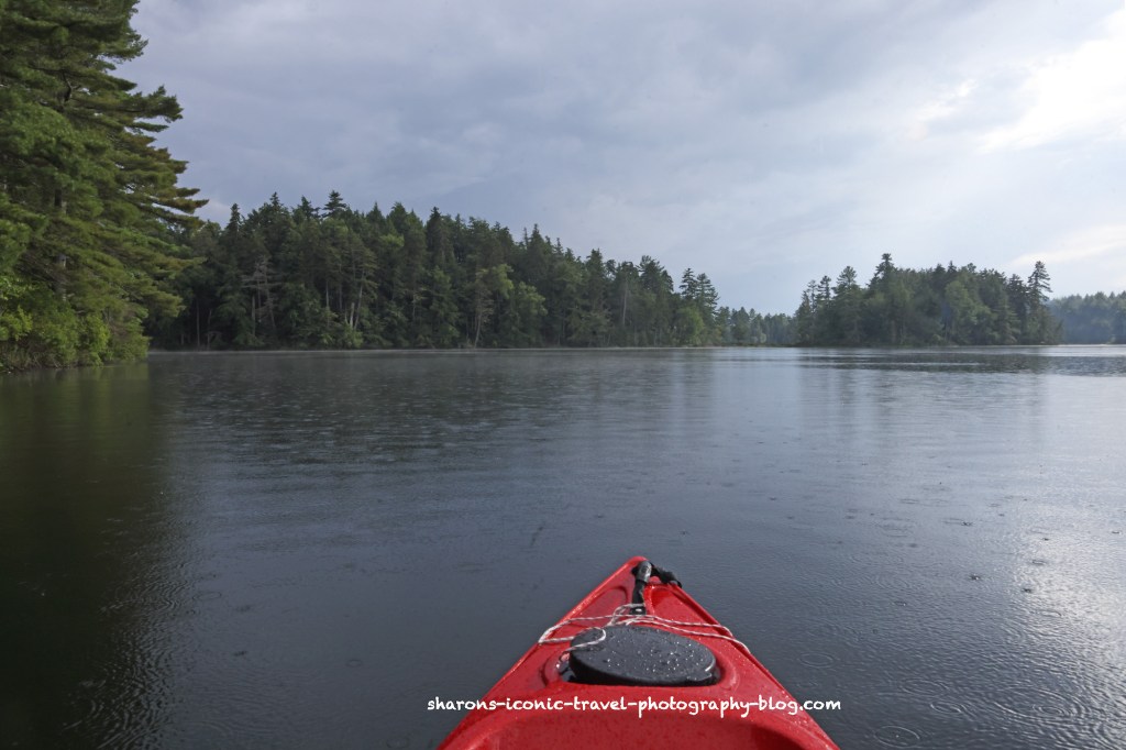
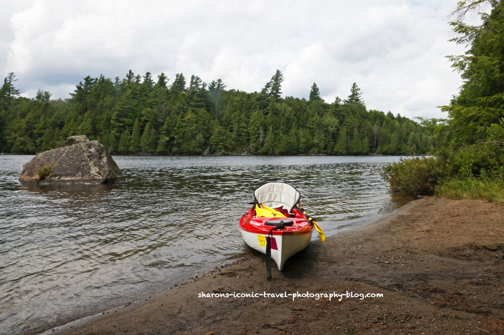
Heading south along the east shore of Pollywog.
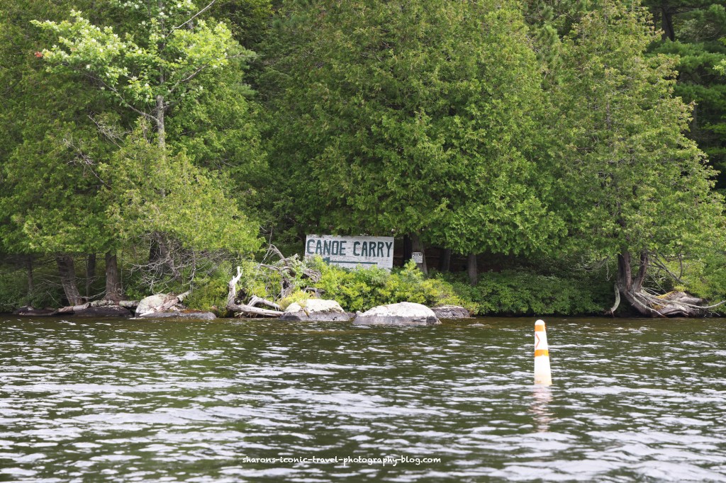
Canoe Carry to Follensby Clear Pond
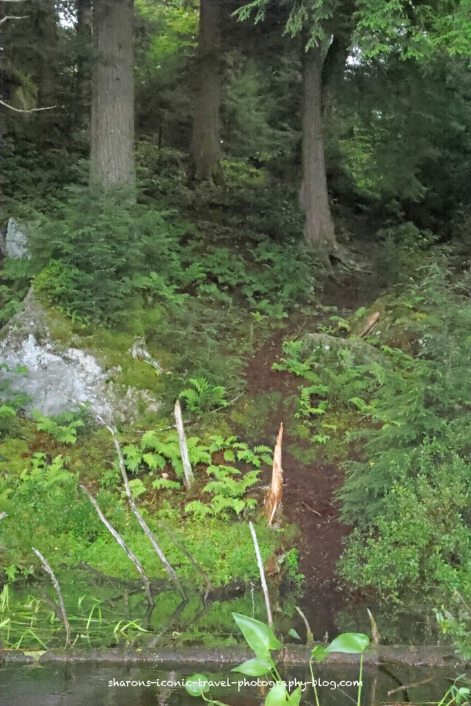
This appears to be the canoe carry to Follensby Clear Pond. It has a sign. I found no other marked clear areas that could resemble a canoe carry on this side.
The only place that appeared to be the canoe carry to Follensby Clear Pond is pictured above. It was a no go for me. It was a steep exit from the water and did not look safe.
Continuing South
There is an area on the east side of the pond that looks like a peninsula. It really is an island. There is a water passage break between the island and the land. There is a campsite at this location.
Heading into the West Side of the Pond
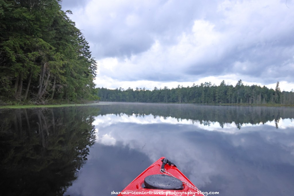
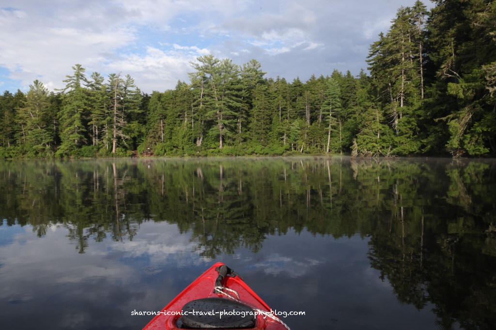
It tended to have a little mist/fog off the water after the rain.
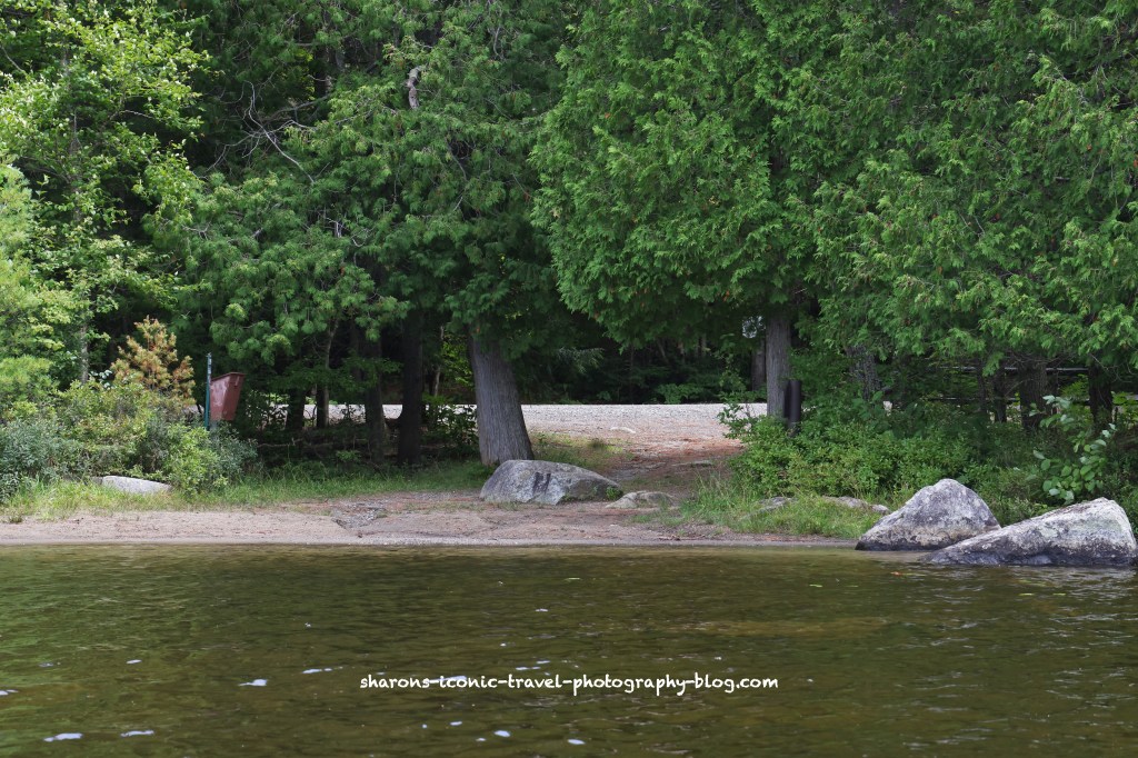
Canoe Carry to Middle Pond
This was not marked , but it was the only location I saw that looked like it was meant to be a canoe carry to Middle Pond. It was very steep and muddy. Again a no go for me.
Heading Back
The break again between the island and the land.Back the where I started.
Wildlife
I missed out on this pond. The day before I met someone at Follensby Clear Pond that said they saw 4 adult loons swimming and playing on Pollywog. So the next day I went to Pollywog. While I was there, I heard loons loudly talking to each other, but the sounds were coming from Follensby Clear Pond. You can’t win them all.
Once again I highly recommend this pond. It seems most bodies of water you cannot go wrong with the in Adirondacks. However, the connections to other ponds via the canoe carries that I came across on the Pollywog side looked dangerous on two out of three that I looked at. So I recommend driving to to access the pond where I did. I did not look at the canoe carry to Little Pollywog on the south western end of the pond.
Get out and enjoy all nature has to offer. I highly recommend experiencing the Adirondack lakes and ponds.
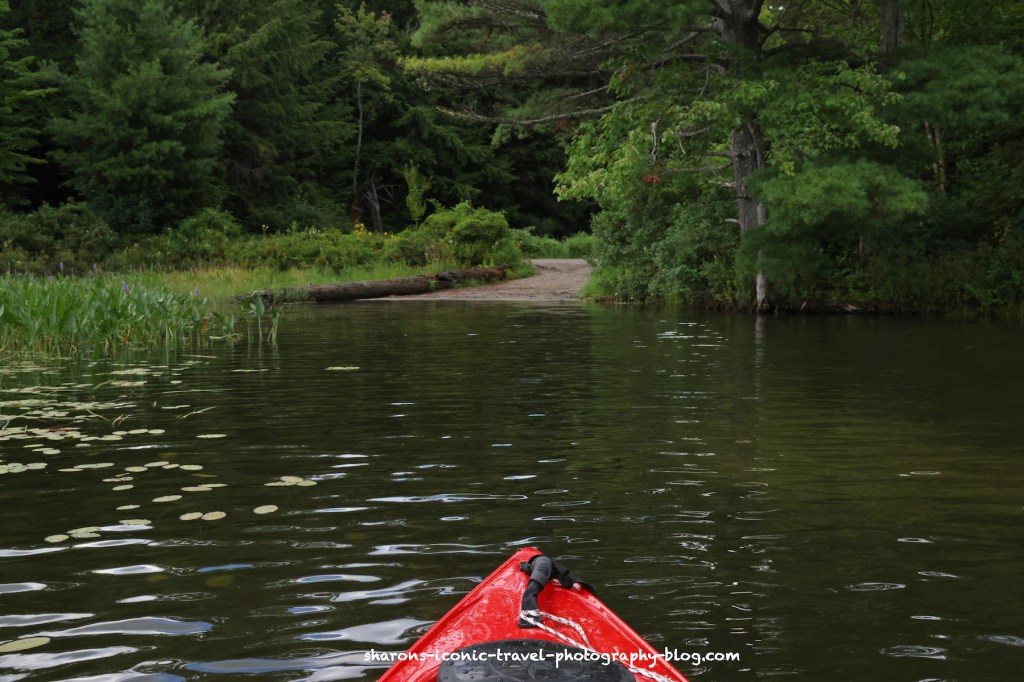
It was a dark, windy day. What should I do? Kayak of course. If I waited for sunny days with blue skies I would hardly ever kayak.
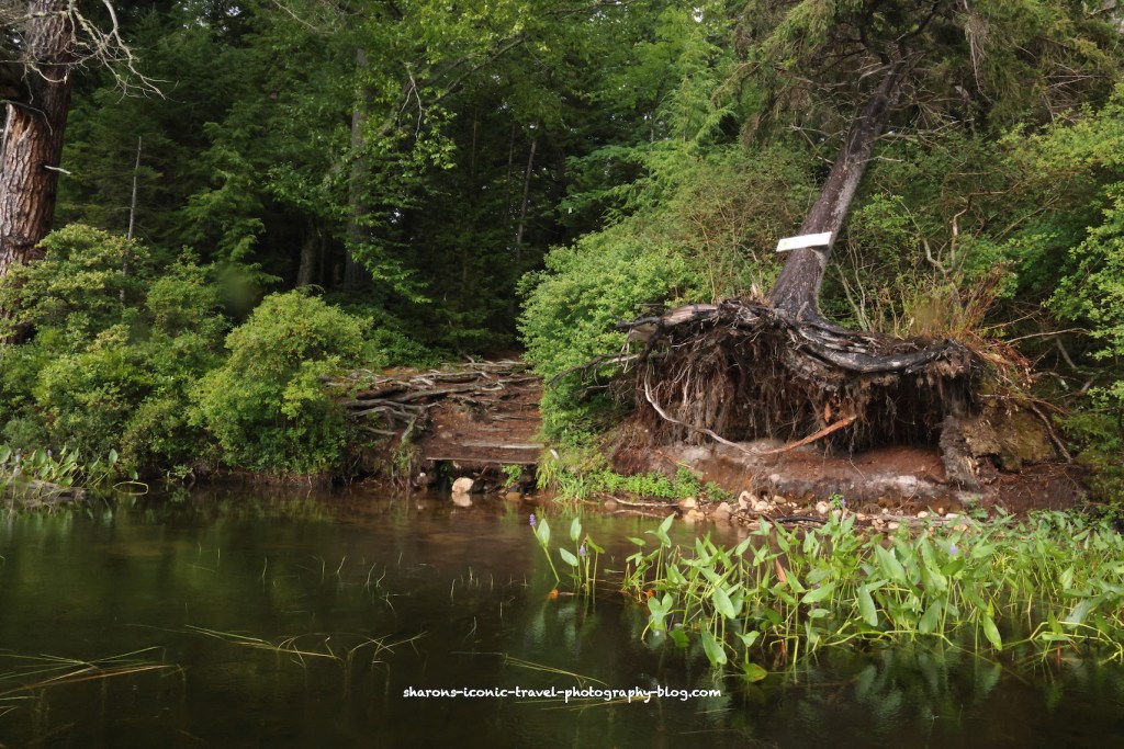
I made this trip in August. Stony Creek Ponds is southwest of the village of Saranac Lake. You can go there by taking Route 3 from Saranac Lake or Tupper Lake. You turn onto Corey’s Road. Not far down the road is a wider area along the road next to a badly maintained road/path on the east side of the road. The path was not well marked from the road when I made this trip. You need to park along Corey’s Road and carry your kayak/canoe in on that path. It is a long carry, so use a kayak/ canoe wheels/ cart or go with a buddy. Be careful of the roots and potholes on the path.
Boat Launch and Parking
The boat launch
The boat launch itself is nice. It is a gradual descent into the pond. It is perfect for kayakers.
Ponds
Heading east and north
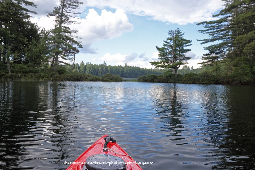
Although it was a dark day, the scenery was worth the trip. I was followed by a kingfisher who just stayed far enough away that I did not try to photograph it.
Campsites
This was campsite 3 if I remember correctly.
According to the Adirondack Paddler’s Map North there are six numbered campsites along these ponds. I saw no sign of anyone camping along these ponds while kayaking, but as I returned to the boat launch there were a few middle aged couples getting ready to head to one of the sites via canoes. It appeared they would have the wilderness section of the ponds to themselves that night.
Indian Carry- Canoe Carry
The northern part of these ponds are wilderness area.This is where you would exit to carry your kayak/canoe to Upper Saranac Lake.This is a long canoe carry that takes you from this pond the the south end of Upper Saranac Lake.As you can see this is part of the network that makes up the Northern Forest Canoe Trail.Traveling now on the opposite side of the lake.This bridge appears to be part of a private road going west to east across the pond. There are some private lands mostly on the southern 2/3 of these ponds. The northern section appears to be part of the High Peaks Wilderness area.
Heading Back Towards the Boat Launch
Entry into the bay- There are campsites on both sides of this entrance into the bay area.
The boat launch is in a bay area on the northwestern end of the ponds. Part of the land around the bay is wilderness, and part of it is private land with a few house on it.
The boat launch is ahead around the bend to the left.
Plants
I did not see any wildlife along these ponds other than kingfishers. The kingfishers I only saw from a distance. This red flower was growing on the shore of the ponds in many spots. The cloudy day with wind did not lead to good conditions to get pictures of these plants. I believe this is a cardinal flower.
Cardinal FlowerFlower growing near a downed birch tree on the shore near the boat launch.
Connection to Other Bodies of Water
By map and by the word of someone else I talked to after this trip, Stony Creek Ponds connects on the south end to the Racquette River. Again, by Indian Carry (Canoe Carry) you can access the southern end of Upper Saranac Lake.
This is another nice area to kayak in the Adirondacks and I highly recommend it. If you want a smaller body of water with places to stop on the northern end, this may be for you. Having ways to kayak/canoe into other bodies of water is always a positive.
What can you do besides eat and go on the carnival rides at the Dutchess County Fair? If you love animals you will find there are many events involving animals. Here are just a few .
4H Judging and Viewing
A cow awaiting judging
There are two arenas to watch the judging of animals. You can also walk around the areas where the farm animals are kept. In some cases you may be able to pet the animals.
The 4H children are eager to answer questions about their animals. They will demonstrate how they groom them.
4H Costume Contest with Cows
Saturday the children and their cows were called to the ring grouped by age. The winner of each age group will face the winners of the costume contests with other animals like chickens.
Scarecrow and hale bale.Cows the milk truck.Top Gun themeWilly Wonka
Dock Dogs
Dock dogs has been an event at the fair for years. Dogs compete in different categories. In this event they were judged by how far they jumped chasing an object of the handlers choosing thrown into the pool. This event goes on multiple times during each day.
Some dogs are highly motivated experts.This one is really focused on the toy.Some are new to the event and had to be encouraged to jump into the pool after the object.
If you like animals, the fair just might interest you. These are just a few of the animal related attractions at the fair. The Dutchess County Fair is one of the largest county fairs in New York State, so there are plenty of things to see. Sunday, August 27, 2022 is the last day for the year. Otherwise consider it a destination next year.
Late afternoon into the early evening can be great light if things work out for photographing wildlife. A fellow photographer joined me on this trip. She joined me in kayaking this body of water.
First, I saw this green heron catch a dragonfly to eat. There are lots of dragonflies at this location. One even landed on my zoom lens and parked for a little while.
These may not be all the same fish. I actually watched him catch a few fish in not a long time period.
First, he spears it.Then, he manoeuvres it around to swallow it.
I can’t believe such a small bird was eating all these fish in a small time frame.
Thanks you green heron for showing me your catch!
It is amazing what you can see if you get outside and go slow. My friend heard him before we saw him. If you go fast, or have on earphones etc. you may miss a lot. Slow down and enjoy nature!
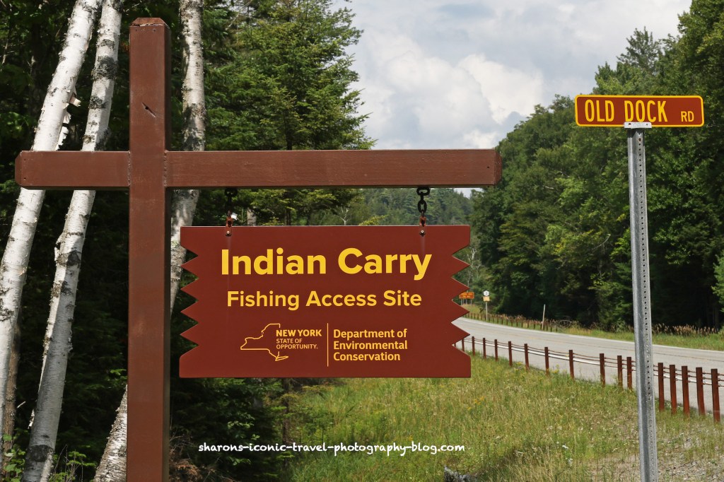
How can you access Upper Saranac Lake from the southern end? One way is through Indian Carry access site off of Route 3 southwest of the village of Saranac Lake. Another way is carrying your canoe carry via the Bartlett Carry from Middle Saranac.
Boat Launch
This launch seems to be possible because of an easement the state obtained to make the boat launch. Therefore, you need to stick to the road on the way in and stay within the boundaries of the easement that makes up the road and the boat launch. On the west side of the launch is private property and there are houses along the lake going west and then north of this corner of the lake.
There is parking off of route 3. But if you follow Old Dock Road you will come to a parking area right near the launch. It is a very long road and if you want to launch your boat you would probably need to drive your car down there. This launch is for kayaks and canoes.
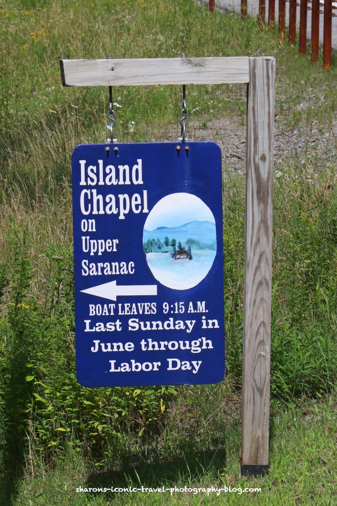
Evidently you can catch a boat that will ferry you to the Island Chapel if you wish to attend.When you arrive at the lower parking lot there is a day use camping area if you cross this bridge. It also has a privy/outhouse. Bring your own toilet paper.Dock for people canoeing.
There is a dock for those canoeing and an area next to it that is good for kayakers to launch from. It is a gradual entry into the water.
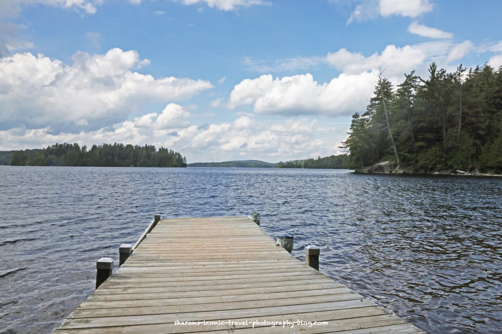
This is the view of the dock from the water. To the left next to the dock is where you can launch your kayak from.
Upper Saranac Lake
The weather was threatening on this trip. I think it sprinkled a few times, but thunderstorms did not arrive until later. I mostly kept to the edges, but at one point paddled across.
Going west then north along the shore there were private homes spread apart.
Going into the bay on the east side there were a few homes spread apart.
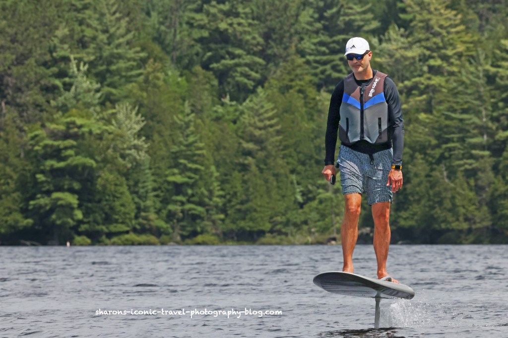
A couple passed me twice on hoverboards.
I saw a few people on my travels. I saw a couple hoverboarding. I also saw a father and two sons canoeing /kayaking separate boats loaded with gear to camp. In addition there were a few motor boaters and a man fishing from his kayak.
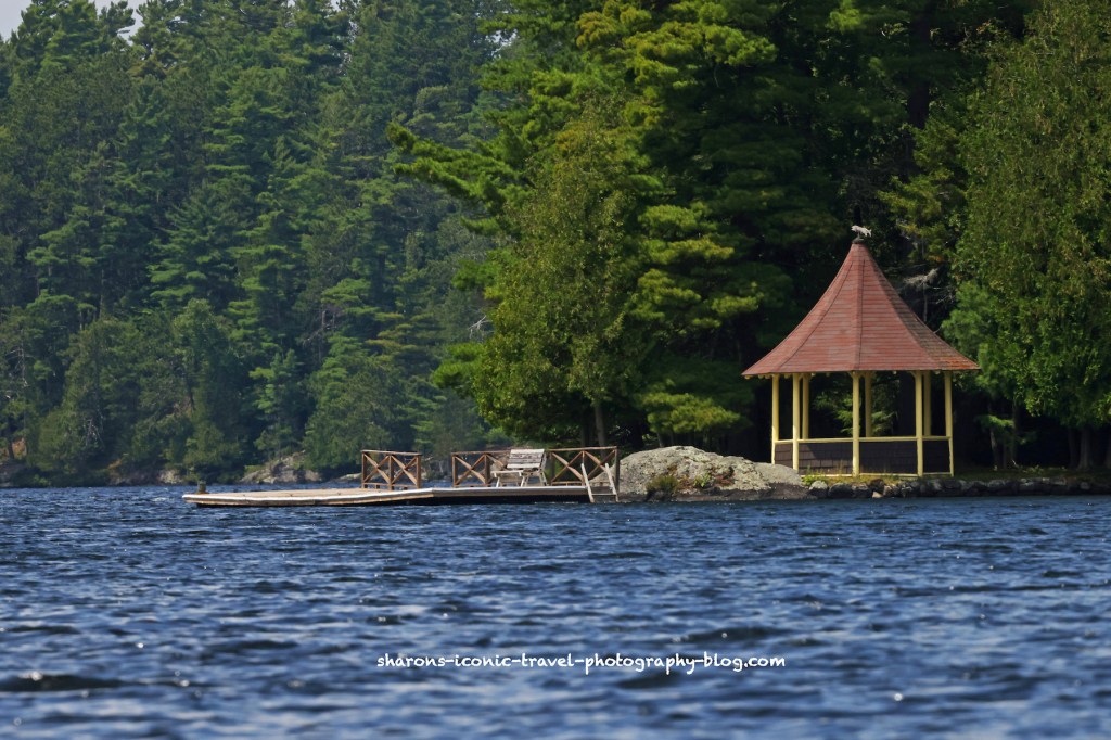
A dock and gazebo on the lake.
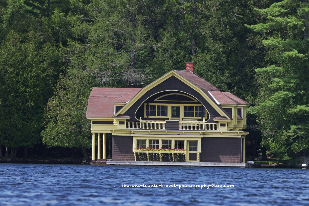
One of the elaborate boat houses along the lake. Boats can park inside these in a garage like area inside that you drive your boat into. The top level usually can not have bathrooms or kitchens as it is too close to the water. There would be a main house not far from this boathouse.
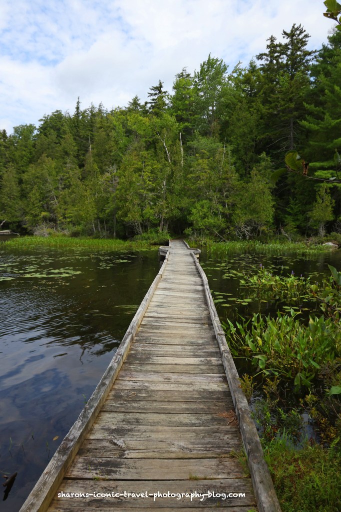
Bridge that is part of a walking trail you can access from the parking lot near the boat launch.
Bartlett Carry
Bartlett Carry is a canoe carry route that takes you from Upper Saranac Lake to Middle Saranac Lake. It is on the southeast side of Upper Saranac Lake.
There is a sign pointing to the direction of the boat launch when you get closer. It is hard to see from a distance.
I showed the boat entry/exit from Middle Saranac end of the Bartlett Carry on a previous post. On both ends the canoe carry is shallow leading to the entry/exit which is perfect for kayakers. There was no sign at the actual launch site. As you can see there is a sign in/out box for those camping on the islands and other campsites on the left side of the picture. There are houses close to the boat launch.
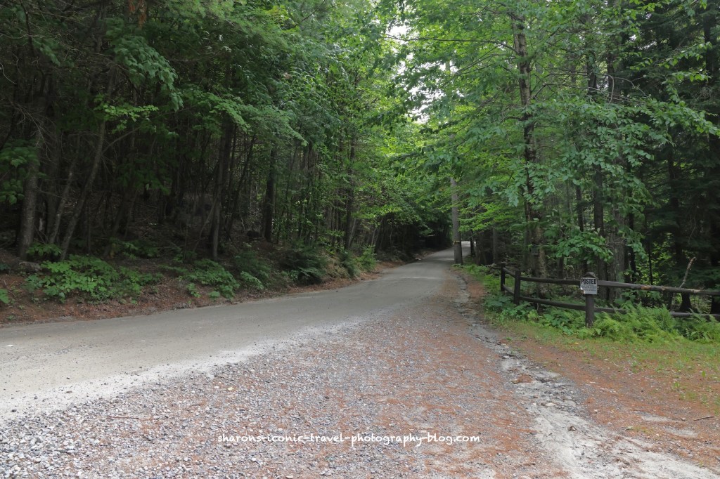
Bartlett Carry Road is shown on the map as a private road. It is open to people carrying boats from one end of the canoe carry on Middle Saranac to the canoe carry on Upper Saranac Lake. On the road a sign marks the direction of the other end of the carry.
The canoe carry is along this road. Since it is a private road you can not drive your car on it and there are signs saying you can not park along the road near the launch.
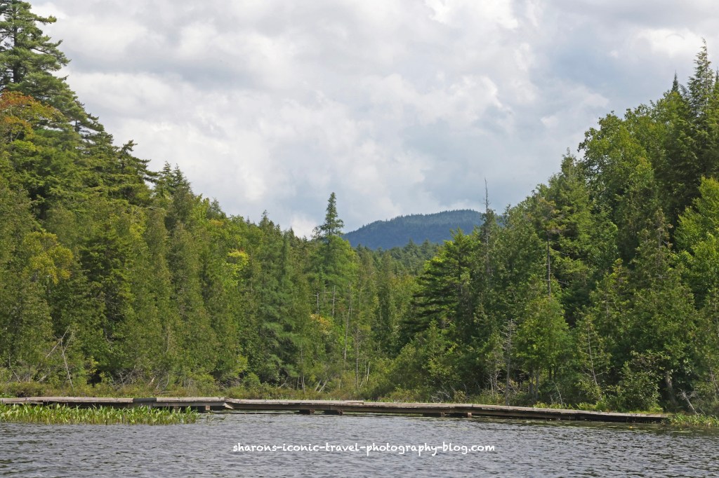
This is the view from the Upper Saranac side of the Bartlett Canoe Carry looking west.
This is the view from the Upper Saranac Bartlett Canoe Carry looking northwest. The carry is in kind of a bay/cove area on the southeast area of the lake.
Wildlife
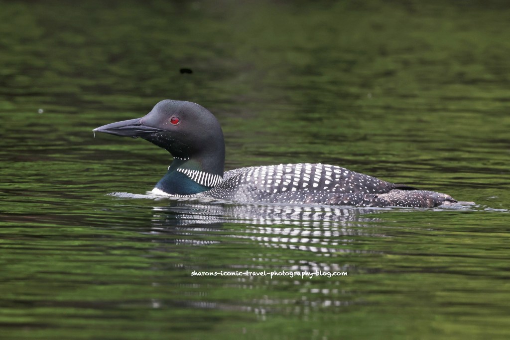
Seeing wildlife makes the trip even better for me. I was lucky enough to see three adult loons hanging out together. They were talking a lot that morning and I was hoping to get an audio file of the conversation, but there were kids close by screaming and playing in the water.
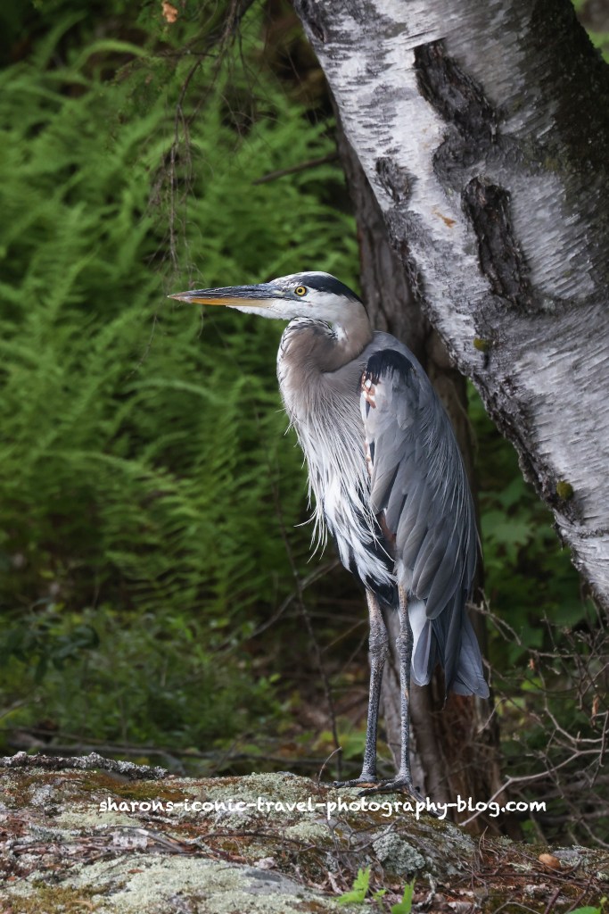
Common Loon- There were three adults the morning I was there on the southern end of the lake.Great Blue Heron hanging out on the shore next to a birch tree.
The great blue heron was just north of the loons a short paddle away. It was hanging out on the property of a house being renovated. A lot of construction noise was going on and it did not seem to phase the heron. The heron was not phased by me either. It was not actively looking for food just chilling by the water.
I highly recommend this lake and boat launch. There were not many motor boats when I went. I saw maybe one or two. As with any large body of water in the Adirondacks, if weather is threatening stick to the edges of the lake or pond.
What times a great for getting wildlife pictures? Early evening and early morning are great times to get wildlife pictures in open areas. If you have the sun behind you and facing the animal it work well lighting wise.
Again, I find these green herons easier to get pictures of on a kayak. Sometimes I move past them without realising there are there if they are in the plants.
These pictures were taken in early evening. I personally like the lighting best this time of day.
Looks like a mohawk!
Enjoy the rest of the warmer weather. Get out an enjoy all nature has to offer.
Here is another bird I saw one a local body of water that they are working to clear of invasive plants. It is bigger than the green heron, but much smaller than the egret. This is a juvenile little blue heron.
There were no signs of any adults around. So this heron must be on his own now. Juveniles are all white with a two toned bill. An adult little blue heron is blue-grey with a purple-maroon head and neck.
Focusing on what is under him in the water.I did not see him catch anything at this location.He is at another location to try to catch something.Sticking to the edge of where the water has been cleared to fish.
This bird is either in a bad mood or intensely focused.
He did not seem to spot any fish.No fish. He had to settle for a dragonfly.
Again I want to thank the local municipality for attempting to remove the invasive plants. I understand this bird is a short visitor in our area. It may only show up for a week before it moves on. Removing the plants ensures it had a spot locally to make a layover.