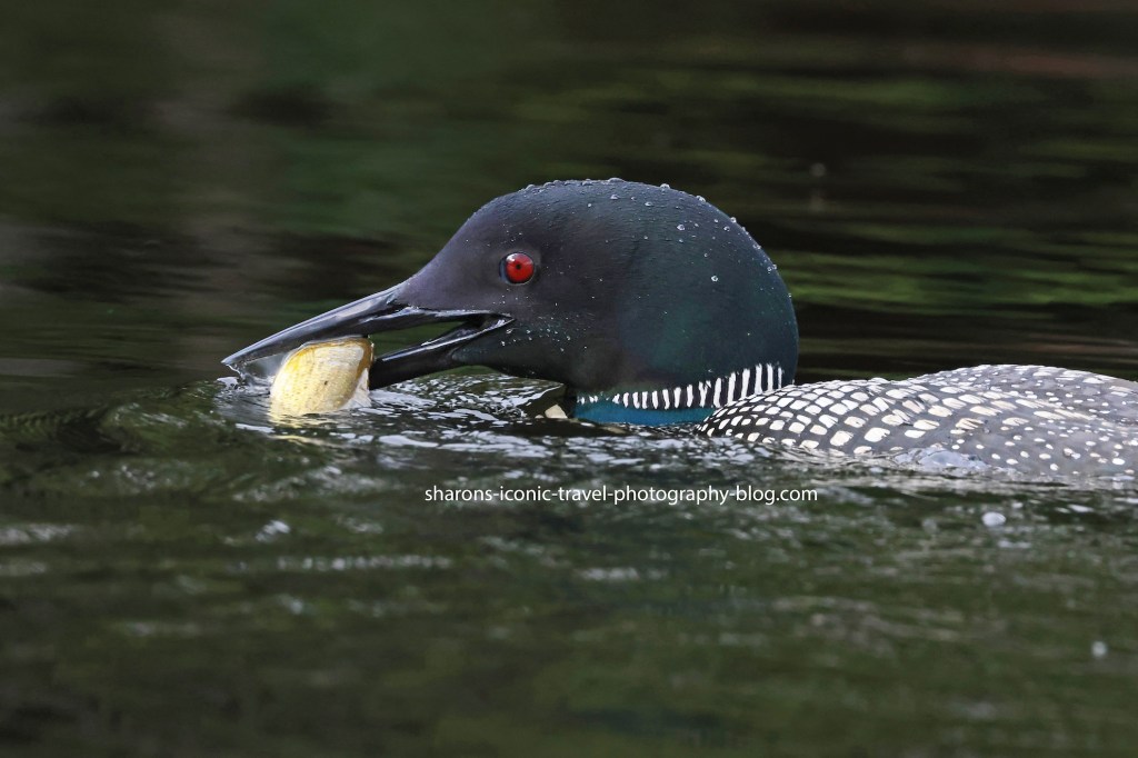
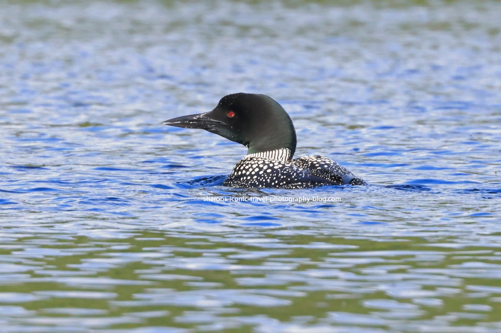
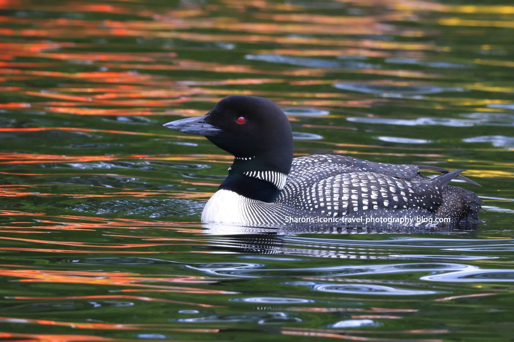
Just another loon picture from earlier in the summer. I am really busy at work, but hope to get somewhere on an upcoming holiday if it works out time-wise and health-wise.
Loon from the St. Regis Lakes in the Adirondack Mountains of New York.
Enjoy these last days of summer. Fall is closing in.
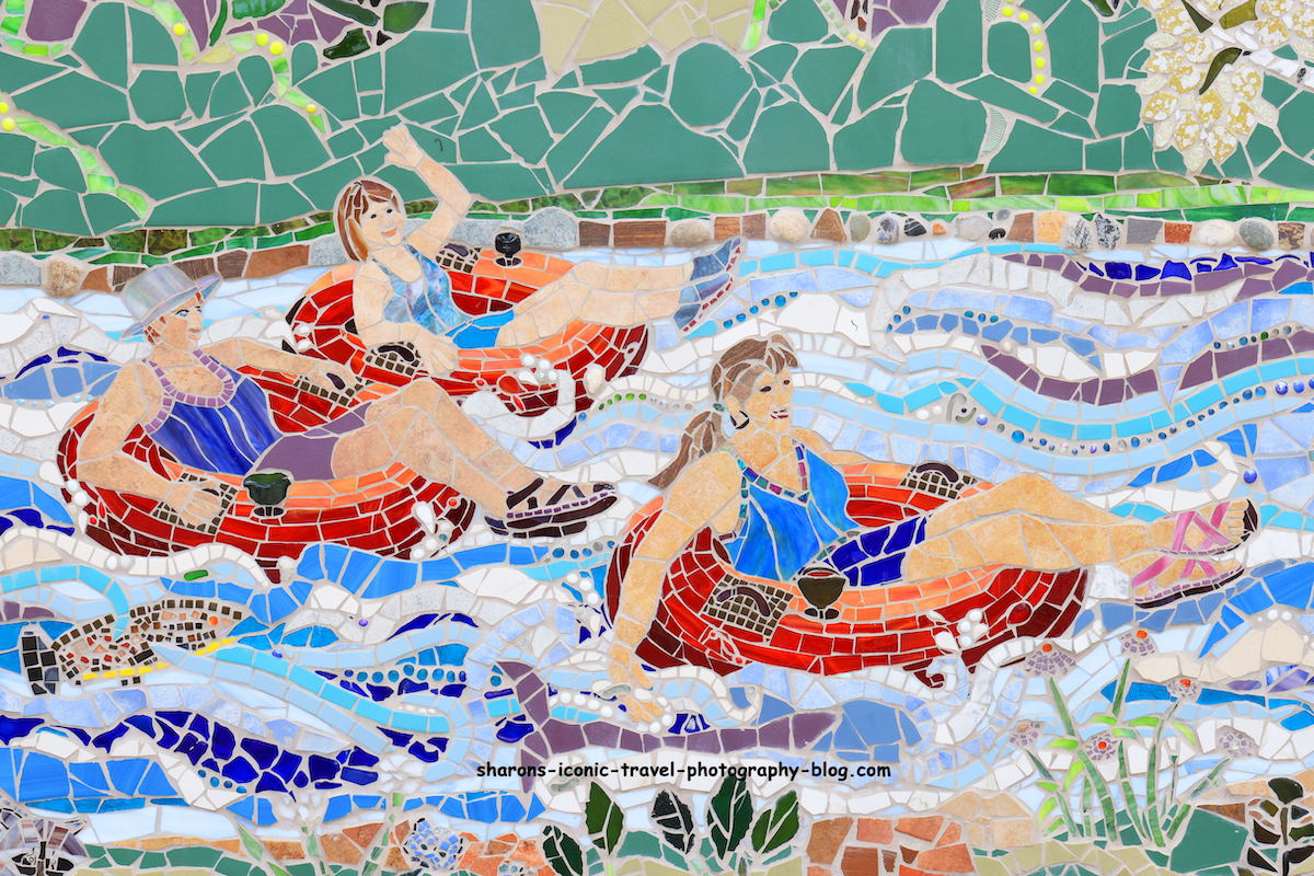
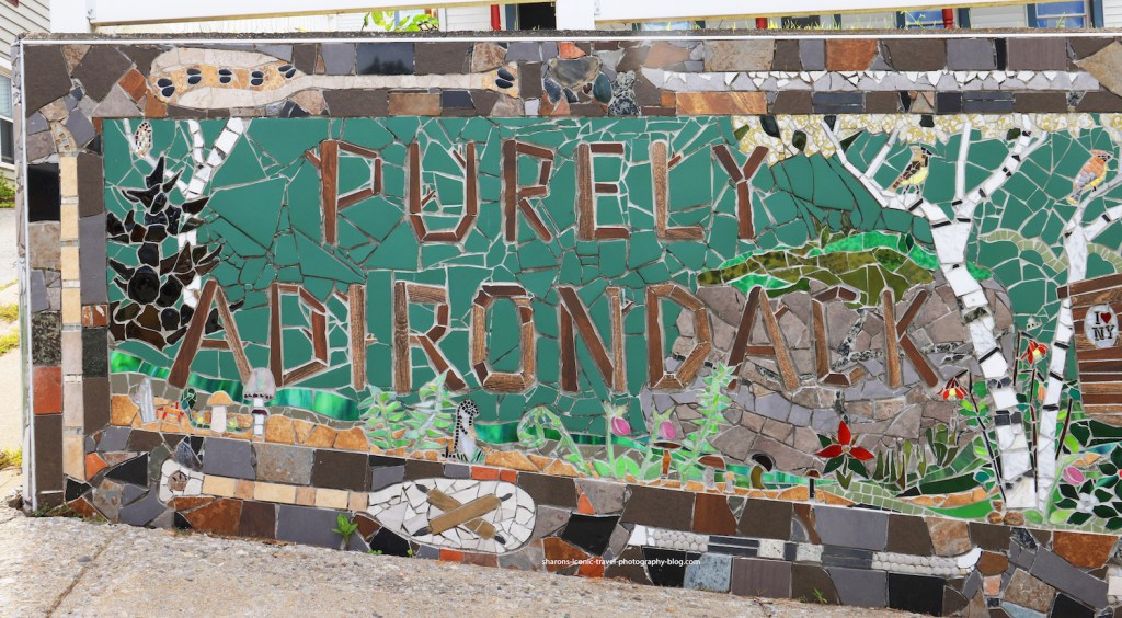
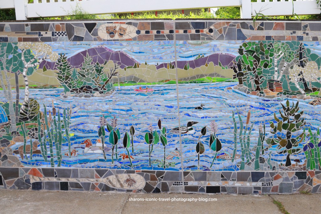
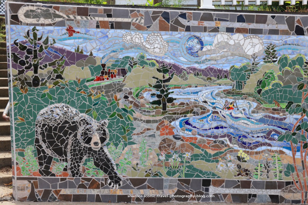
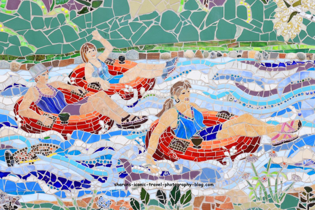
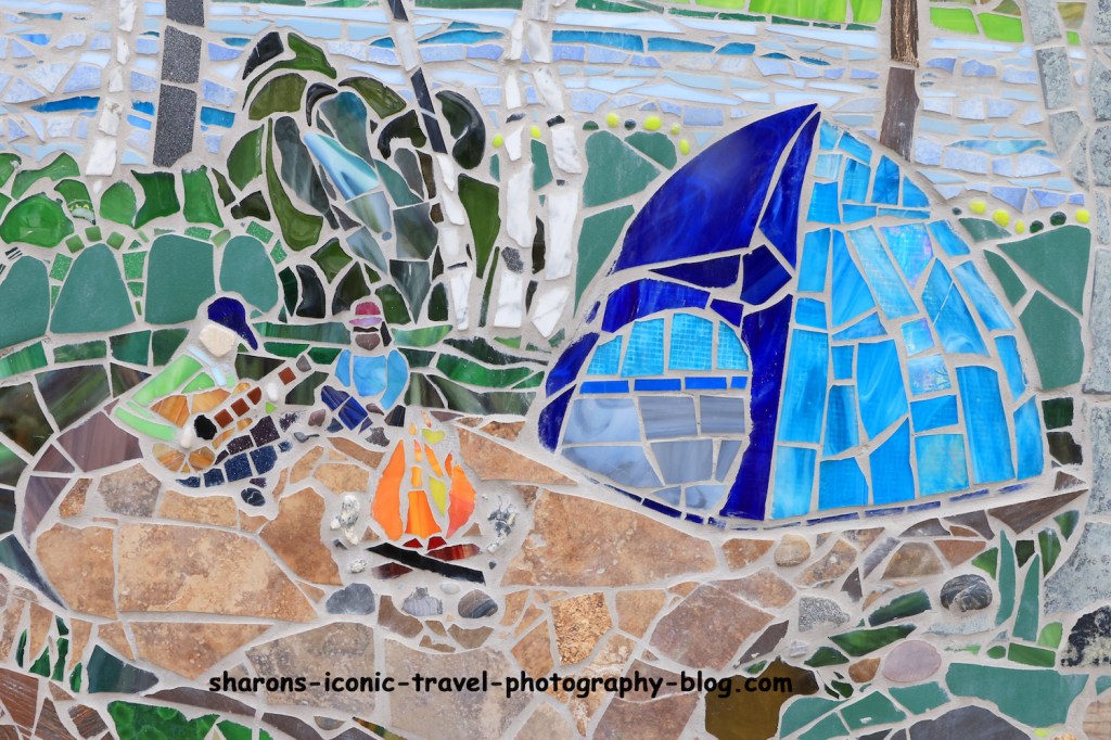
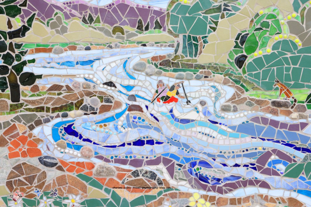
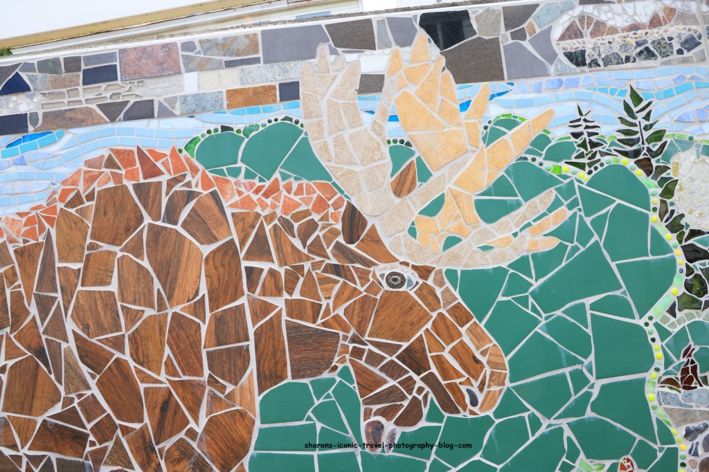
What can you do with a large concrete wall? You can turn it into a mosaic or mural. This is exactly what they did in North Creek, N.Y.
This mosaic is on Main Street in North Creek. The mosaic depicts the animals and activities that make the Adirondacks what it is. It was artist Kate Hartley’s idea to turn this 180 foot concrete wall into a mosaic. She had the help of over 700 volunteers including students from the area and visitors, so this was a community project.
Overview
I could not get pictures of the whole wall. There were cars parked in front of it. Below are the sections I could get. The rest I took closer pictures of sections of the wall.
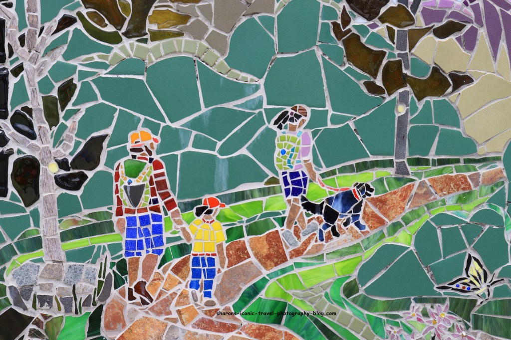
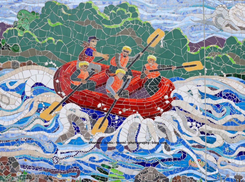
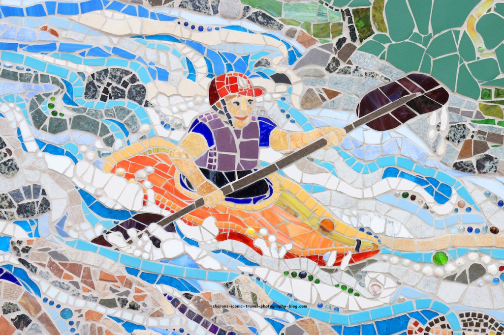
Activities
They did a great job picking out activities that one can do in summer in the area.
Hiking
There are a lot of mountains to climb in the Adirondacks.
White Water Rafting
There are white water rafting trips out of North Creek on the Hudson River.
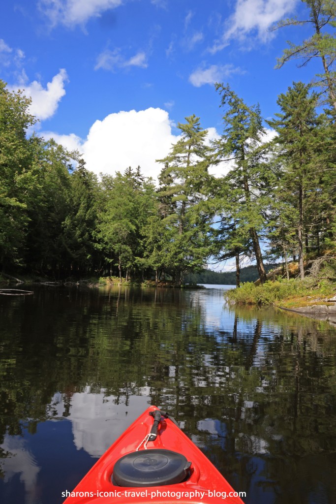
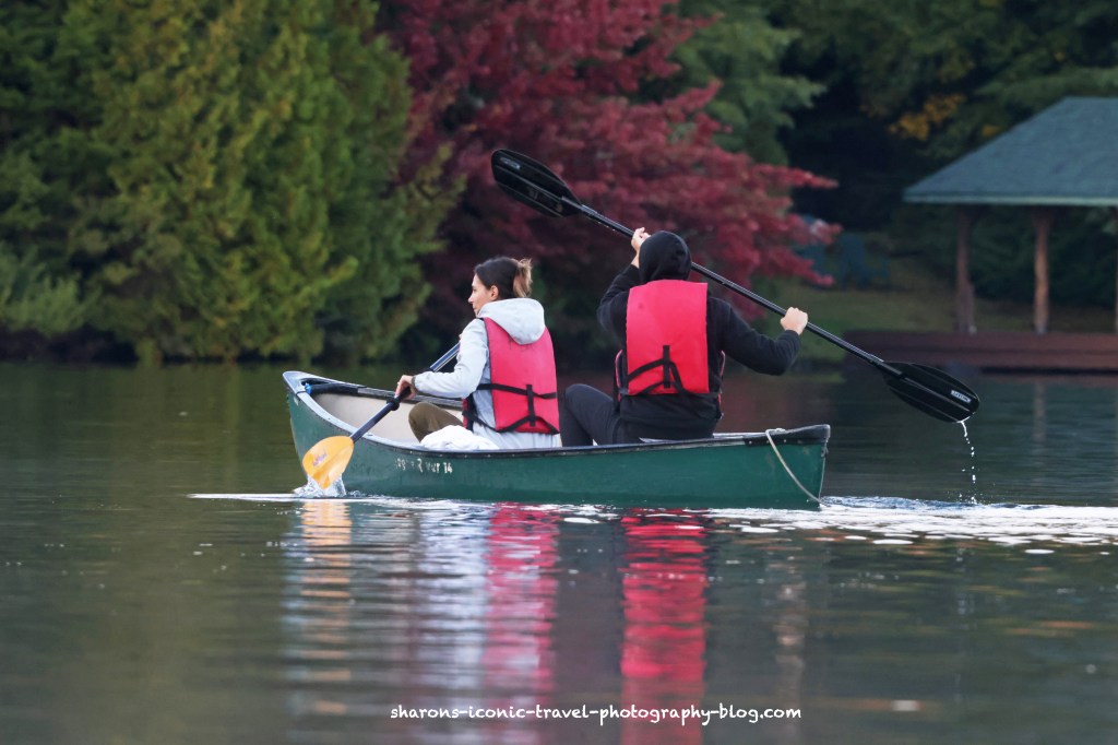
Kayaking or White Water Kayaking
You can kayak calm waters of lakes or ponds or kayak white waters in the Adirondacks.
Tubing
There are places that bring you there and pick you up where you end.
Camping
There are many places to camp in the Adirondacks. Some you pay a fee, others that are more wilderness sights are free. Some can only be accessed by canoe, kayak or boat.
Canoeing
Like kayaking, there are calm waters to paddle on and not so calm.
Wildlife
Moose
Moose are seen the Adirondacks. I saw my first (NY) one last year crossing a road early in the morning. By the time I stopped my car and picked up my camera it was on the other side of the road into the woods. This was north of Tupper Lake.
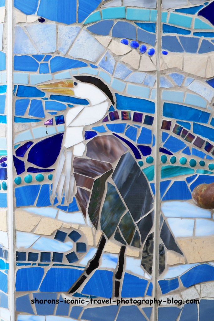
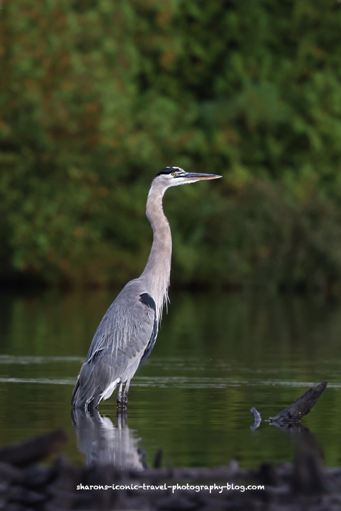
Great Blue Heron
Common on many types of water. They move around and fish on lakes, ponds, streams, etc.
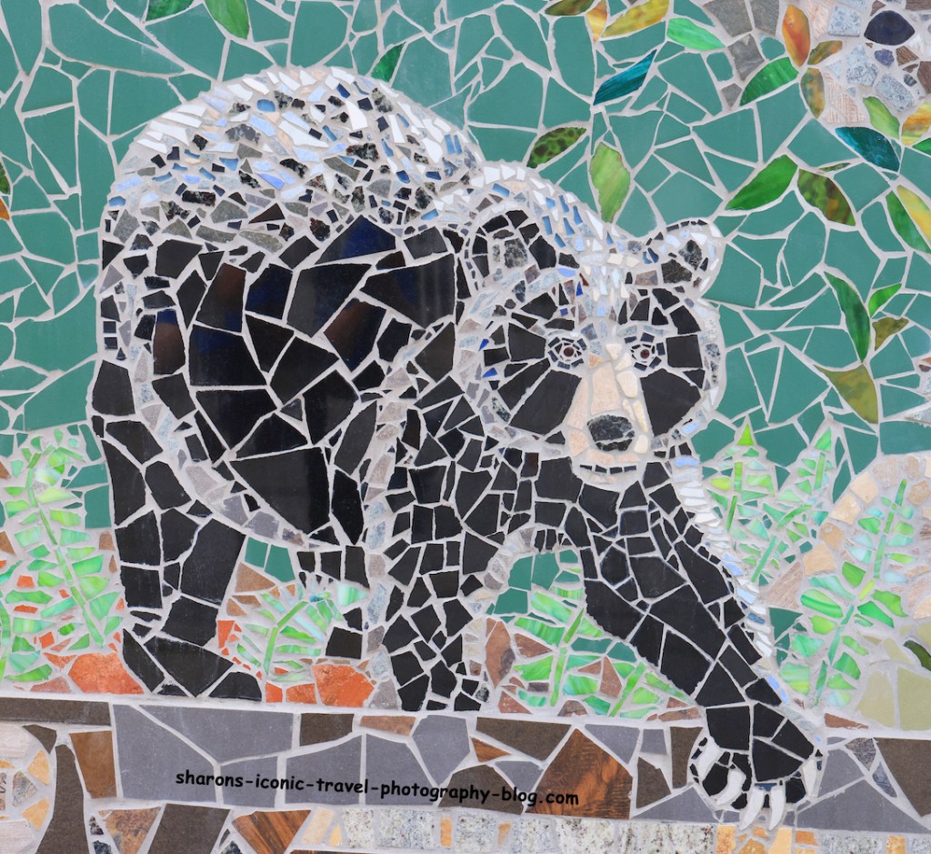
Black Bear
Black bears are frequently sighted in the Adirondacks.
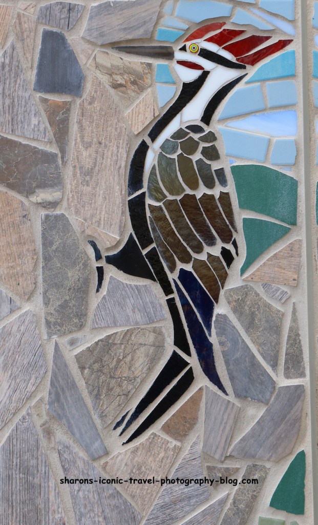
Pileated Woodpecker
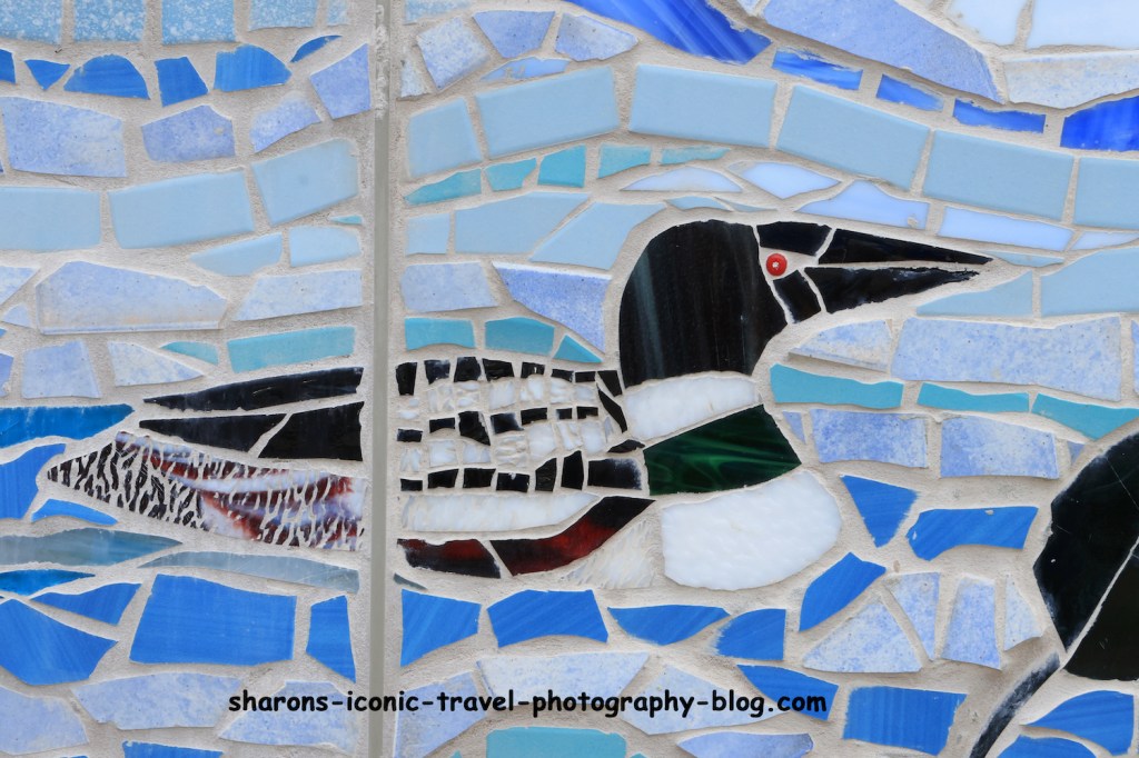
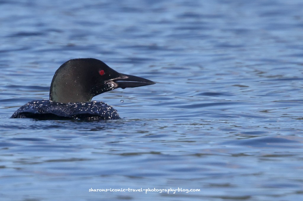
Loon
Common Loons are on almost every lake and pond large enough to take off on and have enough fish.
Again these pictures do not represent the entire mosaic. I love seeing artwork like murals and mosaics. It is always a bonus to find out it was a community project. I think this mosaic did a great job representing the local area. If you are skiing Gore in Winter or White Water rafting the Hudson River, stop by and check out the mosaic. It’s Purely Adirondack.
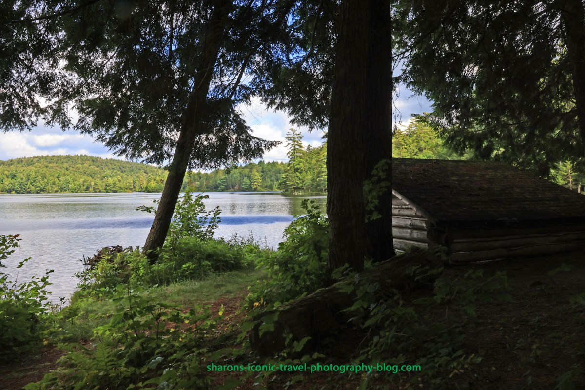
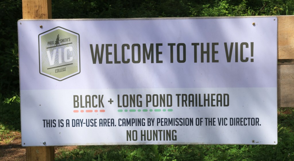
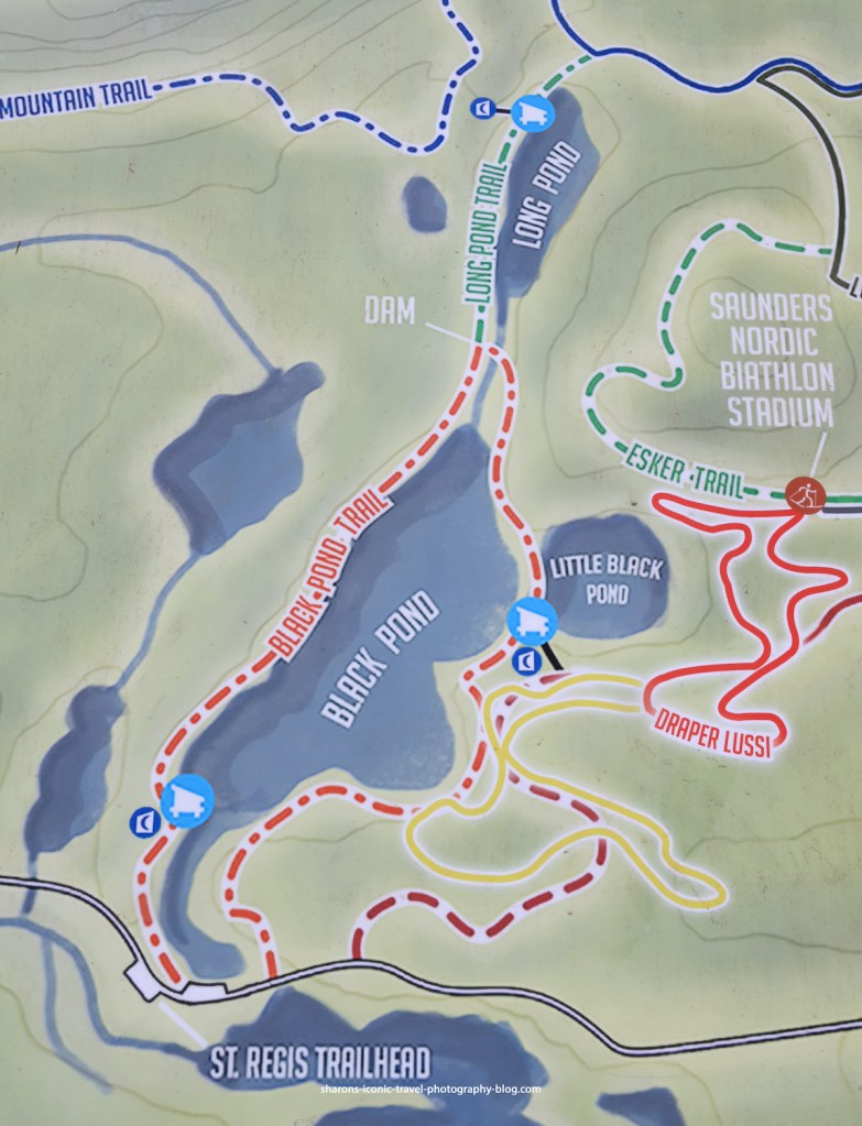
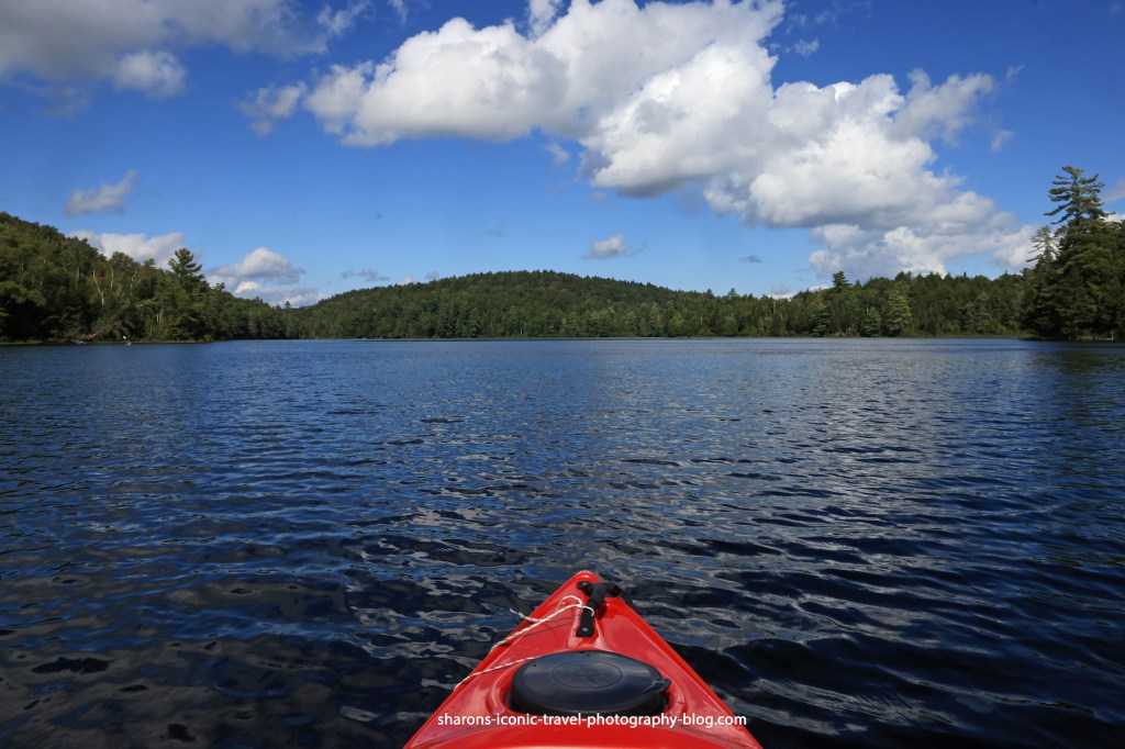
What college campus has several hiking trails and ponds open to the public? Paul Smith’s College in the Adirondack Mountains does. Black Pond is on an area of land controlled by Paul Smith’s College. The public is able to access the trails to hike and the ponds to kayak or canoe with no cost.
Black Pond’s parking lot can be accessed off Keese Mills Road in Paul Smiths, NY. It is a small lot that holds maybe 6 cars.
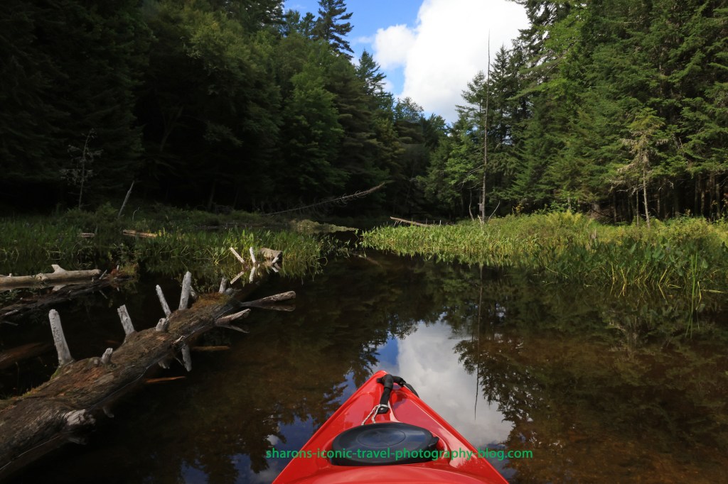
Close to the parking lot is the boat launch. It is more for canoes as the dock is higher off the water. It is a little tricky for kayaks. There is an area next to the dock you can step in the water with a depth of about 1 1/2 to 2 feet next to shore that is rocky on the bottom. When I say rocky some of the rocks are big, so be careful.
The area to paddle from the dock to the lean-to on the pond is narrow. I count this as a passageway and not the pond.
Above is the entrance to the larger portion of the pond. The lean- to will be on the left of the entrance.
This is at the end of the entrance to the pond.
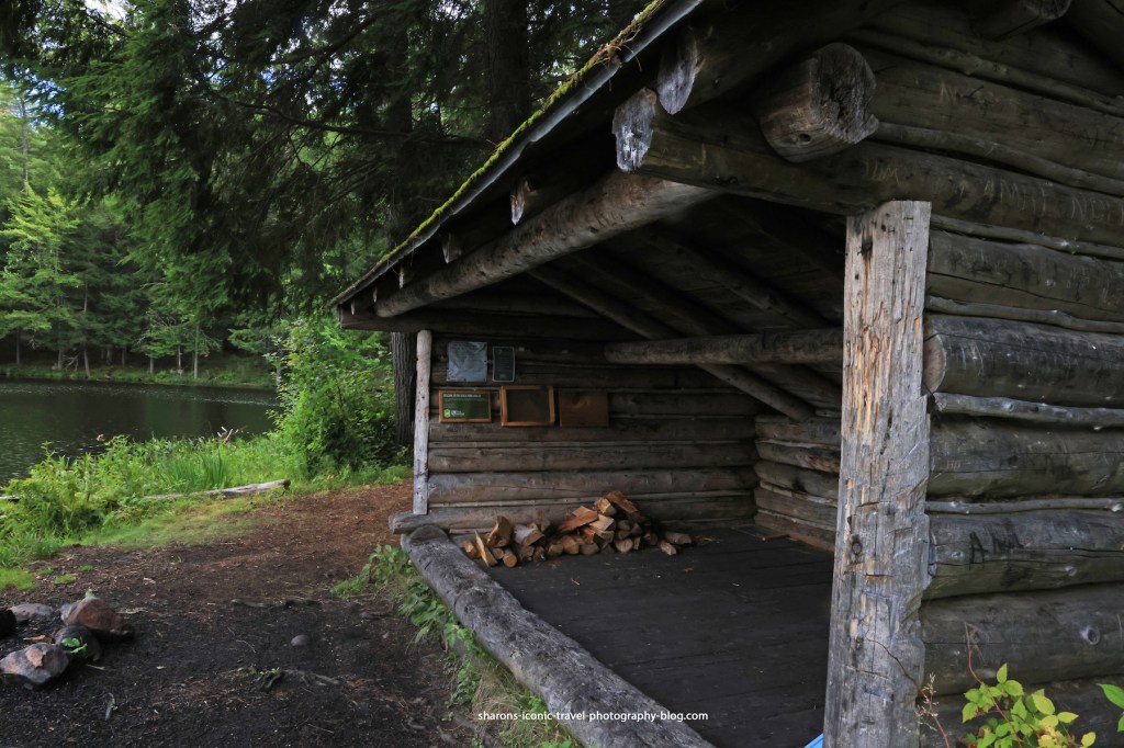
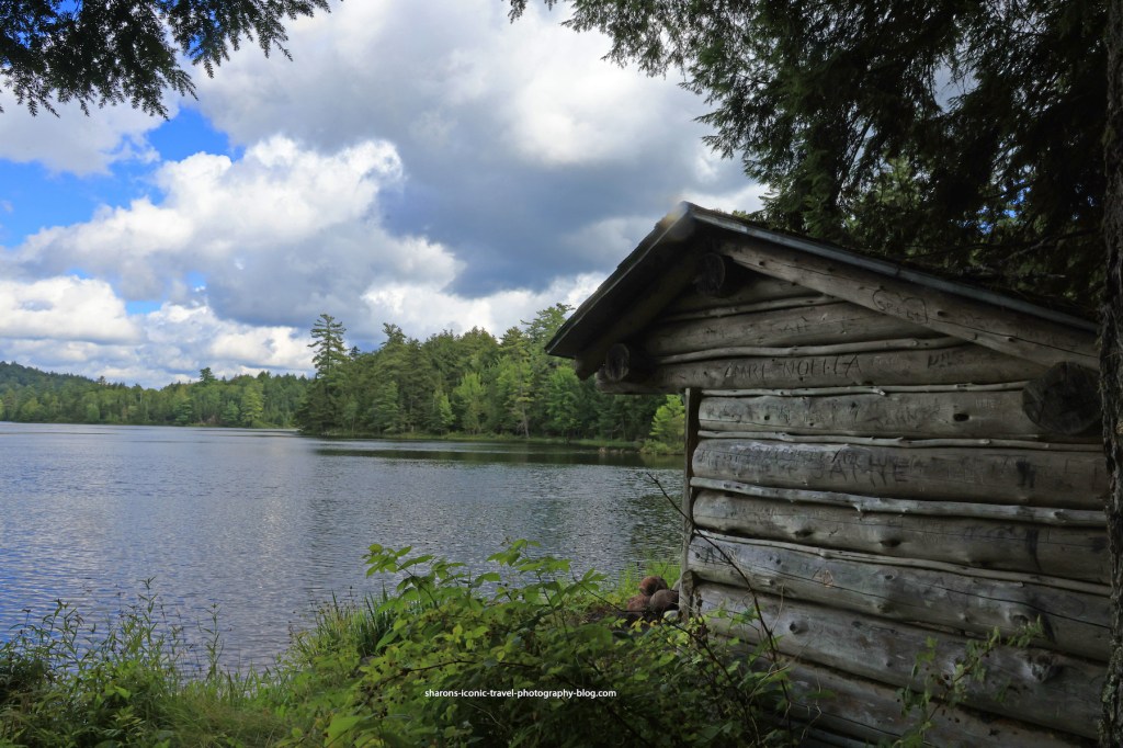
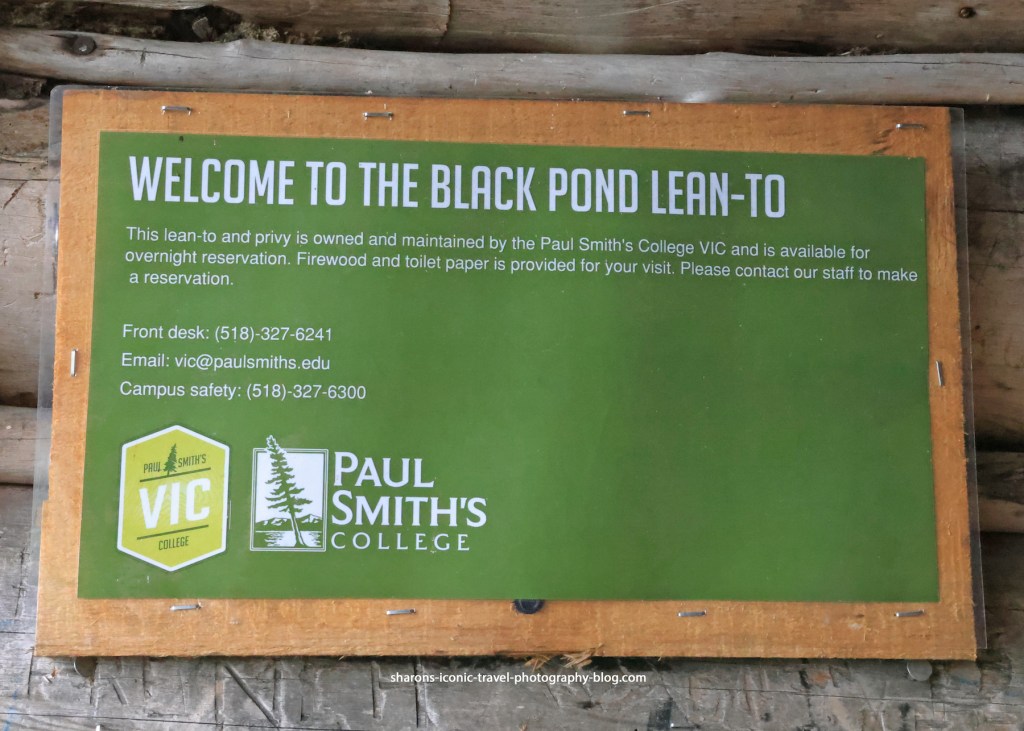
Lean-to
There are two lean-tos along the trail/lake. This is the first one near the entrance. You have to reserve them. They provide the firewood and toilet paper. There is a nearby privy/ outhouse. I don’t think any other sites in the ADK along lakes provide toilet paper and firewood .
They leave firewood in the lean-to so it stays dry. Since it rains in a short thunderstorm almost daily, that is a good practice.As you can see you get a good view of the pond from the lean-to. There is a fire-pit in front of it and the water is shallow in that area and you are able to get out of your boat there.Contact information to reserve the lean-to.
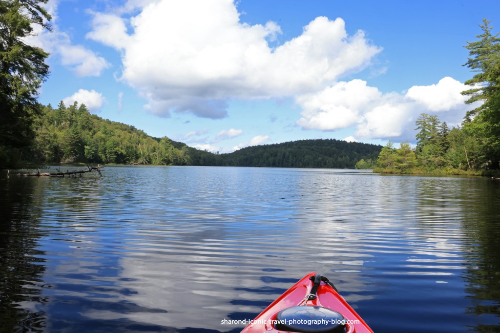
Pond
The pond does get some wind, but I found it less windy than larger nearby ponds. This pond did not appear to have access to other bodies of water.
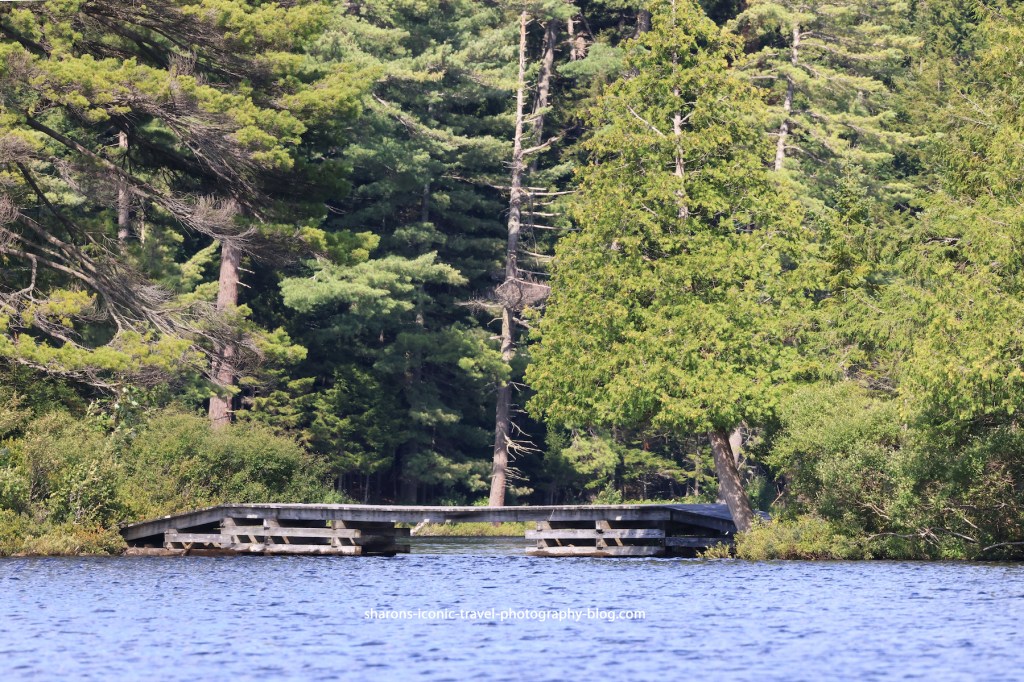
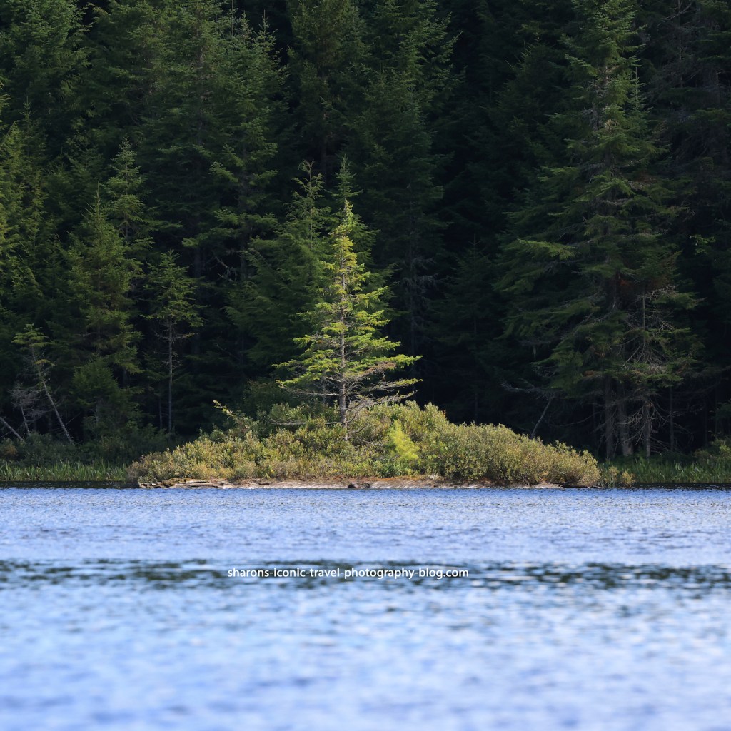
The water under this bridge appears to go to Little Black Pond. The bridge is too low to go under and too high to get on from a kayak. There was no access point on shore to the trail.Lone tree on an island.
Due to downed trees I did not see an access point on the north side of the pond to Long Pond. I don’t know if it was normally able to be accessed via kayak.
Wildlife
Wildlife is always a bonus for me. This pond had loons. There were ducks on the narrow part near the boat launch that were camera shy. They may have been black ducks. Adult loons may have one main pond, but will travel to other nearby ponds and lakes to socialise with other loons and fish. I believe I also saw a kingfisher.
This is a pond I would return to. I would bring a picnic lunch and bug spray. I got bit by mosquitos on land when hiking the trail, but not while kayaking. The lean-to was unoccupied and the area has a picnic table. It is also in close proximity to other larger bodies of water if you are trying to go to more than one body of water in the same day. If you are in the area and are looking for a shorter paddle, kayak or canoe Black Pond.
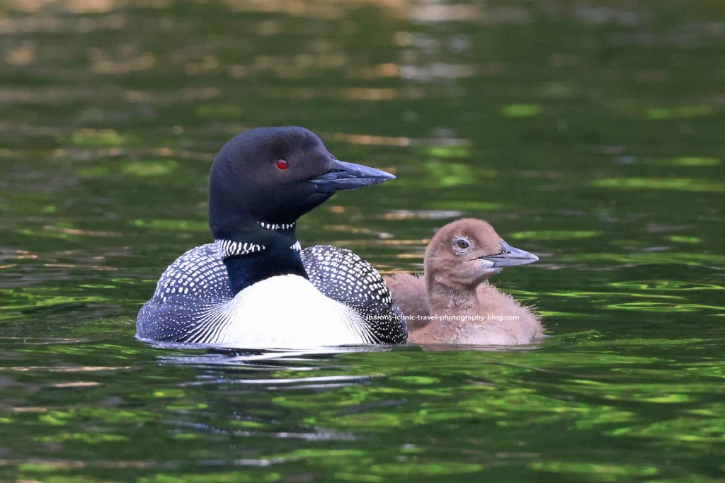
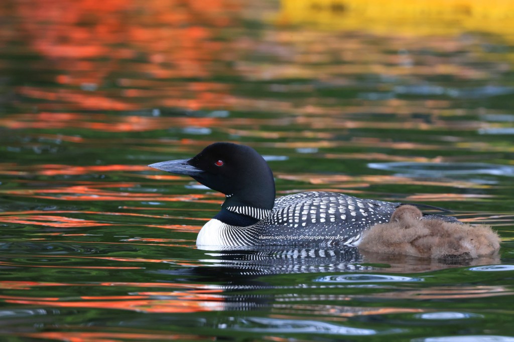
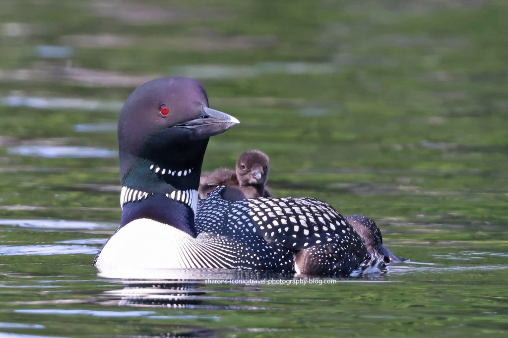
I find it fun watching loons. This parent had babysitting duty while the other parent was at another section of the lake in the Adirondack Mountains.
The loon below is power napping. It ate a few fish in the middle of the lake and then it then swam to the side of the lake with the parent. The parent kept watch while the baby napped.
The parent needs to keep watch. After I started kayaking away, the parent started giving a distressed call. I looked up and the eagle circled and landed in a tree nearby. Then it decided to fly off to a tree on the opposite side of the lake. On my few trips to the lake I have now seen the eagle multiple times either chase an adult loon flying or circle and get close to the baby and parent causing the parent to go into alert mode. I hope these loons make it through their time at the lake without the eagles getting one of them.
Sometimes you lucky out with sunlight, and sometimes you don’t. One this morning after the fog lifted you could witness some great colours on the water. These are just two of many I got that morning.
What is on or near the shore affects what colours you see reflected on the water’s surface. It could be boats, boat covers, kayaks, SUPs, etc. Also if the sun happens to be behind your back or at an angle can affect how you see the colours.
Articles on our near shore can add to the photo in ways you may not have originally expected. Get out and enjoy the summer between the rain. If your weather is like New York, we have downpours almost everyday.
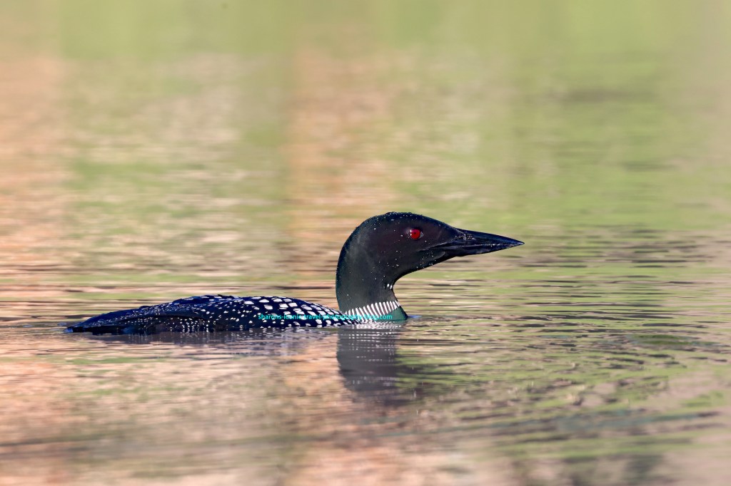
Normally I don’t say where I find most of the wildlife I do. Loons are on most ponds and lakes in the Adirondacks that are long enough to host them and with enough fish. These loons are on Loon Lake, of all places, in the Adirondack Mountains of New York.
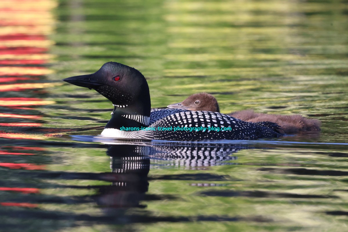
The baby’s legs are straddled out. It seemed to have a hard time balancing itself on the parent’s back at times.
This was the first time I was lucky enough to see a baby riding on its parent’s back. I have been up looking for this in June and July in previous years, but missed out in the past. I went up to stay for two nights, and made three kayak trips on Loon Lake. I saw them each time.
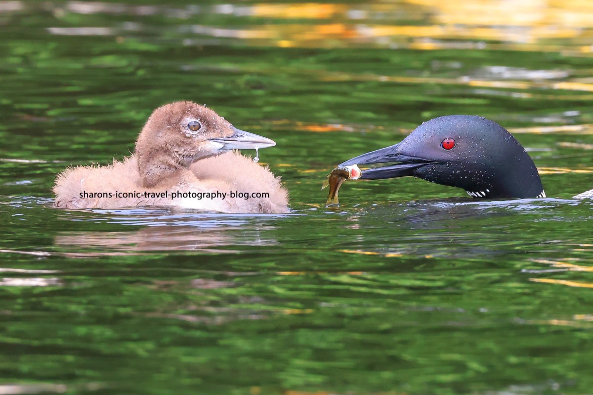
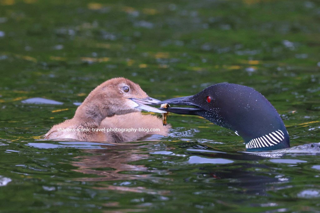
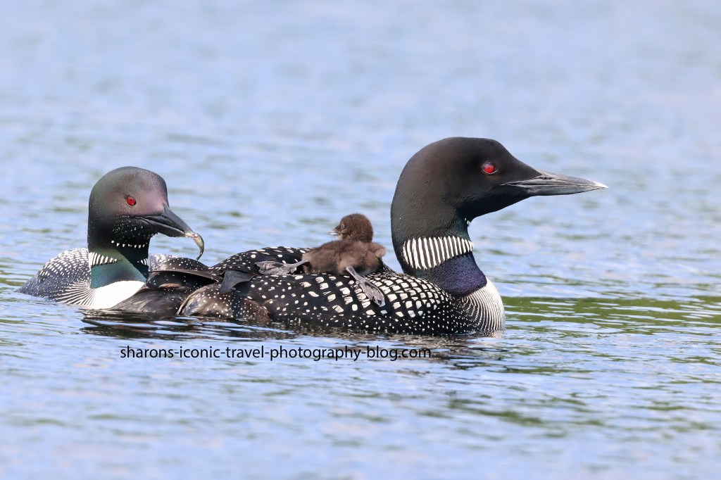
This parent had babysitting duty. The other parent was out and about feeding itself and came back periodically to try to feed the baby.
The other parent returning with the fish.
I was told by someone who lived along the lake that there were two eggs, but one never hatched. Most of the land around the lake is private residences or residences as investment property/ rental.
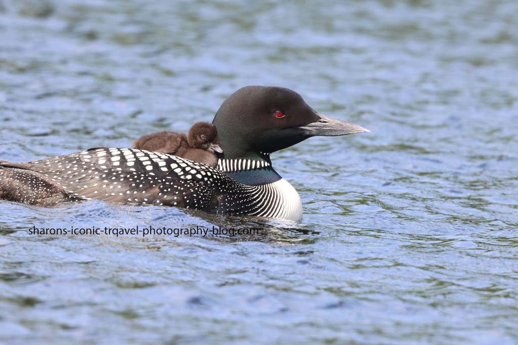
The baby was all tuckered out or knackered.
I probably took one hundred pictures on the first two of the three kayaking trips I made this short vacation. Get out and experience new things! Nature is a beauty to behold.
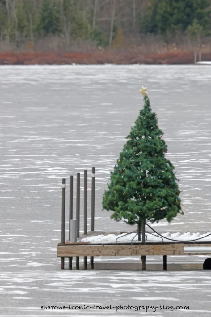
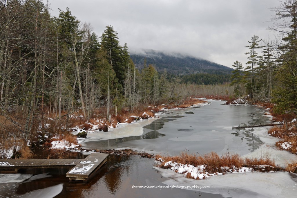
I made a world wind trip up to the Adirondacks. I almost brought my kayak. There was one body of water where I could have kayaked safely it appears with where to launch looking okay, but most places around Saranac Lake had snow and/or ice around the launches and ice on the lakes.
I was hoping they would turn on the lights, but they never did. Christmas tree on a dock as seen from the village of Saranac Lake.
The funny thing is on Thursday this lake had ice on it. On Friday morning the ice was gone. When I left on Saturday morning the ice was back. It is crazy how quick the ice forms and disappears at this point in the year.
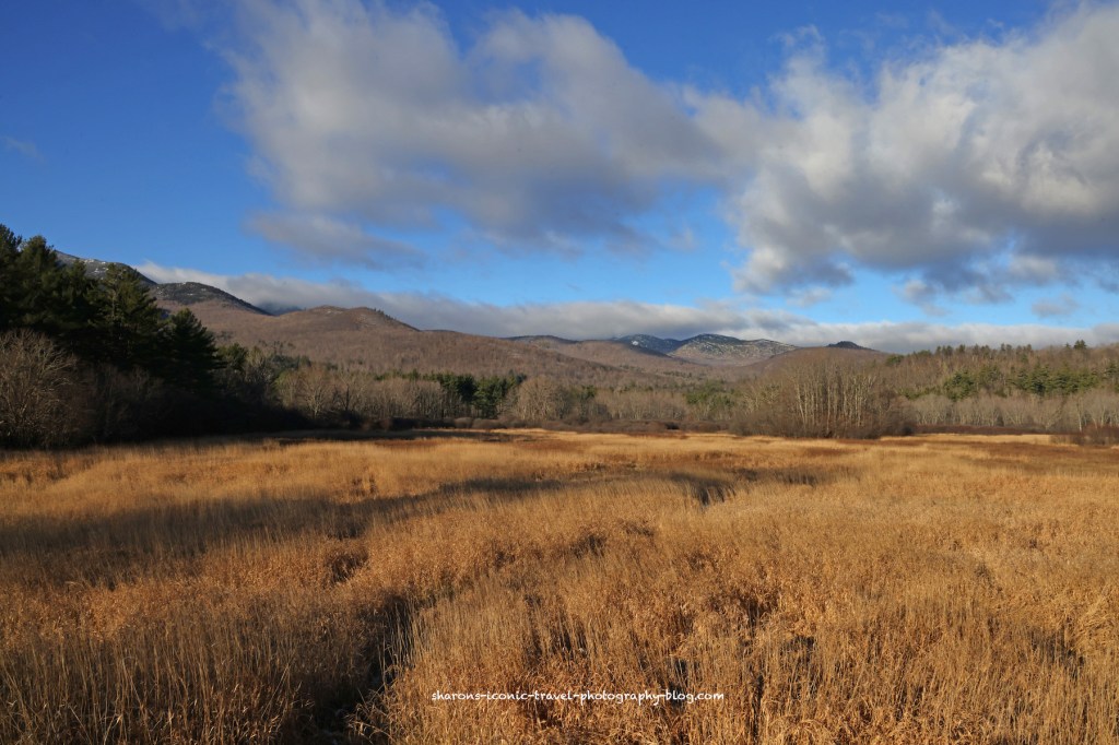
South Creek boat launch looking the opposite direction from Upper Saranac Lake.East of Lake Placid. I think this may in be in or near Keene Valley. This area did not get much snow.
If you are American, I hope you enjoyed your Thanksgiving holiday. If you live in the northern hemisphere, enjoy the transition into winter. There is beauty in every season.
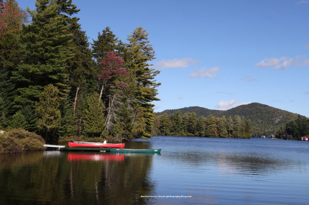
There are two lakes you can access from the town of Lake Placid in New York. From the main business street in the village you can see Mirror Lake. If go on west towards Saranac Lake on the outskirts of the town the much larger lake is Lake Placid. Lake Placid , the lake, has a few hotels along it, private land with mostly summer residences, and some land that falls under wilderness or forest preserve.
These were all from an end of September trip to the Adirondacks. I took one long trip on the lake, and a couple of short trips. I started out from the Paradox Bay area of the lake on the southern end. This area of the bay has shallow areas and attracts wildlife. Basically most of the wildlife I saw along the lake was in that section.
There is a boat launch with ample parking outside the bay on the lake.
On the lake
Correct me if I am wrong, but I think that is Whiteface Mountain in the background. The issue with large lakes in the Adirondacks is many times when you get away from shore it can be quite windy. On my long trip the first day I was there I did fine hugging the island on the way towards Whiteface landing, but on the return when I crossed the lake to the east side is was a struggle to head south hugging the shore. The wind was pretty strong. I did see a few other kayakers out there. I think one whom I talked to briefly ended up getting a ride on a boat. I was too busy trying to paddle to get any decent pictures on the return.
A different trip
There are a lot of summer homes along the lake. Some are only accessible by boat.
Traffic
Canoeists out for short paddle.
In summer this lake is very busy with a lot of motorboat traffic. I shy away from paddling this lake during the summer months. In September after Labor Day many of the summer people have left and there are more kayakers and canoeists than motor boaters. I highly recommend going before or after summer and staying close to the shore of the lake.
Wildlife
Common Loon- I only saw once and it was right where the bay met the rest of the lake.
I did hear and briefly see a kingfisher several times. At some lakes they will pause long enough for you to get a snap of them, at this lake they don’t. I saw two adult kingfishers on the bay.
The heron liked to hang out of the southern end of a bay. There were ducks and also 2 what appeared to be juvenile snow geese I think I included on another post.
I recommend visiting this lake to canoe or kayak before or after summer. Always be prepared and dress appropriately. Be familiar with the conditions. It is a beautiful lake!
I believe this was on Lake Colby outside the town of Saranac Lake
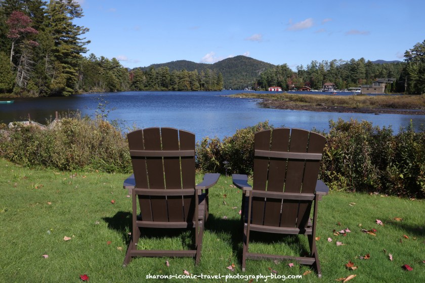
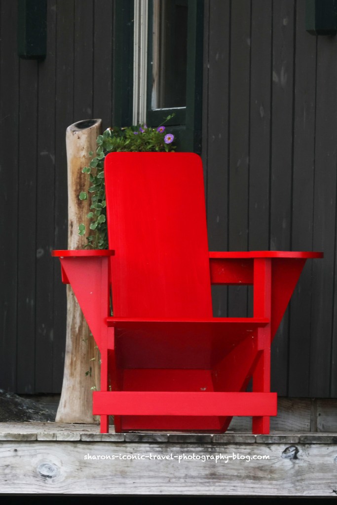
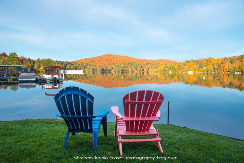
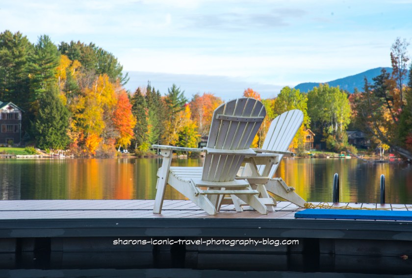
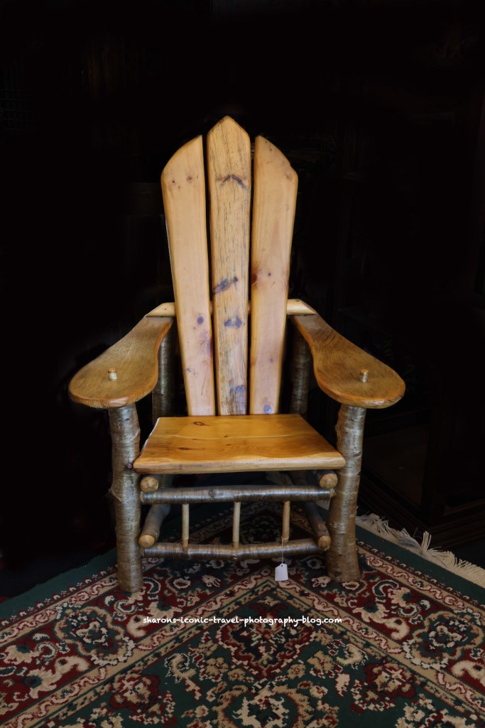
What iconic piece of furniture makes many people envision many summer and relaxation? It’s the Adirondack chair. Invented first as the Westport chair in the Adirondack Mountains of New York, it later became known as the Adirondack chair.
This chair seems to resemble more the original chair: the Westport chair – on Upper Saranac Lake
The Westport chair had a solid back, as opposed to many of the chairs today which consist of slats in the back.
On Lake Flower in the town of Saranac Lake – View from Gauthier’s Saranac Lake Inn property
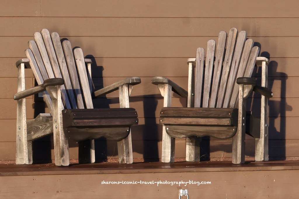
According to Merriam Webster an Adirondack chair is a wooden lawn chair with a high slatted back, broad arms, and a seat that is lower in the back than the front. So the main difference in design between the Westport chair and the Adirondack chair seems to be slats used instead of solid wood pieces for the area such as the back.
Mirror Lake in Lake Placid, NY- Old Style Adirondack chairs and Adirondack recliners.
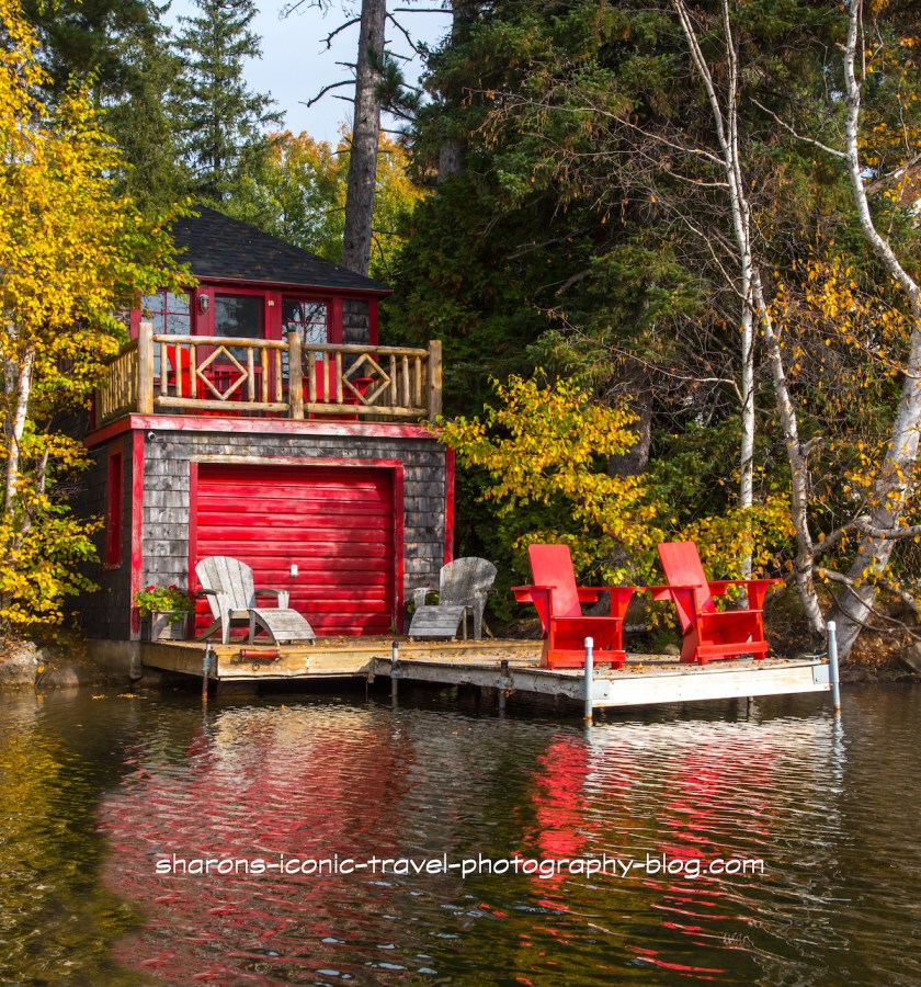
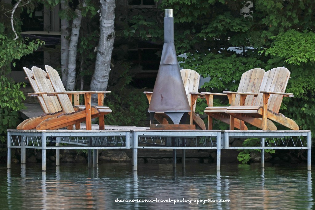
It is popular in the Adirondacks to see the chairs on boathouse docks, boat docks, around fire pits, and on beaches.
Mirror Lake
The Adirondack Mountains in New York usually has dry summers and cold, snowy winters. These chairs typically were built to hold up well in the weather.
Saratoga N.Y. area
The sloping seat many find comfortable. The position of the back area makes it unnecessary for most people to find the need to use pillows with it.
In an antique shop in Lake Placid- a combination of tree branches and more traditional Adirondack chair parts- I think the store owner said this one is not antique a local person makes them.
The size of the arm rests makes it convenient to place a drink on.
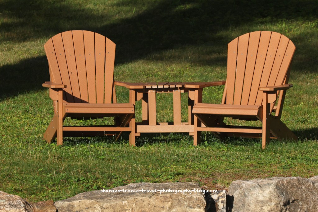
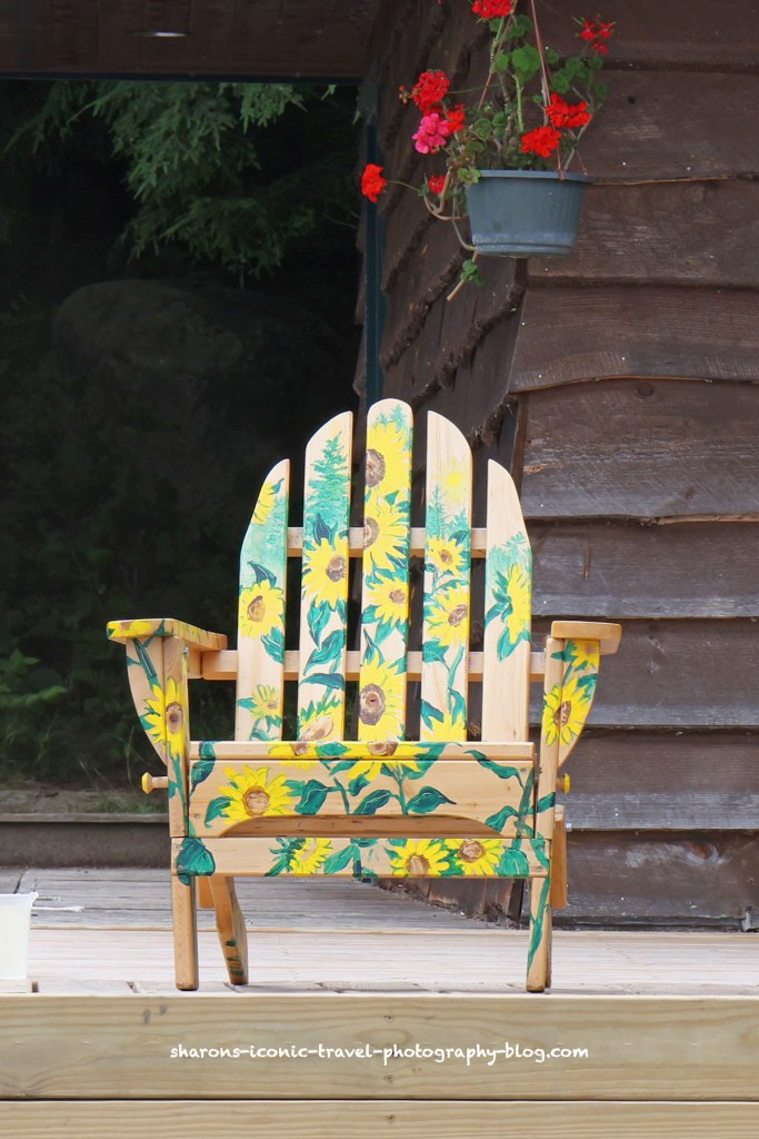
Lake Placid the lake- View from Wildwood on the Lake’s Property (hotel)On Lake Placid- a very nice patina of woodTwo with a connecting tableOn a dock with a chiminea, outdoor fireplace- on Mirror LakePainted with sunflowers- Upper Saranac Lake
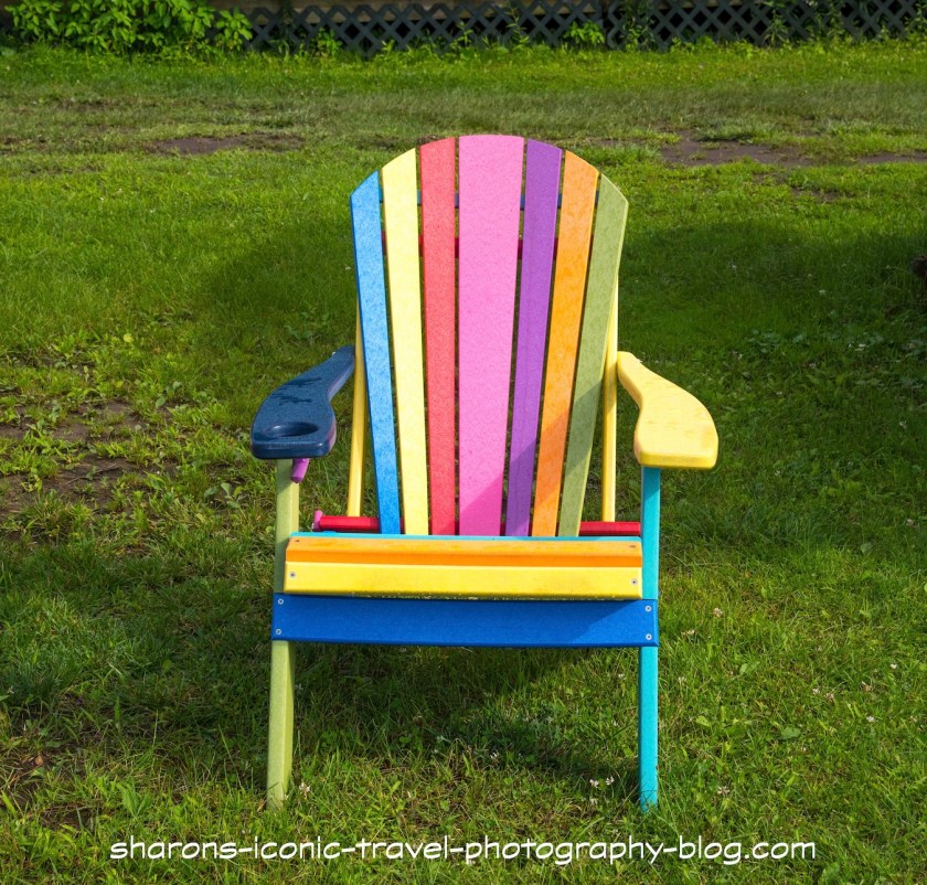
These chairs are not just sold in the Adirondacks, although they can be seen all over the area. They can be any colour or painted with scenes on them. Do you have this iconic outdoor furniture in your yard?