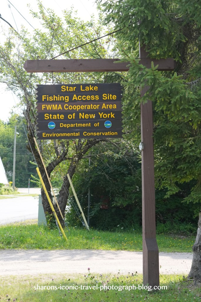
I read somewhere this lake was private, but I found a state operated fishing access boat launch. This means you can kayak here.
Star Lake
This launch has a parking lot across from a gas station store off of route 3 in Star Lake, NY. There are a few parking spaces. I seemed to be the only one that was launching a boat. Others stopped to park there to eat lunch it appeared. It had at least one picnic table at the parking area. I did not see a privy/ outhouse on site.
Star Lake
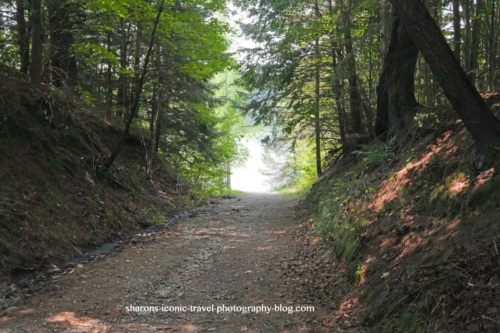
Above is the road down to the launch. I walked my kayak down with the use of kayak wheels.The road was very affected by erosion and had ruts near the top. I am not sure if this area was affected by the storm that delivered 10 inches an hour or so north.
Star Lake
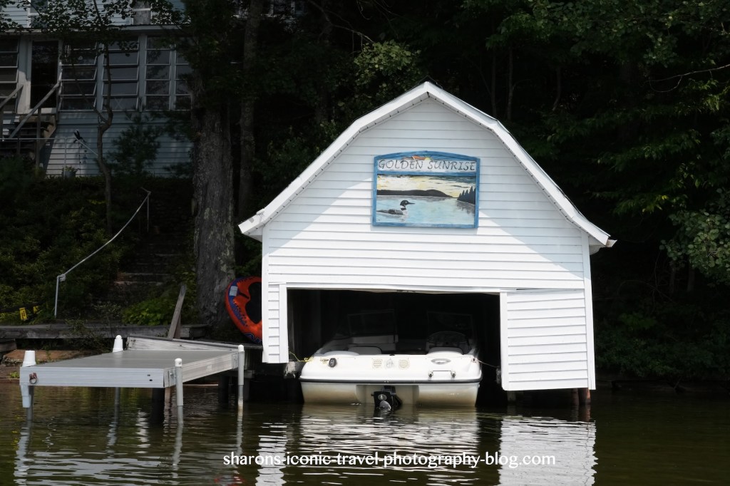
The lake had many houses along certain parts of it, some having boat houses. These are not as elaborate as the ones in the areas of Lake Placid and Saranac Lakes.
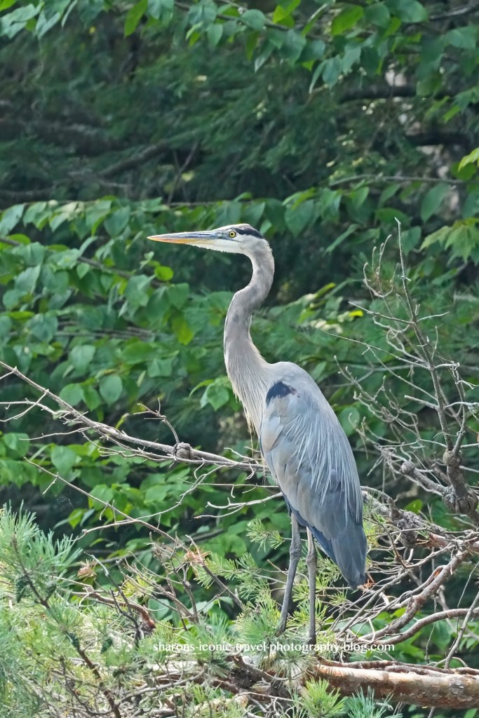
Wildlife
Star Lake- Heron
This heron flew into a tree branch on the shady side of an island.
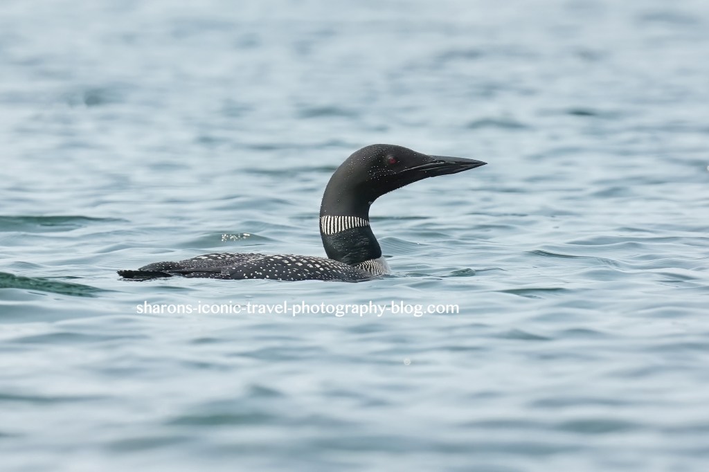
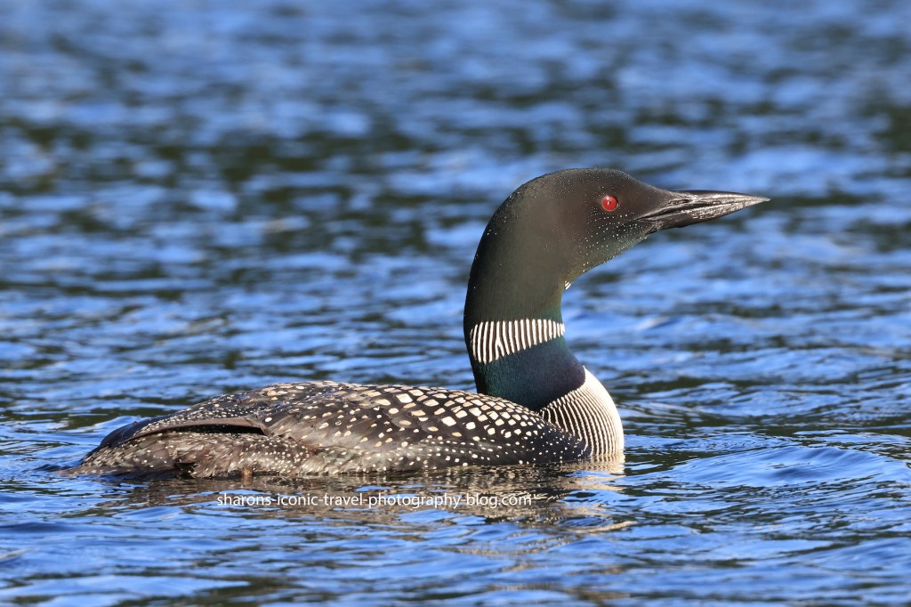
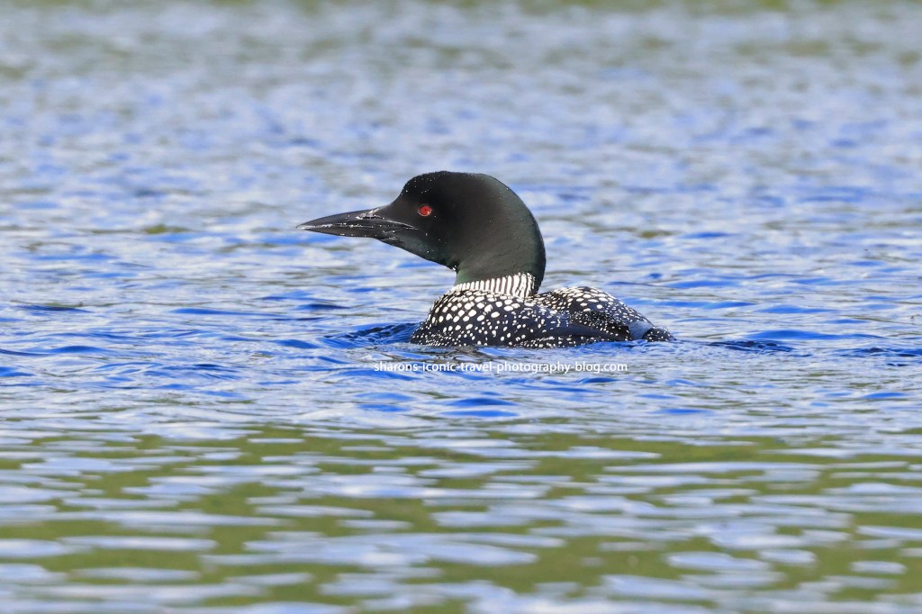
Star Lake – Loon
There were multiple adult loons here sticking together when I was there. I think I saw 4. They were getting along and diving down in spurts. This was taken with a zoom lens at quite a distance and heavily cropped. The quality is not as good as the photos I get of the loons who swim up to my kayak.
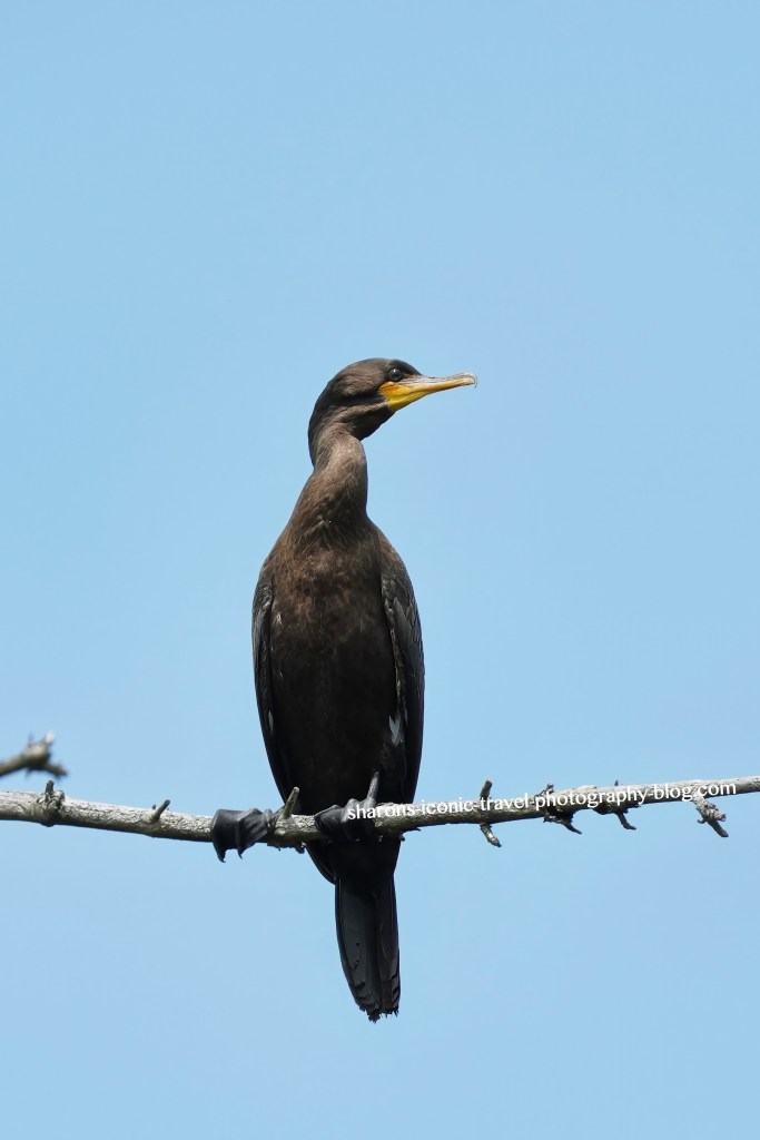
Star Lake – Cormorant
There were two cormorants in a tree. This one had better light on it.
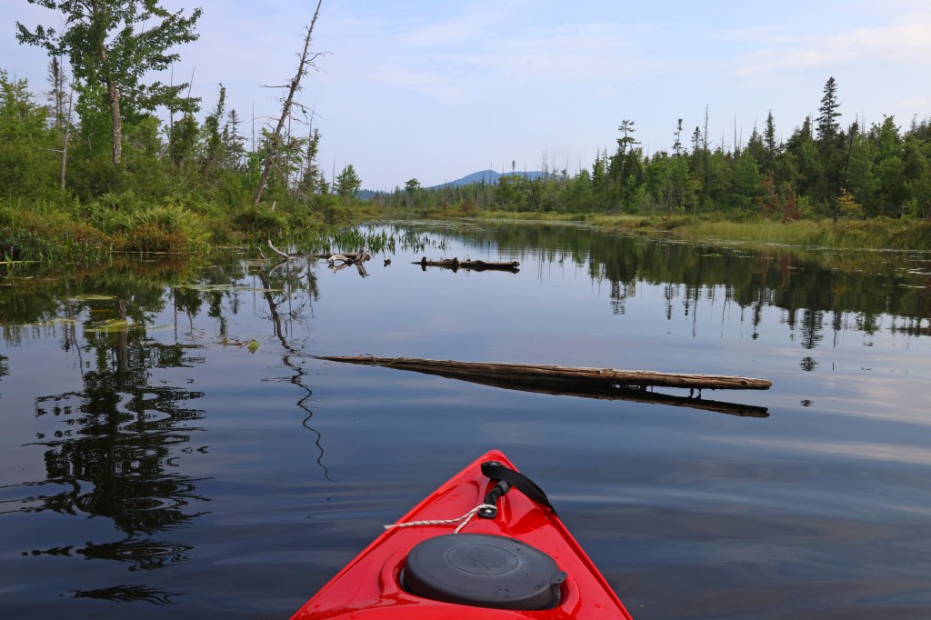
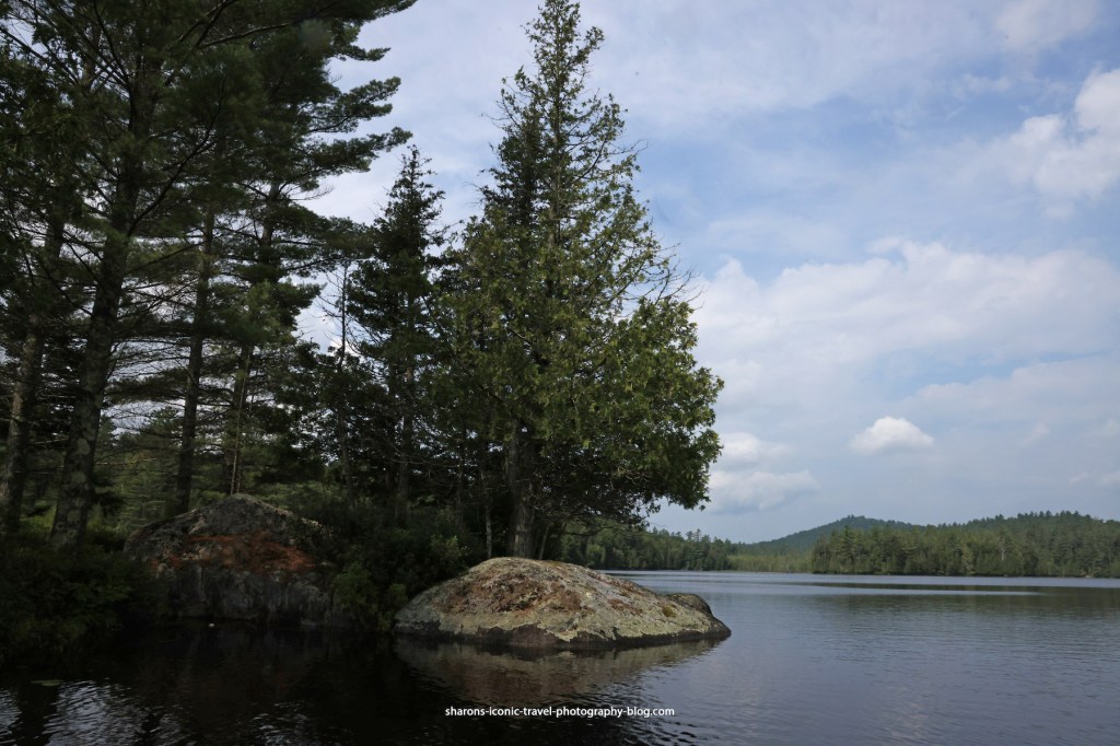
Star Lake
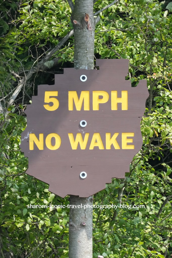
These signs are in the shape of the Adirondack Park. They had a few of these no wake signs up on the lake. All boats were slow moving that day. I was more concerned with the wind.
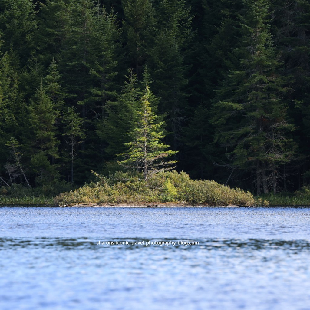
Star Lake
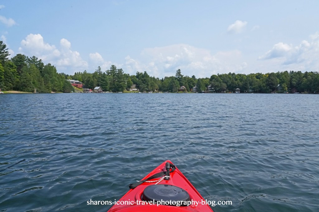
I did not take too many photos of the lake itself. The wind again concerned me. In addition there were many houses along parts of it and people in the water or on shore. I try not to take pictures including people when I can.
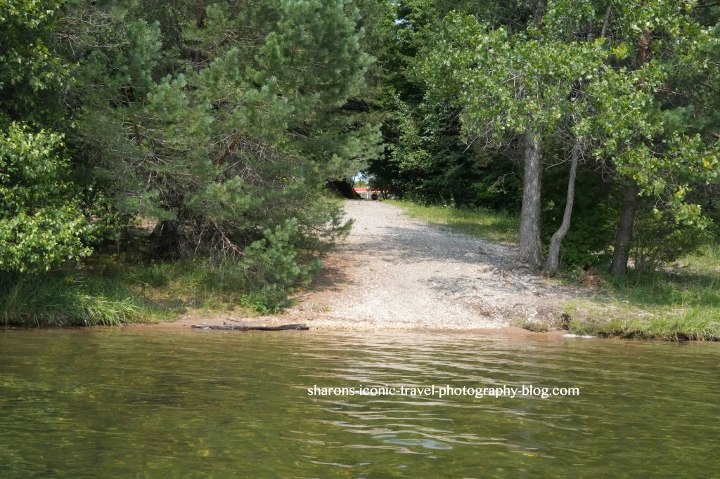
Star Lake
This is the boat launch from the lake. It was easy to get in and out of the lake here, the ruts due to erosion made it a little difficult to move your kayak down to the water. I rate it a nice lake to a canoe or kayak on a day trip.
“To improve is to change; to be perfect is to change often.”
Winston Churchill
The colour of the water appears to change in minutes when out kayaking on a lake. A lot of things come into play such as cloud cover, sunlight, time of day, what is nearby on land will all affect how the colour of the water appears. If you wait around you just may get to see the water appear to be different hue.
This is a loon from Upper St. Regis in the Adirondack Mountains of New York. In other pictures that day, the water appeared green and different shades of blue etc. Change sometimes is good.
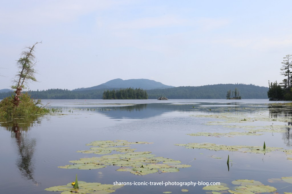
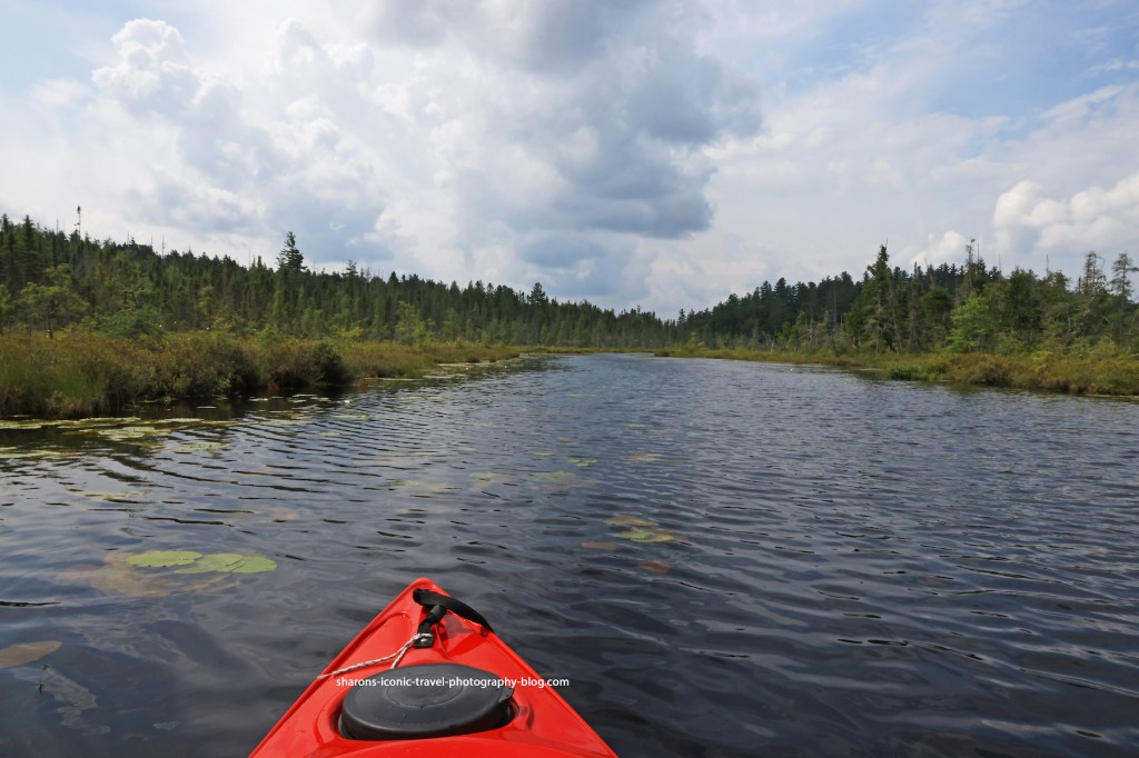
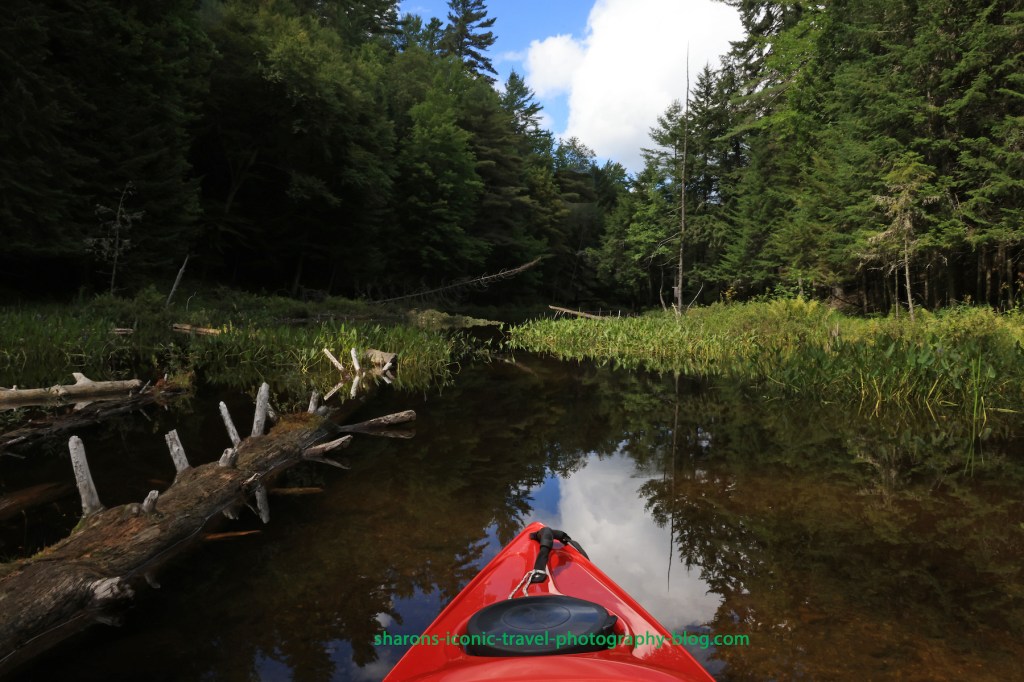
What is one place where you can paddle more than one body of water while not getting out of your boat, and it is close to the towns of Saranac Lake and Tupper Lake? Middle Saranac Lake is one of the options.
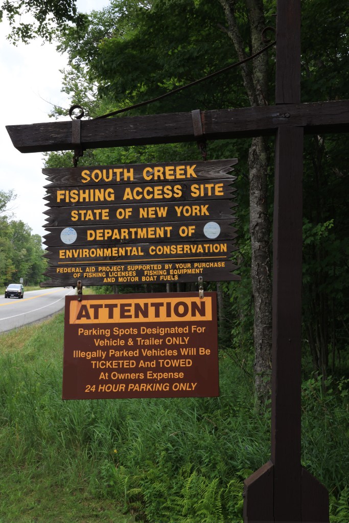
South Creek Boat Launch
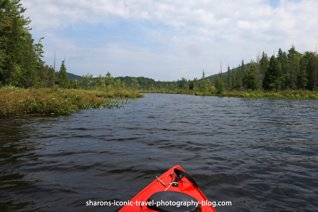
One trip from Middle Saranac you can make is paddling to the Weller Ponds. Both of these are accessed by boat through passageways between the bodies of water. One way to get into Middle Saranac Lake is through the South Creek Boat Launch. It is right off Highway 3 going from Saranac Lake to Tupper.
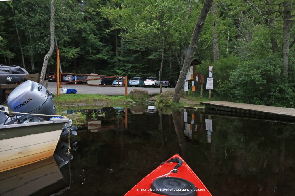
There is a parking lot that can handle several cars. There is a privy/ outhouse closer to Highway 3 in the parking area. They have several barriers up. It is hard to walk a kayak through on wheels. It is easier if someone is there and you can ask them to be a second set of hands to carry it over the big rocks. Once you get it in the water it is a gradual descent into the water which is great for kayaks. People canoeing prefer the dock. I wish they would get rid of one of the big rocks, so people could easily get their kayak or canoe through.
South Creek Passage to Middle Saranac
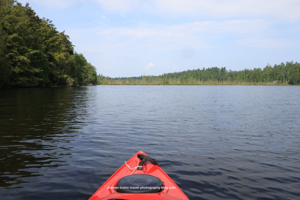
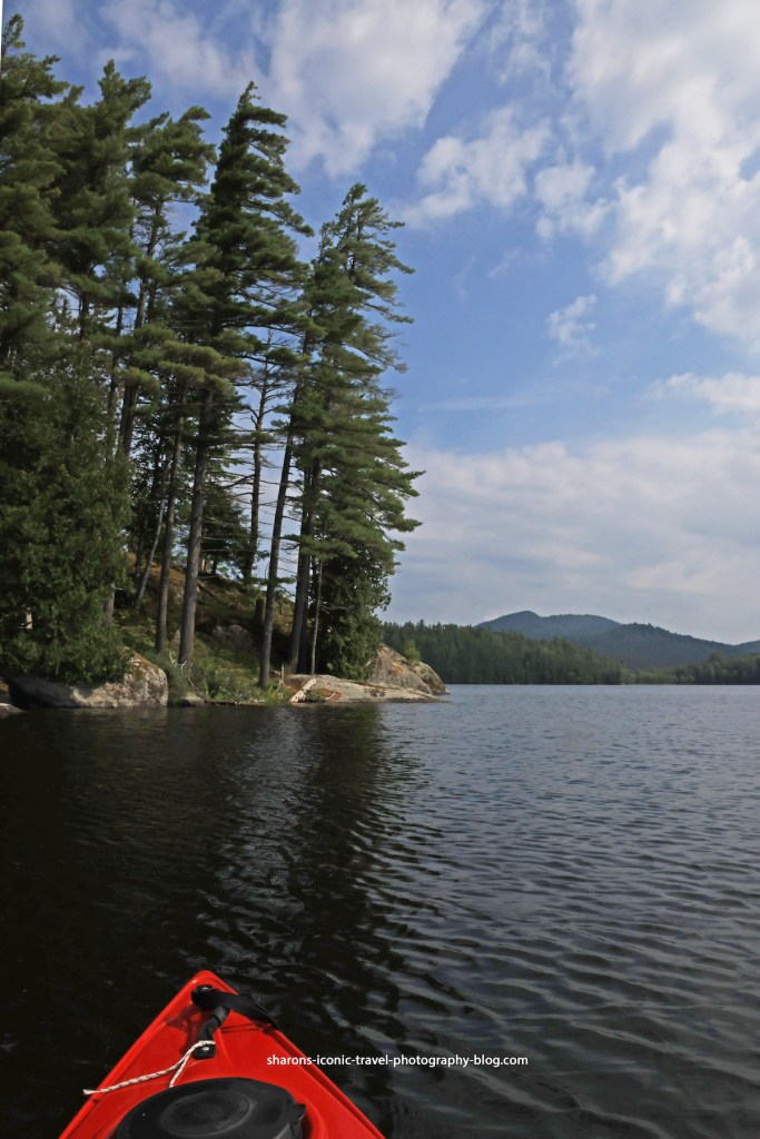
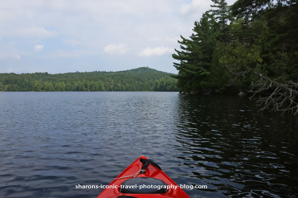
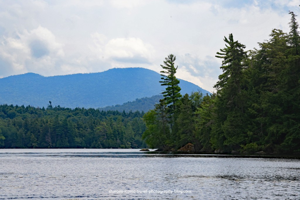
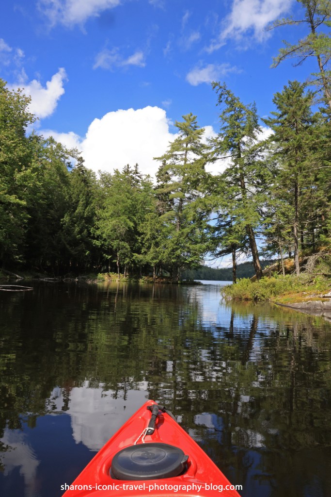
Middle Saranac Lake
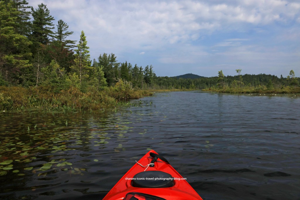
Hungry Bay
Hungry Bay is the northern end of Middle Saranac Lake directly north across the lake from the South Creek entrance to the lake.
Because of the wind and predicted threat of thunderstorms around the time I would try to get back to the parking lot, I skirted the edge of Hungry Bay to be safe.
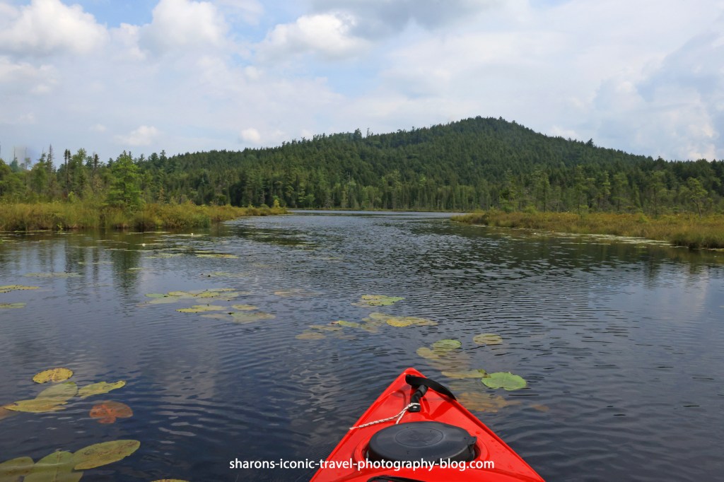
Passage from Hungry Bay to the Weller Ponds
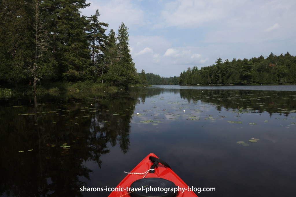
Weller Pond
The above is looking towards the entrance of Weller Pond. I did not take too many pictures on this pond because it looked like the campsites along it and on or near Tick and Tok Islands were occupied. There were also kids out on the lake in boats.
The above picture is looking towards the northern part of Weller Pond from the east side.
Little Weller Pond
If you are heading from Middle Saranac to Weller the passageway to Little Weller Pond is on the right before you get to Weller. This is the passageway leading into Little Weller Pond.
It is a smaller body of water, hence its name. There are no campsites along this body of water.
Passageway Back To Middle Saranac Lake
This is the passageway looking south and heading back towards Hungry Bay of Middle Saranac Lake.
Camping
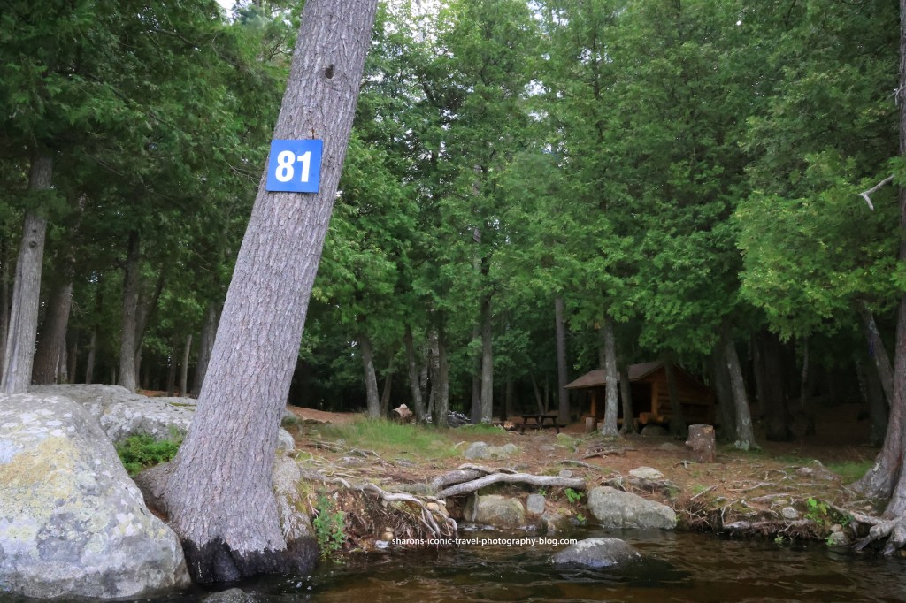
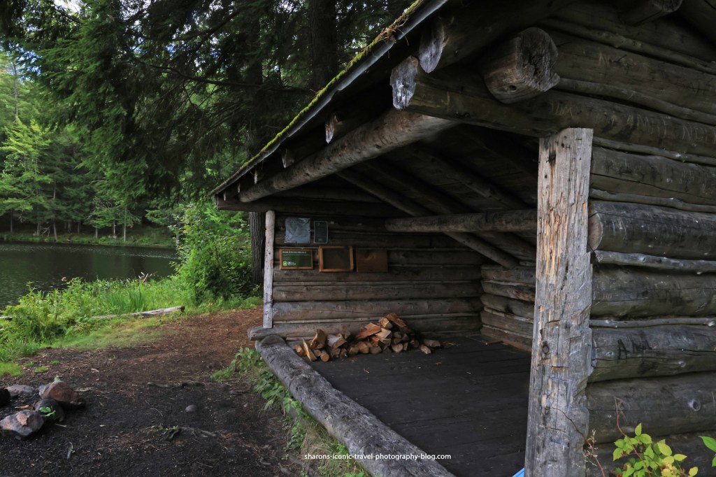
There are camp sites along Middle Saranac Lake and Weller Pond. These sites have to be reserved through http://www.reserveamerica.com or through the reservation number at 1-800-456-CAMP. I have never seen all the sites on this lake occupied on my visits. Campsite 81, pictured above, has a lean-to. Only two other sites, one on the east side of the lake and one on the northwest side of Weller Pond have one. Most of them involve pitching your own tent. They come with a picnic table, a fire pit, and a privy/outhouse.
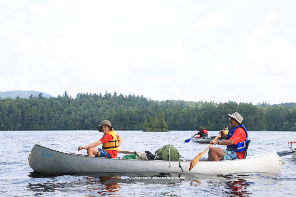
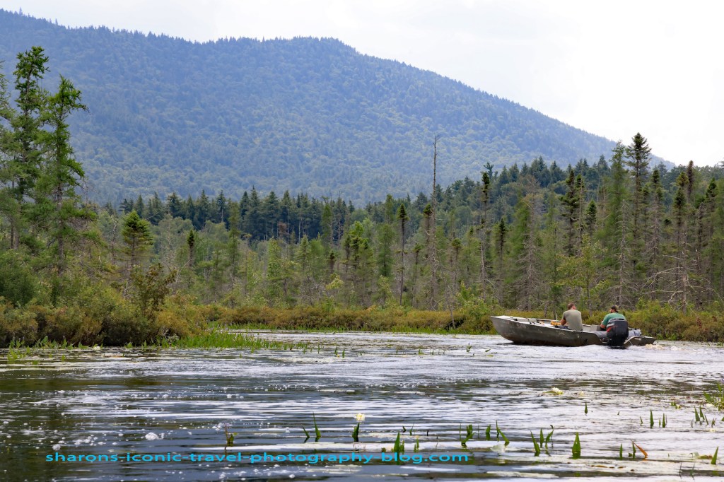
This was a group of boys and men who were heading for a campsite on the lake for the night. They took all their gear on their canoes with them. They traveled with several canoes. This canoe gave me permission to take their picture.
Wildlife
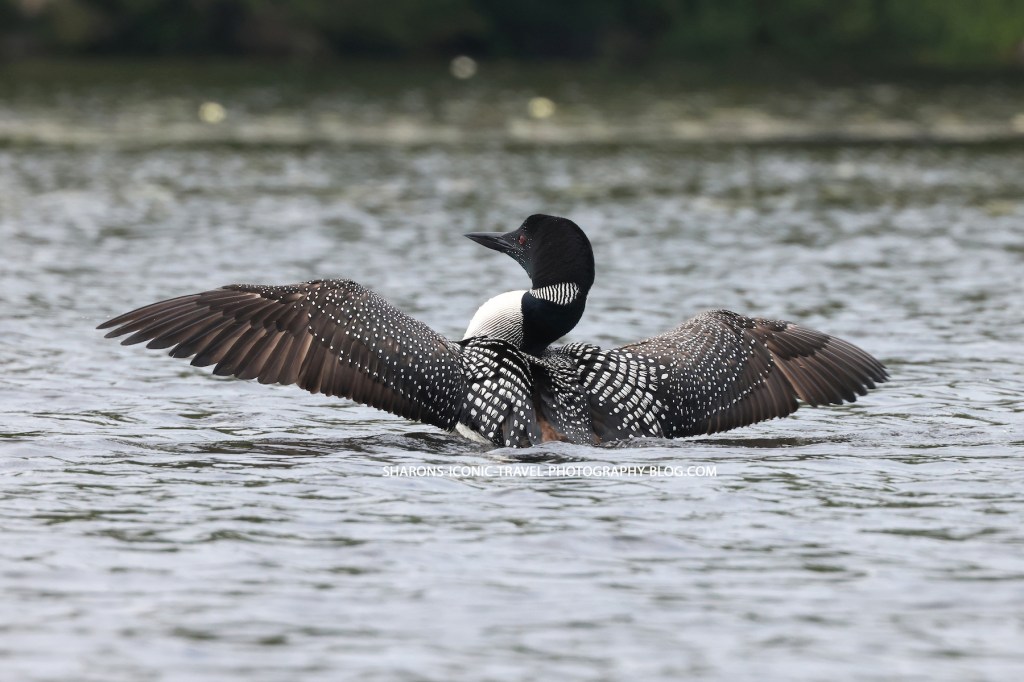
Every time I visit this lake I either see loons or hear them. I saw two together near the South Creek entrance to the lake. I also heard two and saw one in Hungry Bay. An eagle nest is on a nearby body of water, so you may see one circle looking for fish.
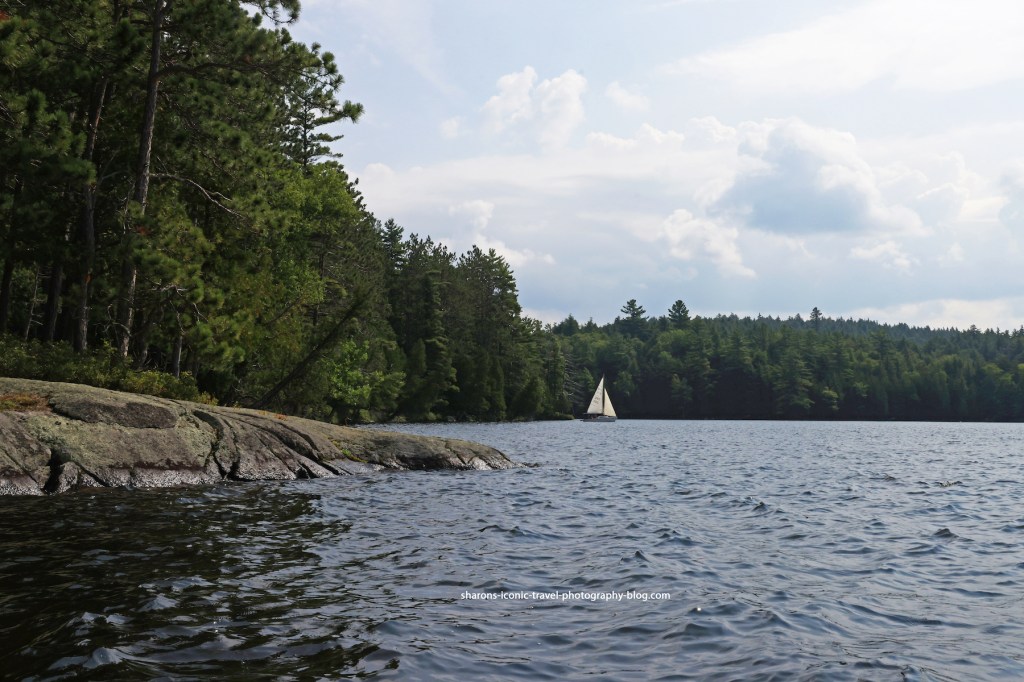
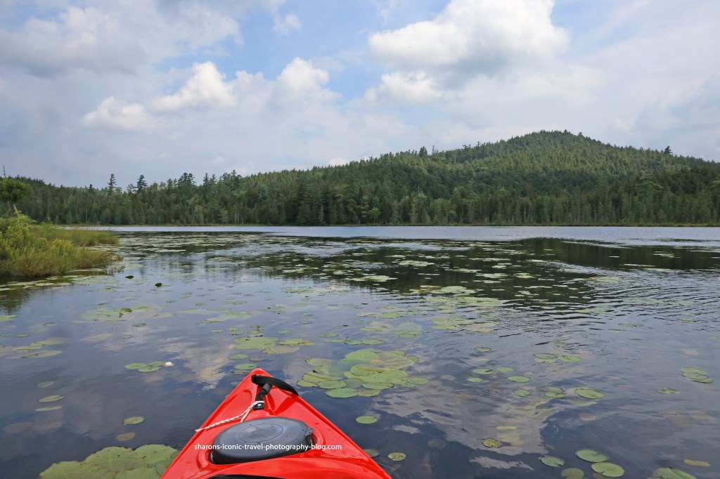
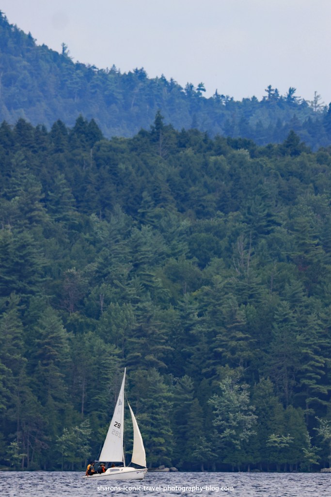
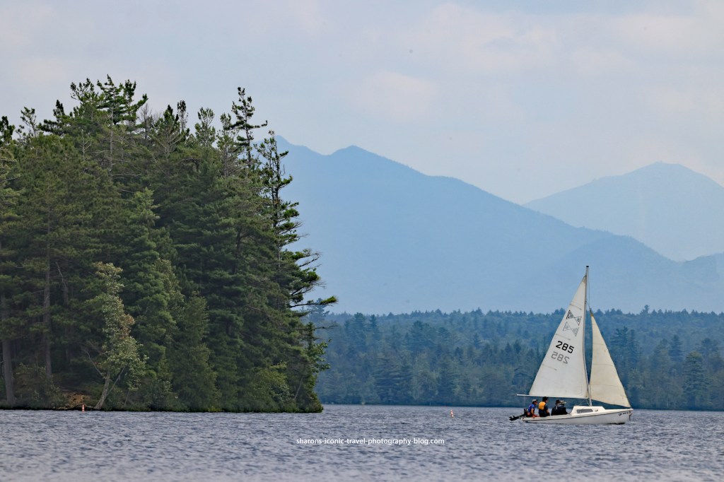
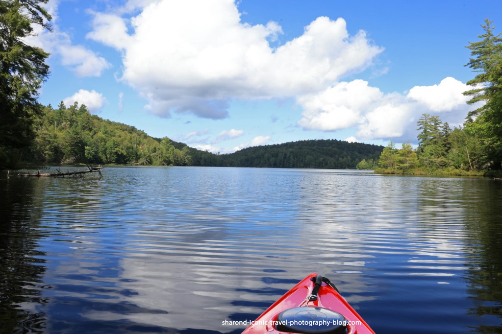
Middle Saranac Lake
This lake is a motor boat lake, although the times I have been here I have mostly seen people in canoes and kayaks either fishing or heading towards campsites along the lake. There are a few private houses as you get closer to the west side. I’m not sure if some of them are water access only or they are ones accessed through the private road, Bartlett Carry.
This visit it was a treat to watch a sailboat take advantage of the winds and circle around the lake.
As you can see from the above photos, one of the positives about paddling this lake are the Adirondack Mountain views.
Entrance to South Creek
I highly recommend paddling this lake and route. You get nice mountain views. I would recommend as always bring food and water. You never know when you might need to pull off for a passing thunderstorm or because you need a rest. The unoccupied campsites have great views and make great picnic spots.
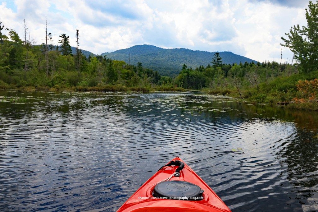
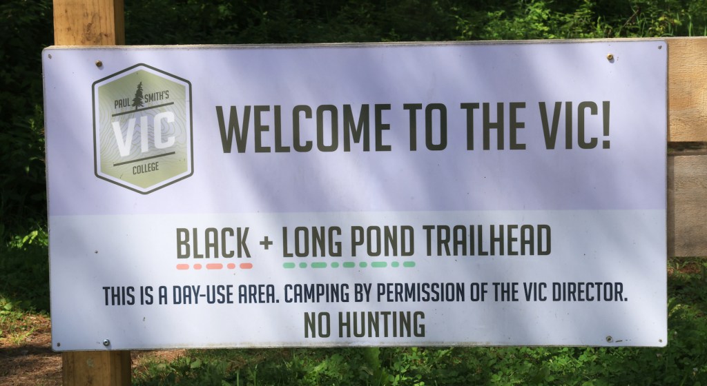
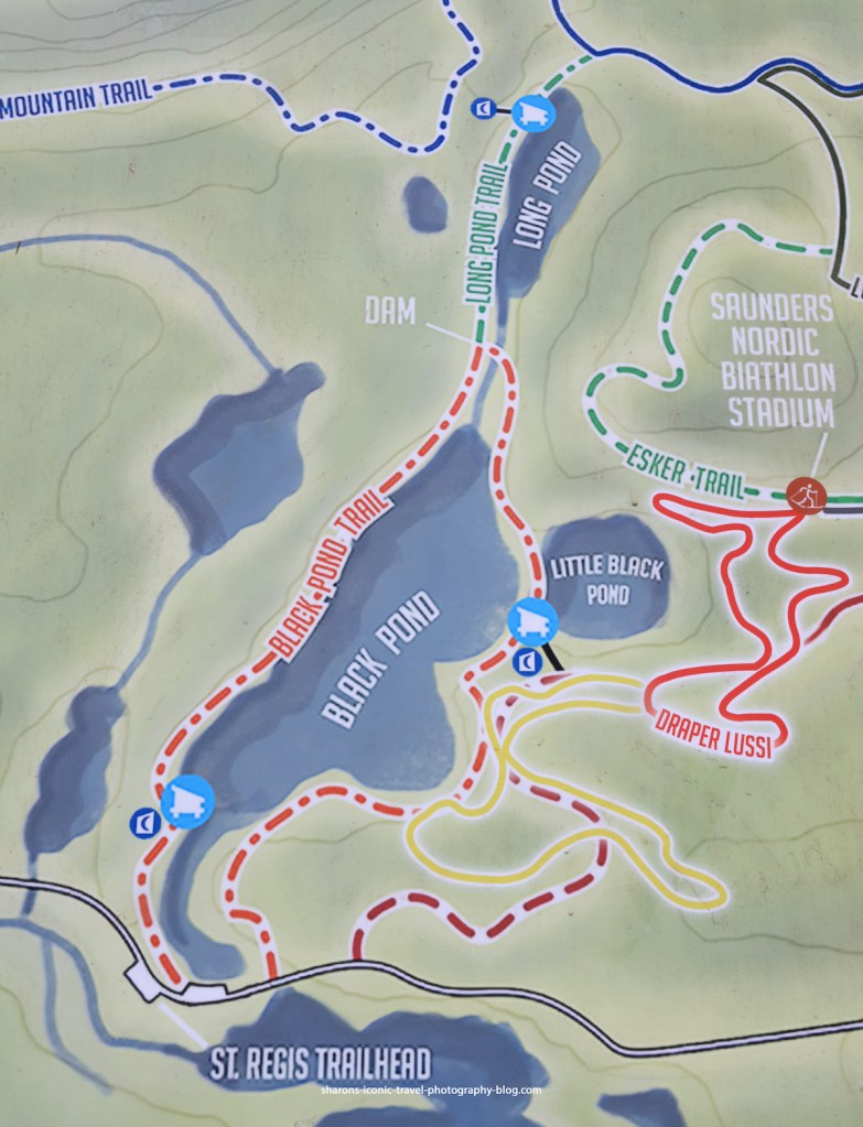
What college campus has several hiking trails and ponds open to the public? Paul Smith’s College in the Adirondack Mountains does. Black Pond is on an area of land controlled by Paul Smith’s College. The public is able to access the trails to hike and the ponds to kayak or canoe with no cost.
Black Pond’s parking lot can be accessed off Keese Mills Road in Paul Smiths, NY. It is a small lot that holds maybe 6 cars.
Close to the parking lot is the boat launch. It is more for canoes as the dock is higher off the water. It is a little tricky for kayaks. There is an area next to the dock you can step in the water with a depth of about 1 1/2 to 2 feet next to shore that is rocky on the bottom. When I say rocky some of the rocks are big, so be careful.
The area to paddle from the dock to the lean-to on the pond is narrow. I count this as a passageway and not the pond.
Above is the entrance to the larger portion of the pond. The lean- to will be on the left of the entrance.
This is at the end of the entrance to the pond.
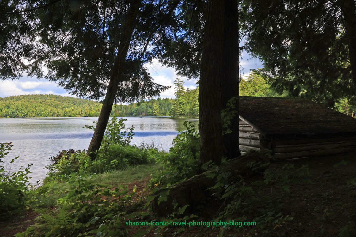
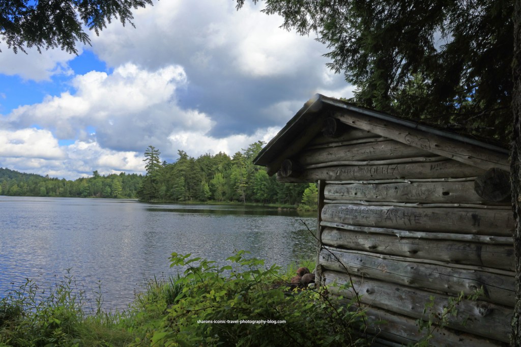
Lean-to
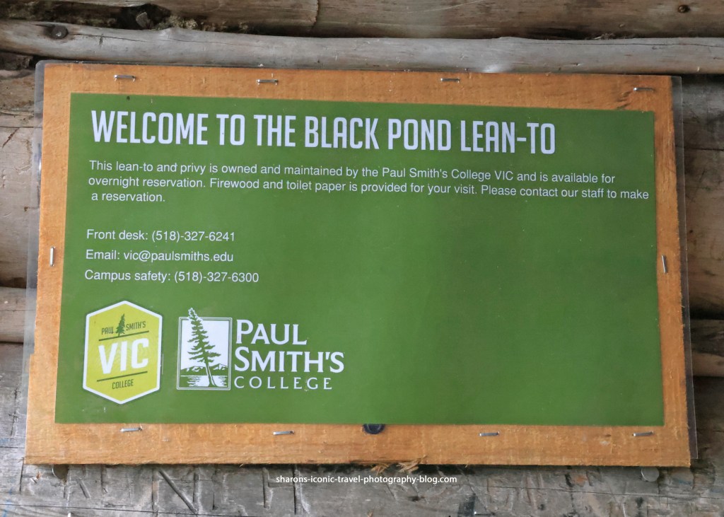
There are two lean-tos along the trail/lake. This is the first one near the entrance. You have to reserve them. They provide the firewood and toilet paper. There is a nearby privy/ outhouse. I don’t think any other sites in the ADK along lakes provide toilet paper and firewood .
They leave firewood in the lean-to so it stays dry. Since it rains in a short thunderstorm almost daily, that is a good practice.As you can see you get a good view of the pond from the lean-to. There is a fire-pit in front of it and the water is shallow in that area and you are able to get out of your boat there.Contact information to reserve the lean-to.
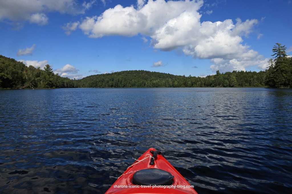
Pond
The pond does get some wind, but I found it less windy than larger nearby ponds. This pond did not appear to have access to other bodies of water.
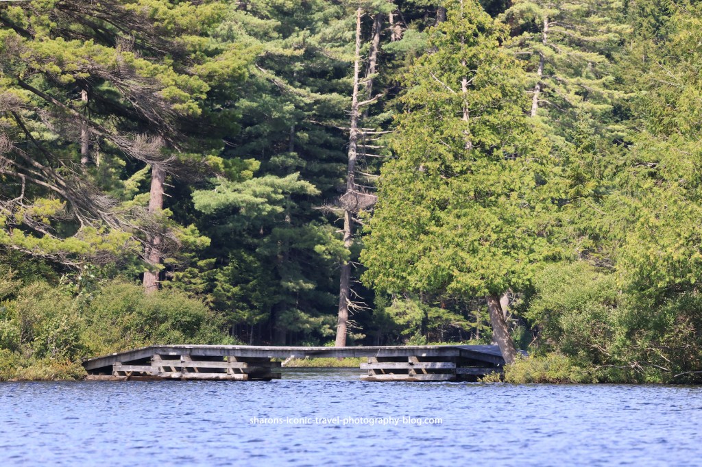
The water under this bridge appears to go to Little Black Pond. The bridge is too low to go under and too high to get on from a kayak. There was no access point on shore to the trail.Lone tree on an island.
Due to downed trees I did not see an access point on the north side of the pond to Long Pond. I don’t know if it was normally able to be accessed via kayak.
Wildlife
Wildlife is always a bonus for me. This pond had loons. There were ducks on the narrow part near the boat launch that were camera shy. They may have been black ducks. Adult loons may have one main pond, but will travel to other nearby ponds and lakes to socialise with other loons and fish. I believe I also saw a kingfisher.
This is a pond I would return to. I would bring a picnic lunch and bug spray. I got bit by mosquitos on land when hiking the trail, but not while kayaking. The lean-to was unoccupied and the area has a picnic table. It is also in close proximity to other larger bodies of water if you are trying to go to more than one body of water in the same day. If you are in the area and are looking for a shorter paddle, kayak or canoe Black Pond.
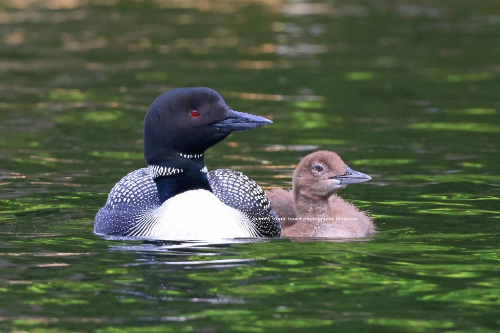
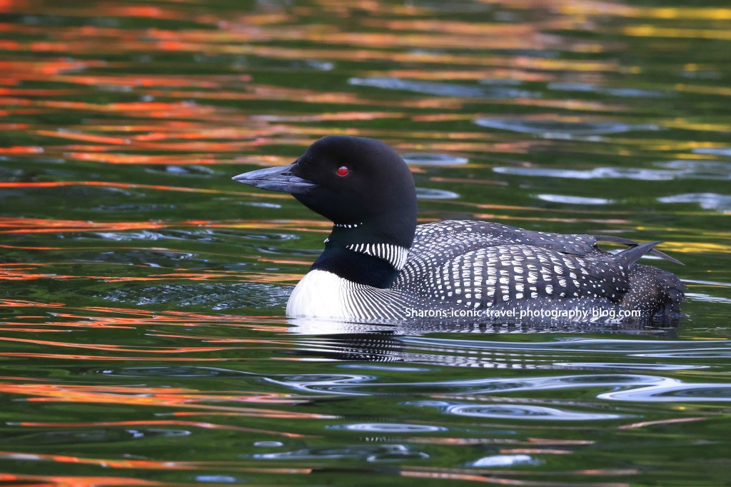
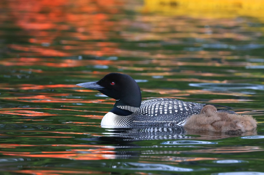
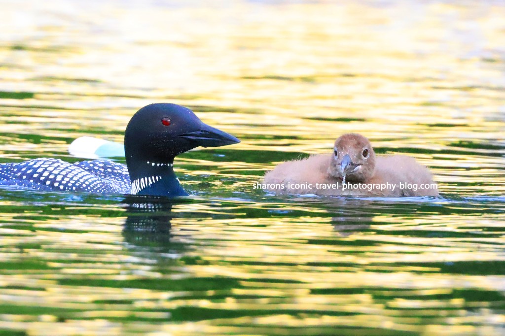
I find it fun watching loons. This parent had babysitting duty while the other parent was at another section of the lake in the Adirondack Mountains.
The loon below is power napping. It ate a few fish in the middle of the lake and then it then swam to the side of the lake with the parent. The parent kept watch while the baby napped.
The parent needs to keep watch. After I started kayaking away, the parent started giving a distressed call. I looked up and the eagle circled and landed in a tree nearby. Then it decided to fly off to a tree on the opposite side of the lake. On my few trips to the lake I have now seen the eagle multiple times either chase an adult loon flying or circle and get close to the baby and parent causing the parent to go into alert mode. I hope these loons make it through their time at the lake without the eagles getting one of them.
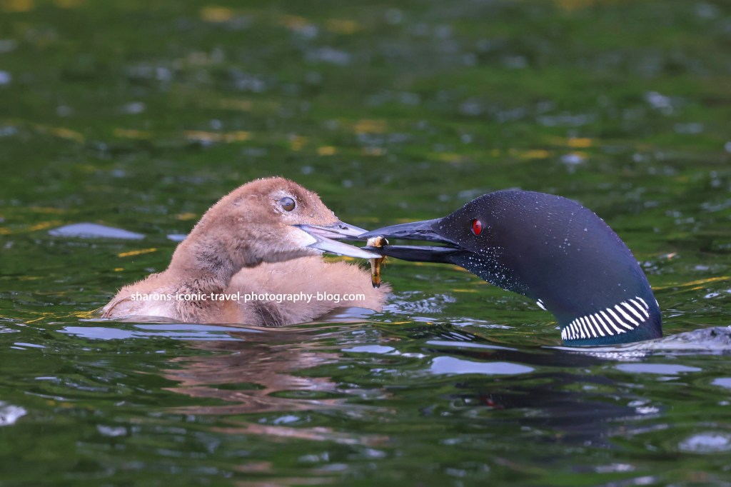
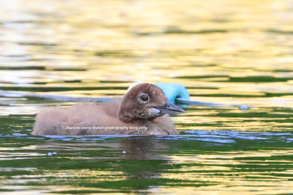
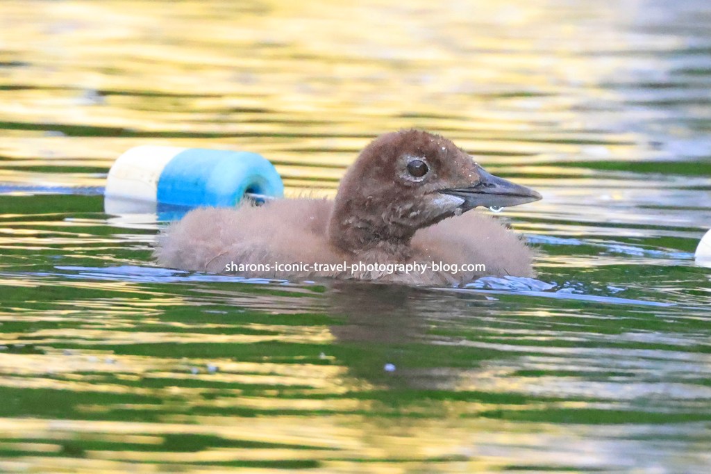
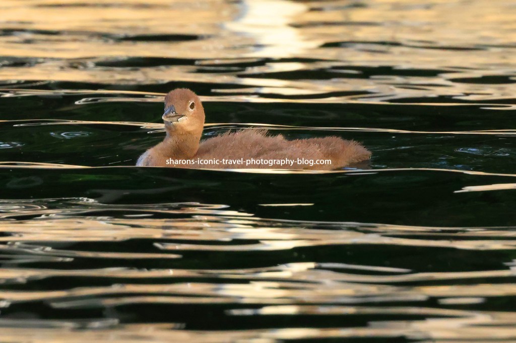
I made almost a week long trip to the Adirondack Mountains in New York. I am not kayaking as far as I did last year. Luckily I do not have to go far to see loons on the lakes I visited. All the pictures below are from one lake. These were over two days. Some were in the evening and others during the morning.
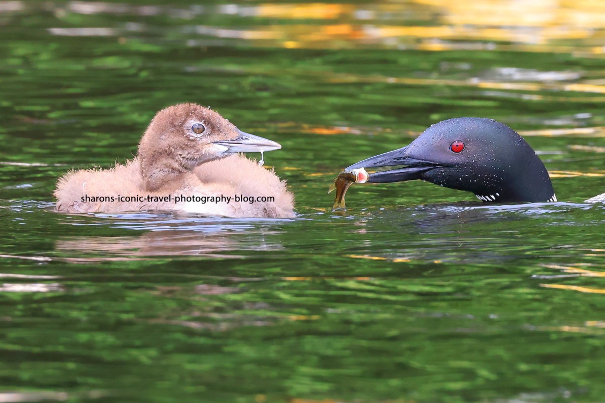
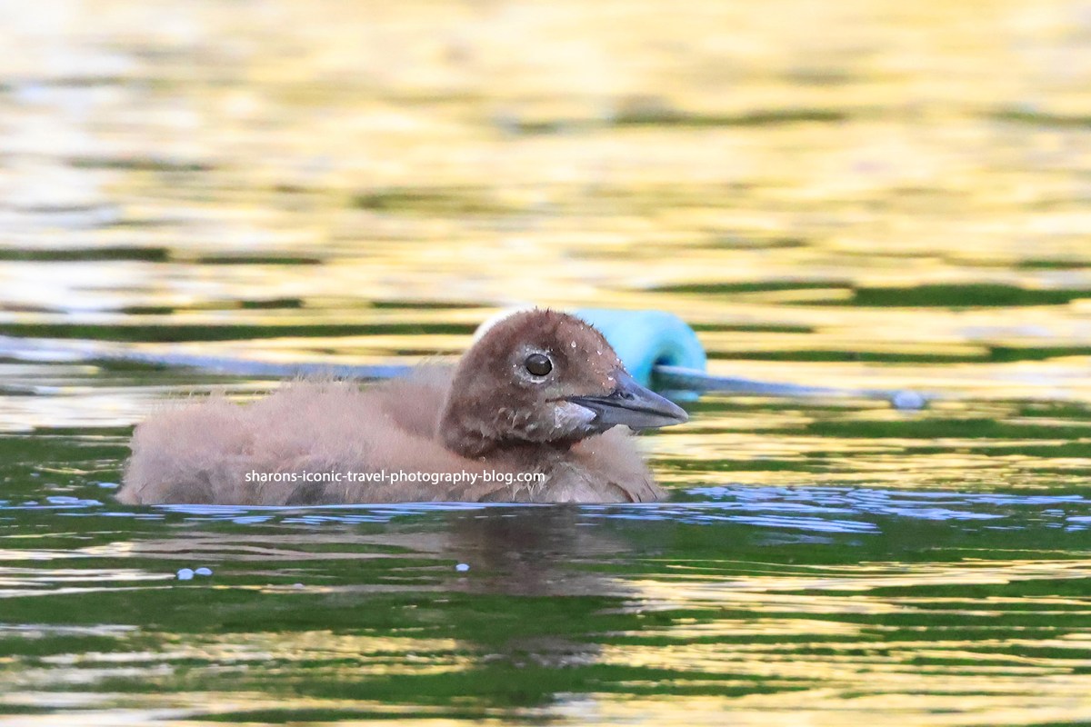
Parent cut off a piece to give the baby.Spitting out waterPatiently waiting for someone to bring it a fish.Riding the waves.
Slow down and enjoy nature. Sometimes you do not have to go as far as you think.
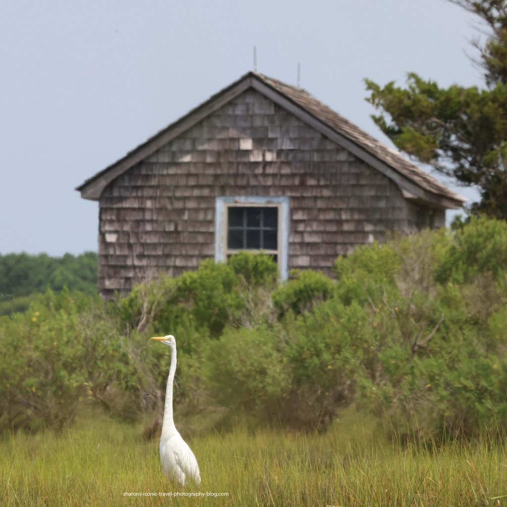
There are a lot of great egrets at Assateague. You can many times see them just as you cross over the bridge onto the island. From the island side if you look on both sides of the road at the marsh areas you usually see a few on each side after the bridge.
This is in front of the building right next to the National Park boat launch on Ferry Landing Road.
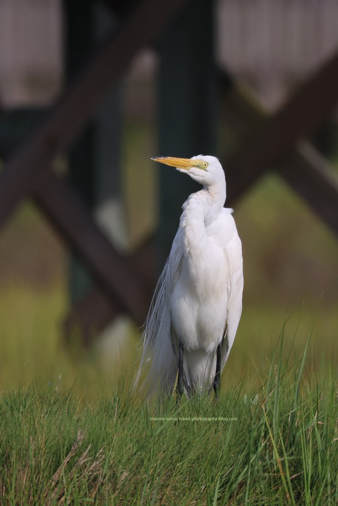
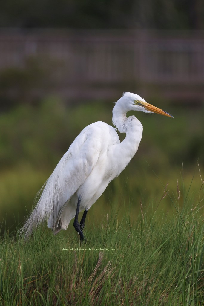
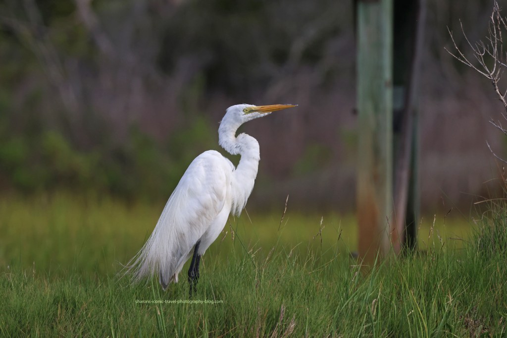
These were all taken on the bay side of the island from a kayak.
Near one of the nature viewing areas.
I mostly saw egrets standing on trees, or standing next to the water in the grasses. They pose great for pictures!
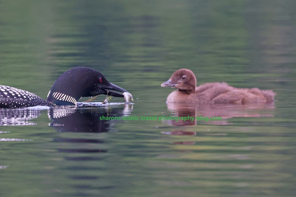
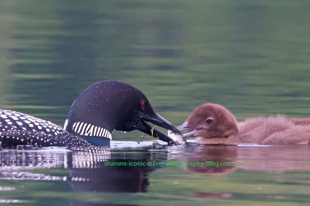
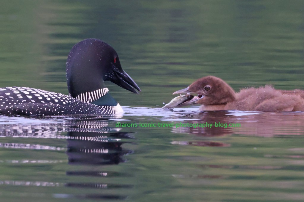
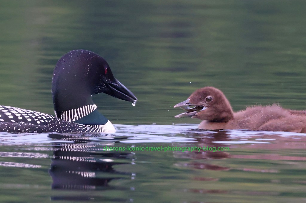
Not all bad light days make for bad shots. The morning I took these this past clouds were covering the sun and the lighting conditions were not optimal. I got some good feeding shots regardless and shots of the parents with fish.
Will the baby take it or not? Many times I see the baby not accept it and swim in another direction with the parent following.
These pictures were all taken at a distance with zoom lens.
The hand offTrying to fit it in.Going down the hatch.
A cloudy day does not always ruin your chance at getting good photos. Go out and enjoy nature even when it is not sunny.
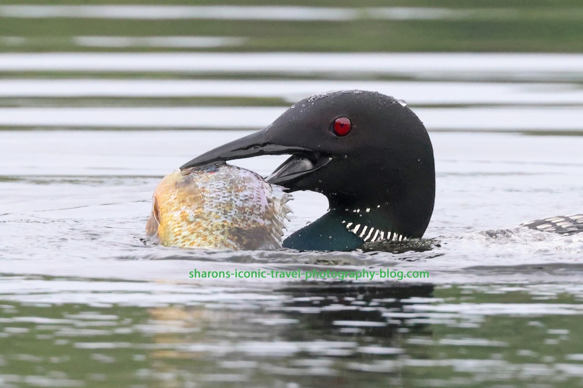
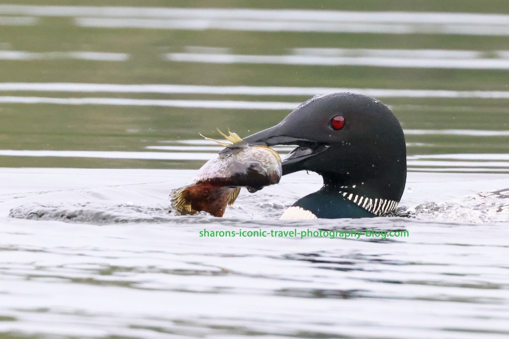
I have had loons swim under my kayak before. This time a mother loon called to her mate. The mate came swimming back to watch the baby loon. The mother promptly went under water and popped up above water on the other side of my kayak. In its mouth was a big fish.
She then went under the water and I could locate her by the light coloured fish she had in her mouth going under my kayak. She then popped up on the side she was originally on, but close to my kayak. I thought for sure she was going to share it with her mate. Nope! I can’t believe she ate the whole thing herself!
Was she showing up her mate by catching a big one so fast? Was she showing off to me? Nature is better than TV. Loons are pretty cool birds. As always keep your distance. If they approach you, let it be on their terms.