Upper Saranac Lake via Indian Carry

How can you access Upper Saranac Lake from the southern end? One way is through Indian Carry access site off of Route 3 southwest of the village of Saranac Lake. Another way is carrying your canoe carry via the Bartlett Carry from Middle Saranac.

Boat Launch

This launch seems to be possible because of an easement the state obtained to make the boat launch. Therefore, you need to stick to the road on the way in and stay within the boundaries of the easement that makes up the road and the boat launch. On the west side of the launch is private property and there are houses along the lake going west and then north of this corner of the lake.

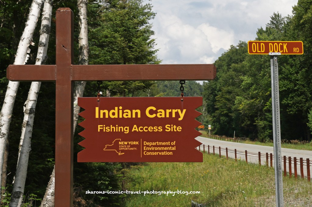
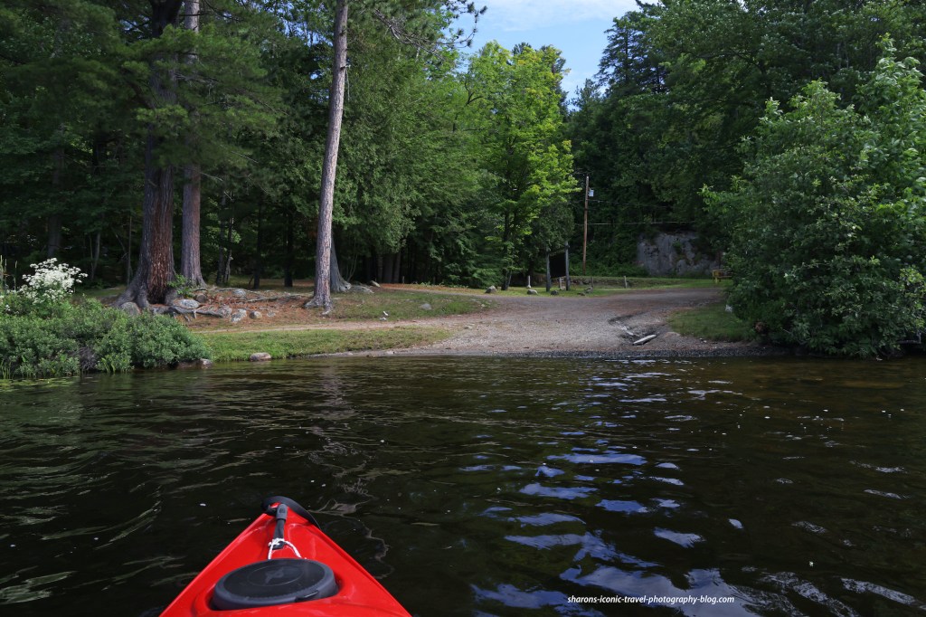
There is parking off of route 3. But if you follow Old Dock Road you will come to a parking area right near the launch. It is a very long road and if you want to launch your boat you would probably need to drive your car down there. This launch is for kayaks and canoes.

Evidently you can catch a boat that will ferry you to the Island Chapel if you wish to attend.
When you arrive at the lower parking lot there is a day use camping area if you cross this bridge. It also has a privy/outhouse. Bring your own toilet paper.
Dock for people canoeing.

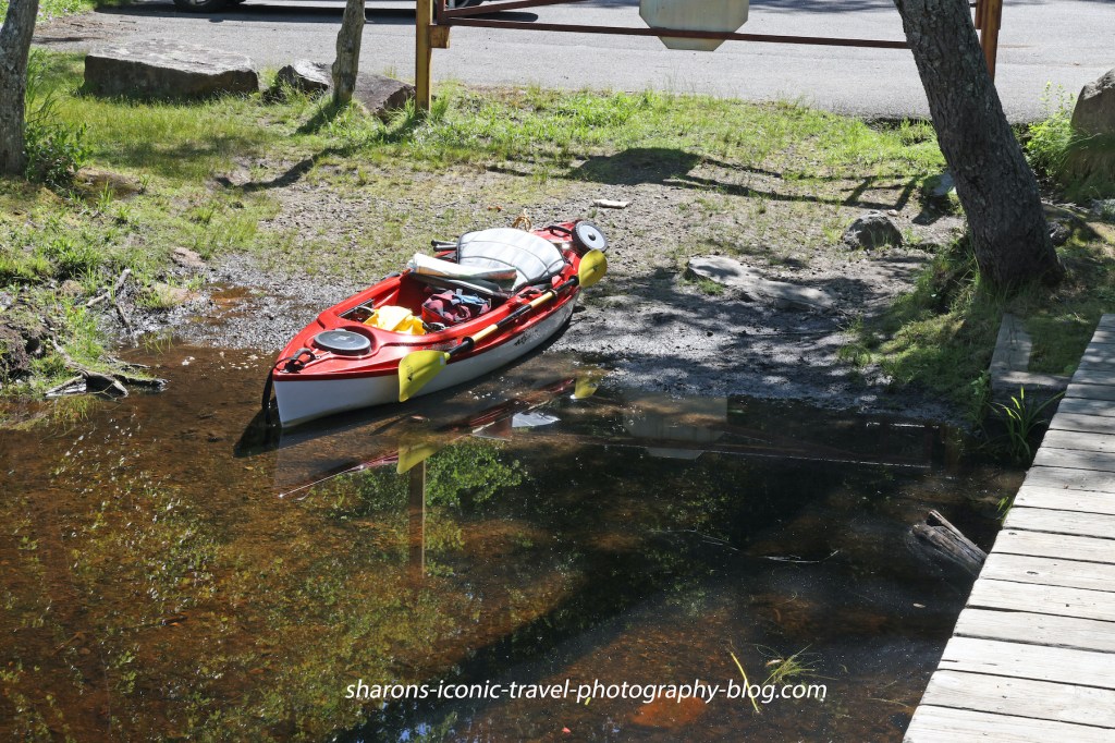
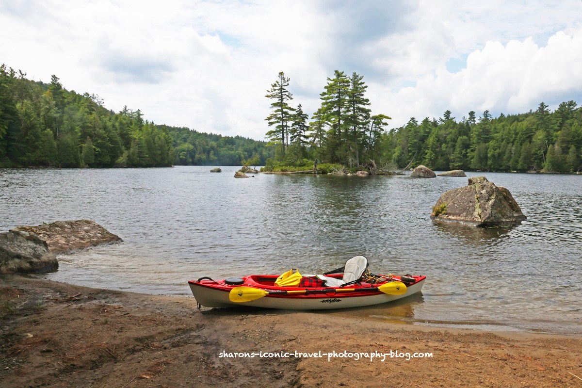
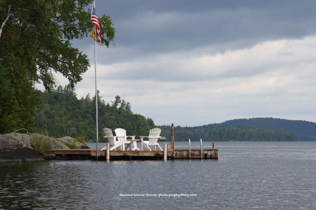
There is a dock for those canoeing and an area next to it that is good for kayakers to launch from. It is a gradual entry into the water.

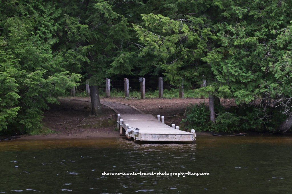
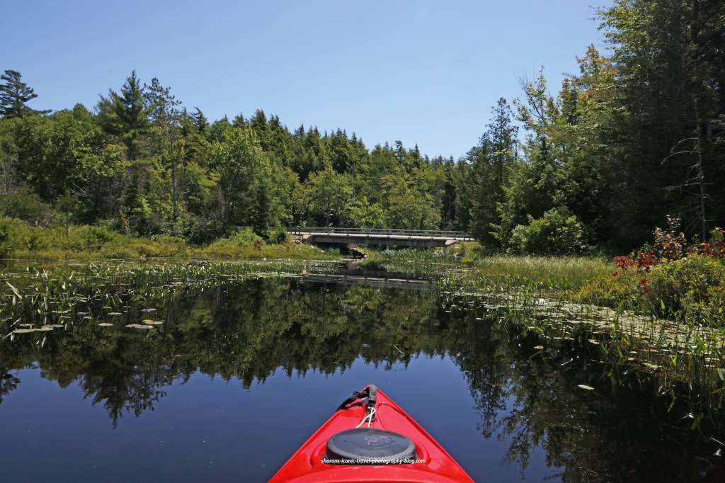
This is the view of the dock from the water. To the left next to the dock is where you can launch your kayak from.
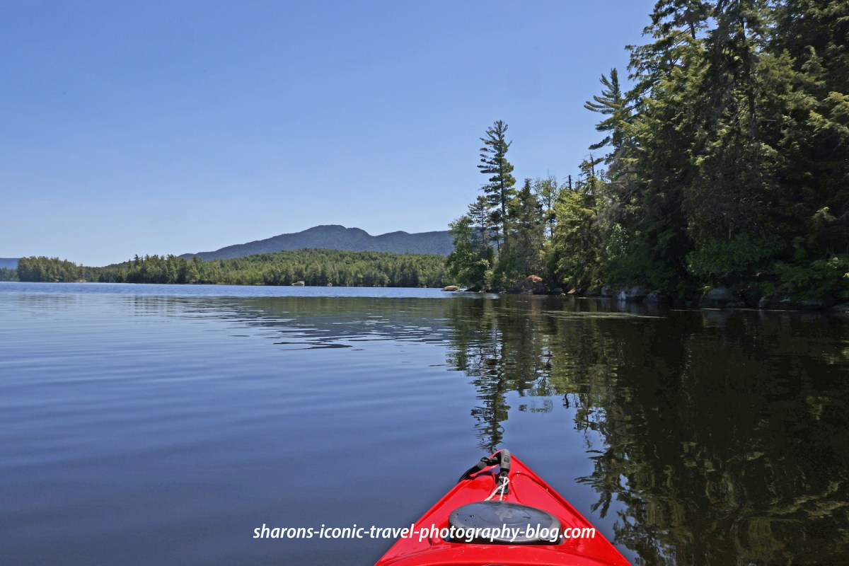
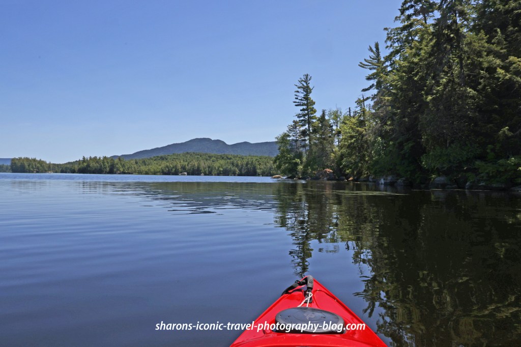
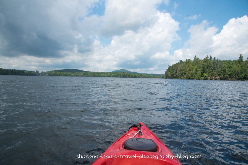
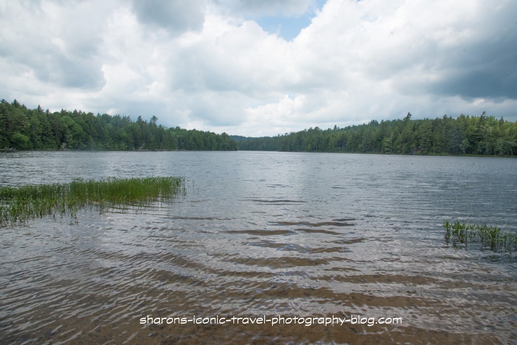
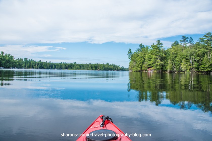
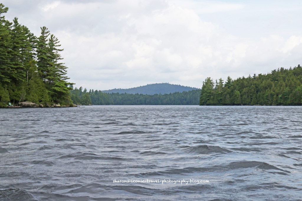
Upper Saranac Lake

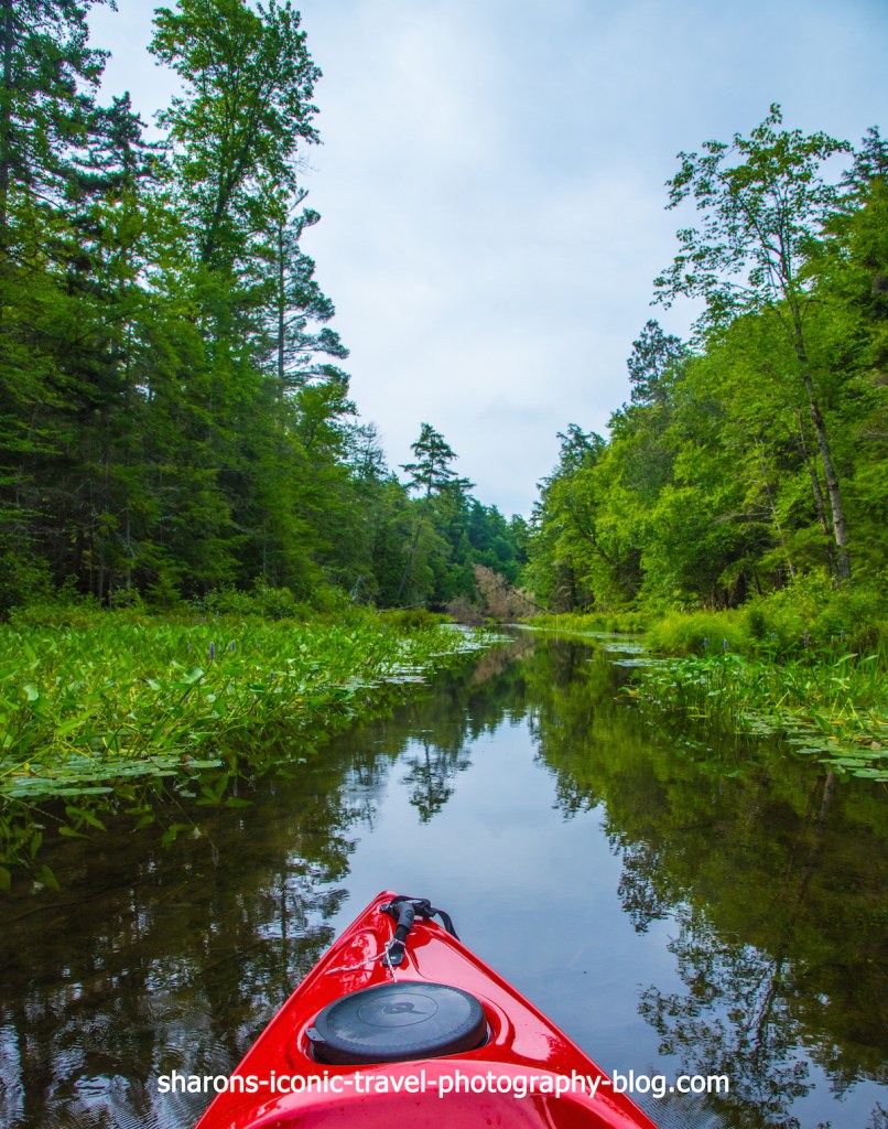
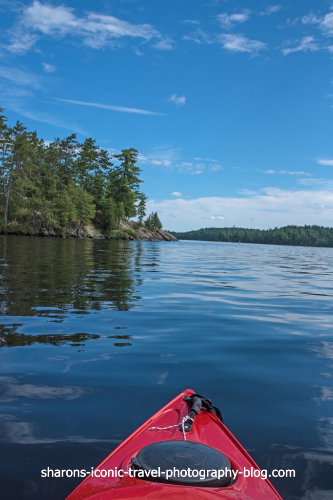
The weather was threatening on this trip. I think it sprinkled a few times, but thunderstorms did not arrive until later. I mostly kept to the edges, but at one point paddled across.

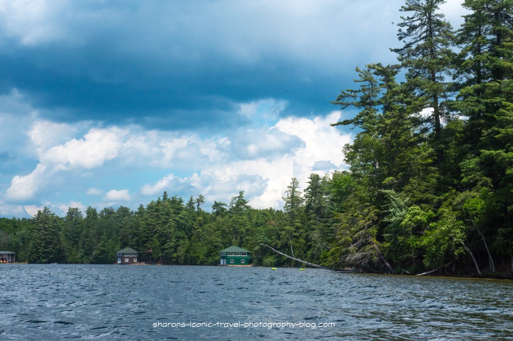
Going west then north along the shore there were private homes spread apart.

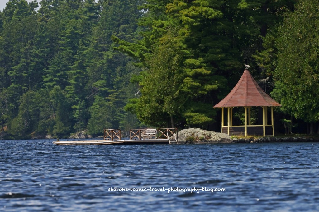
Going into the bay on the east side there were a few homes spread apart.

A couple passed me twice on hoverboards.

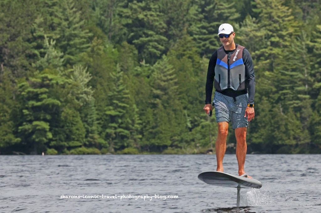
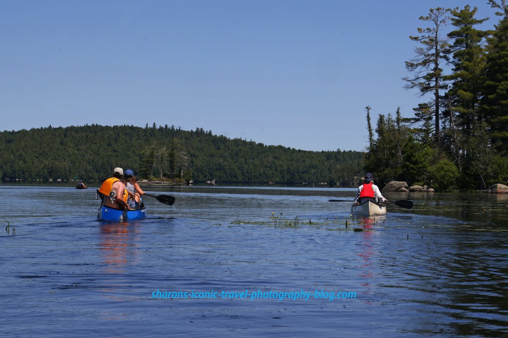
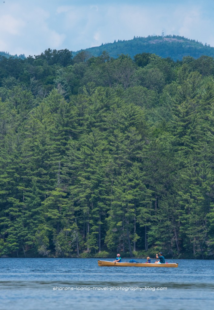
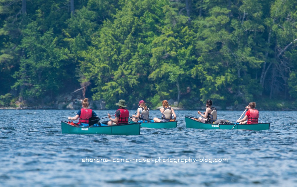
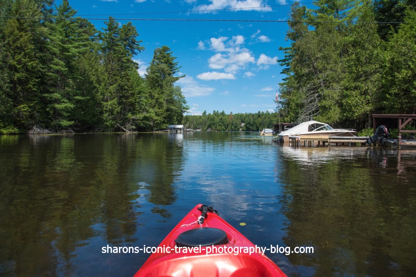
I saw a few people on my travels. I saw a couple hoverboarding. I also saw a father and two sons canoeing /kayaking separate boats loaded with gear to camp. In addition there were a few motor boaters and a man fishing from his kayak.

A dock and gazebo on the lake.

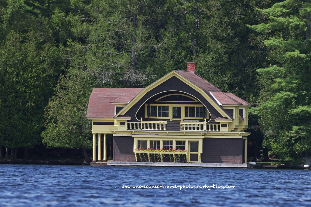
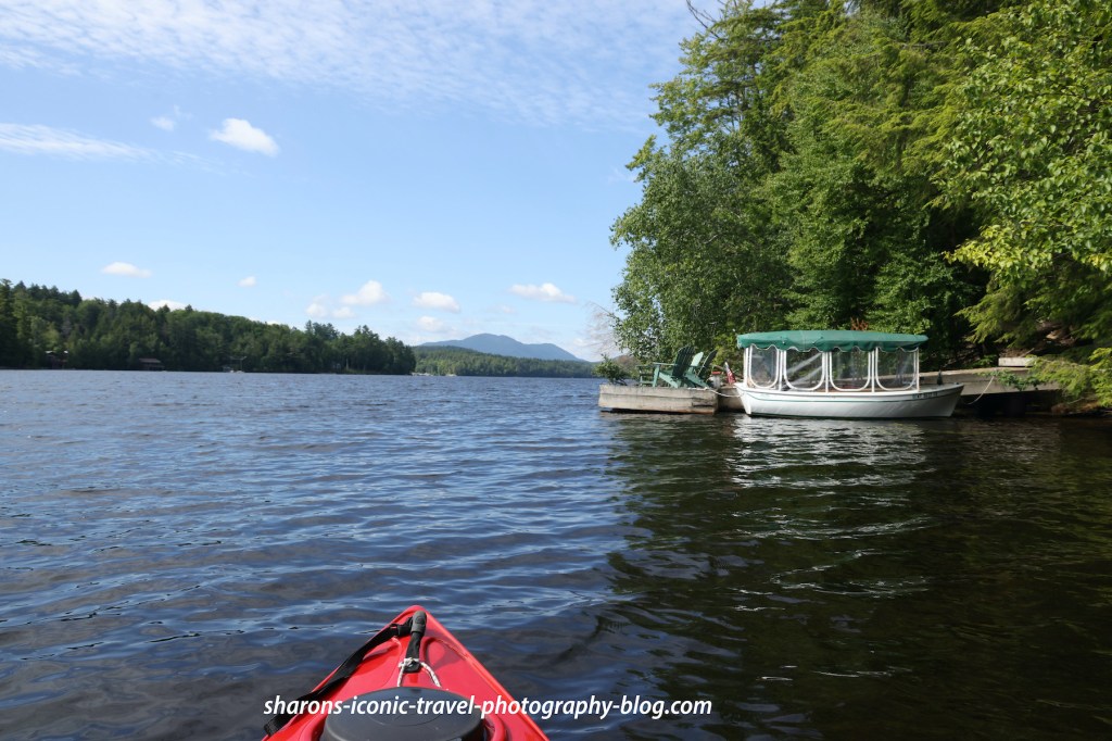
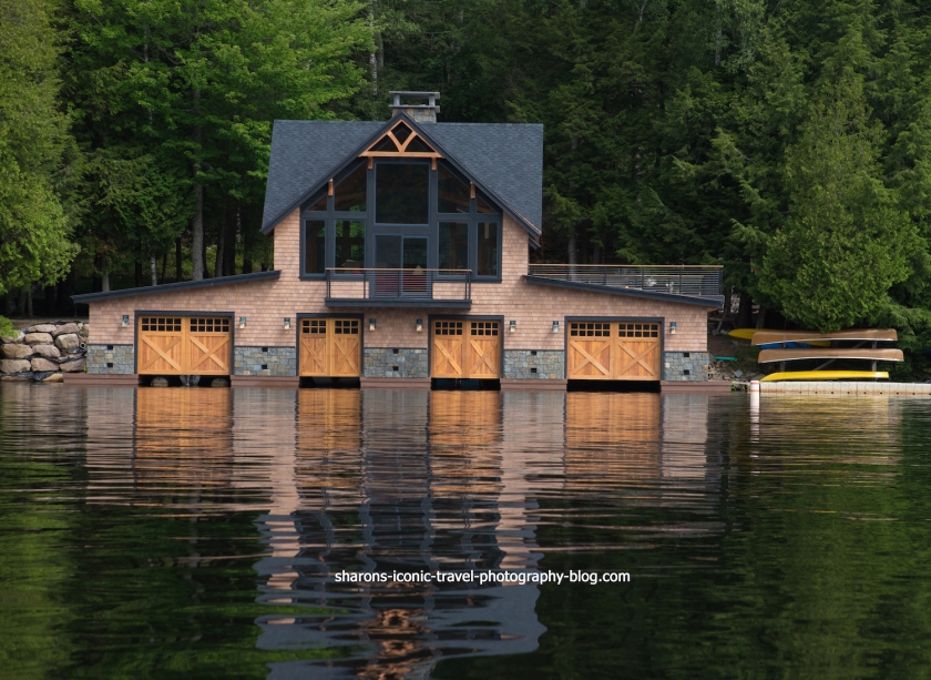
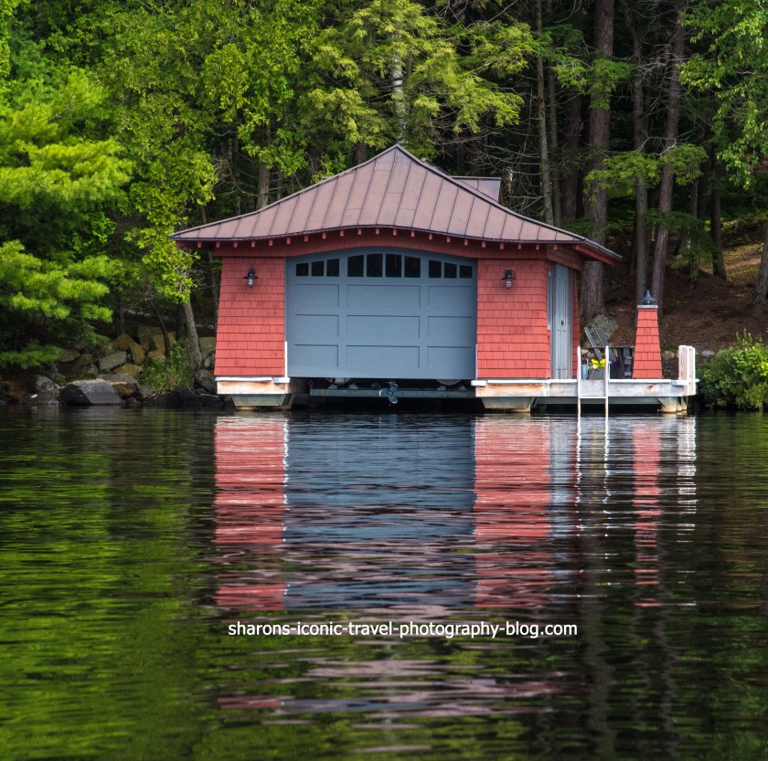
One of the elaborate boat houses along the lake. Boats can park inside these in a garage like area inside that you drive your boat into. The top level usually can not have bathrooms or kitchens as it is too close to the water. There would be a main house not far from this boathouse.
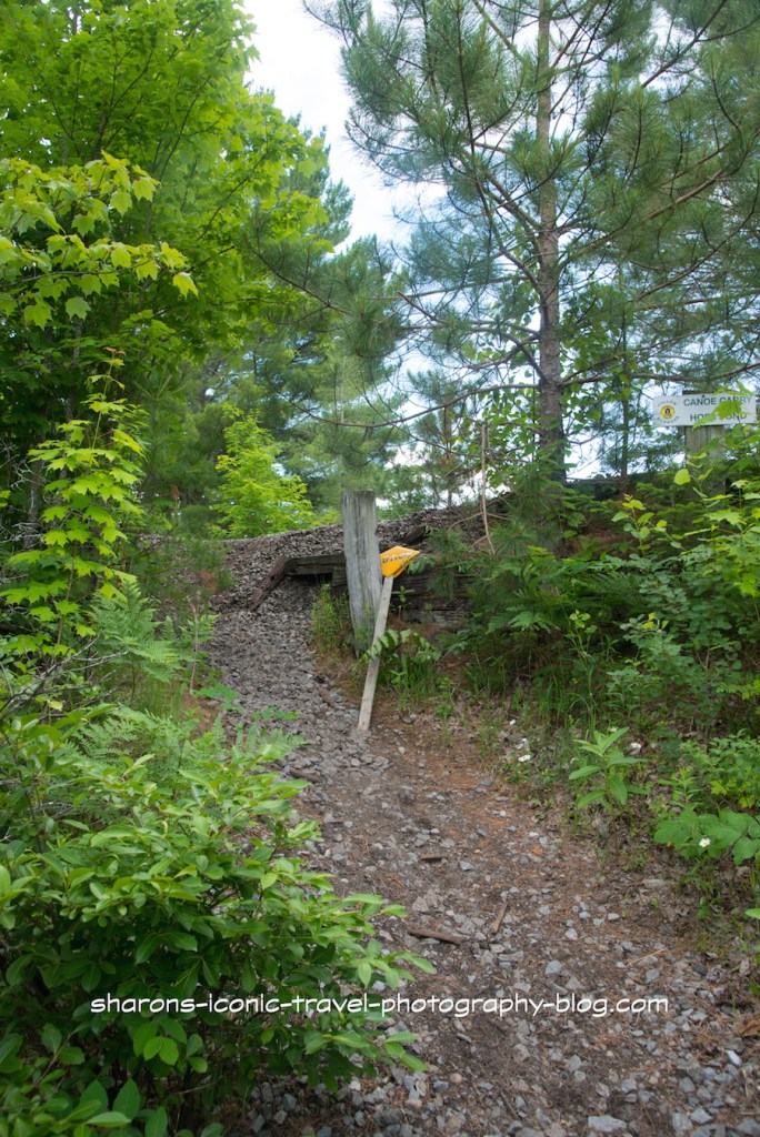
Bridge that is part of a walking trail you can access from the parking lot near the boat launch.
Bartlett Carry

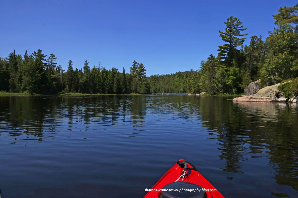
Bartlett Carry is a canoe carry route that takes you from Upper Saranac Lake to Middle Saranac Lake. It is on the southeast side of Upper Saranac Lake.

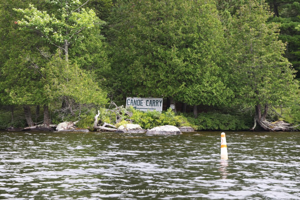
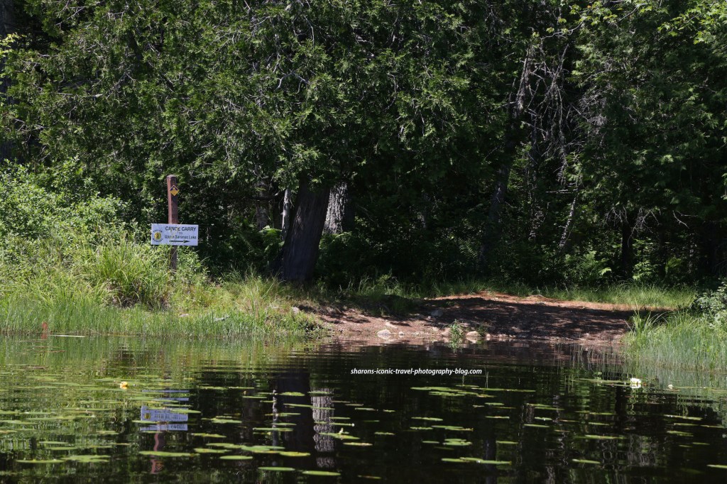
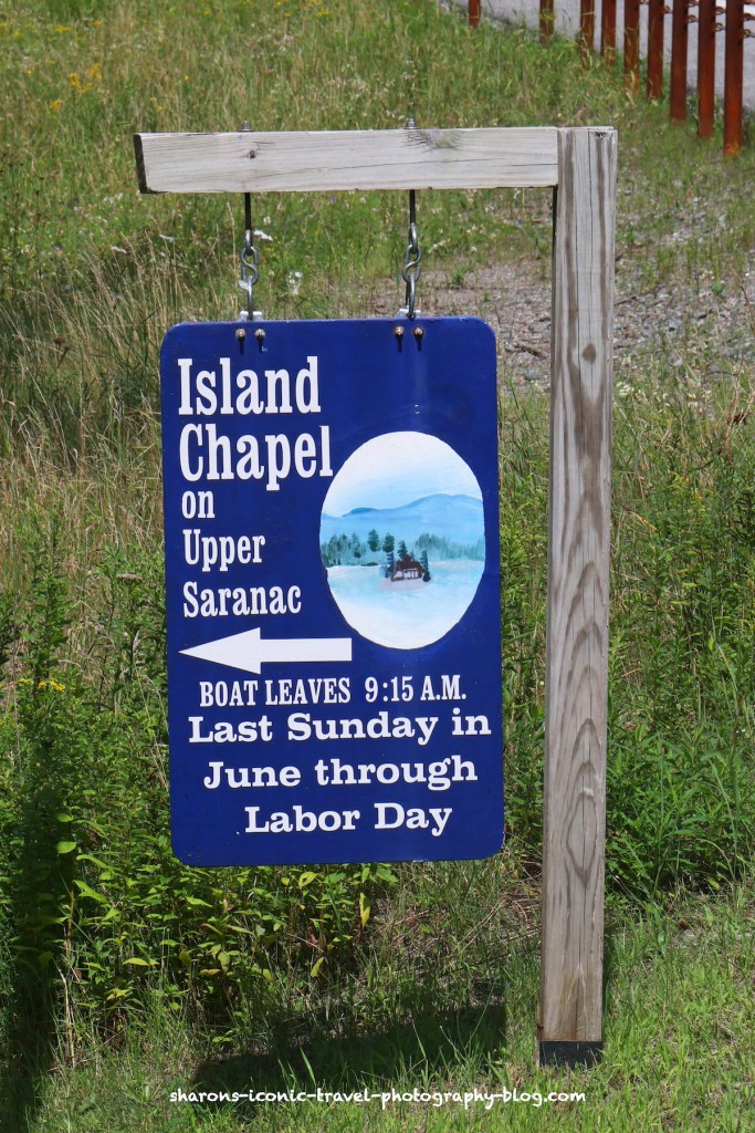
There is a sign pointing to the direction of the boat launch when you get closer. It is hard to see from a distance.

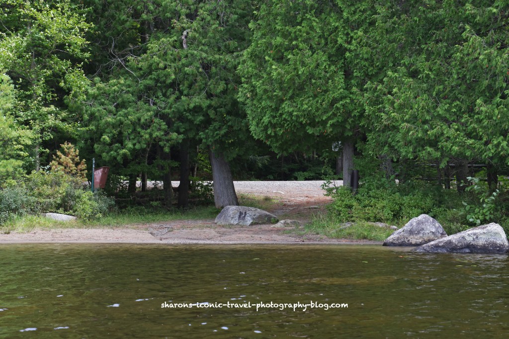
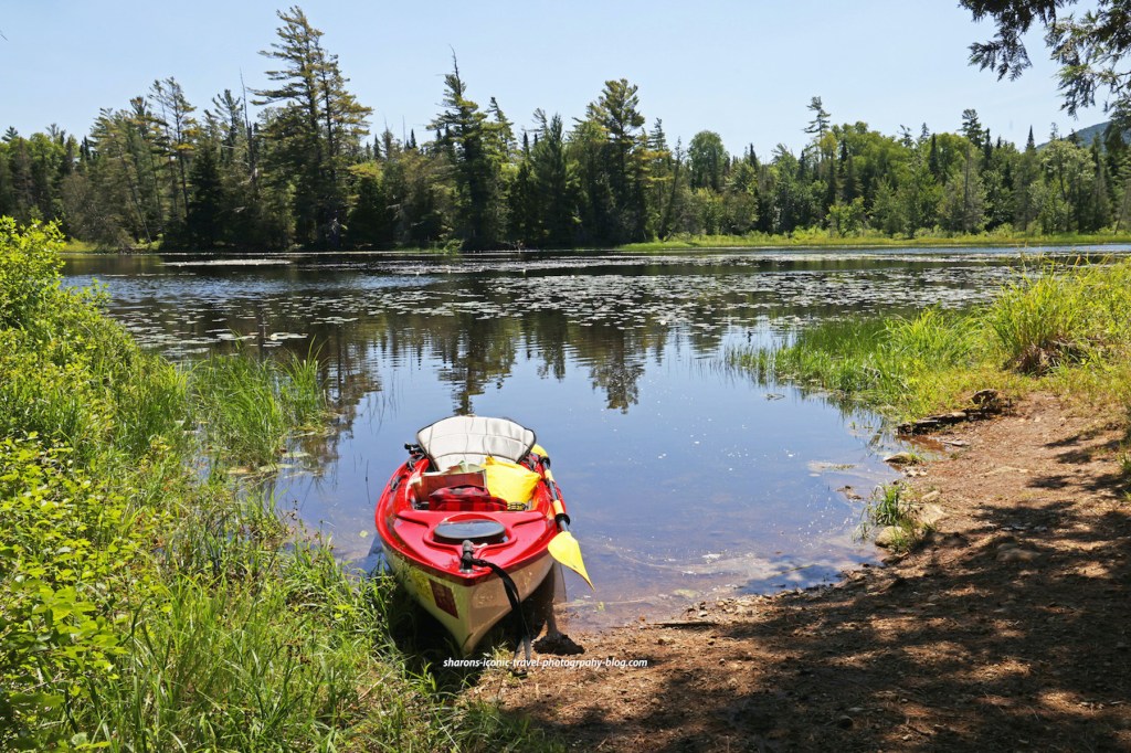
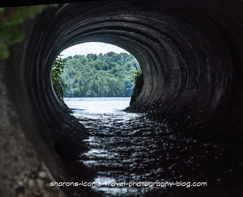
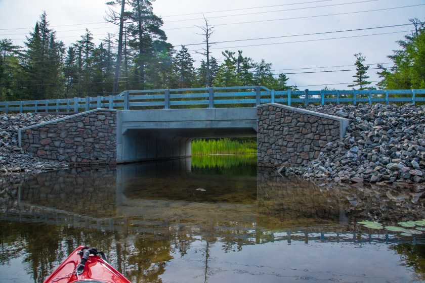
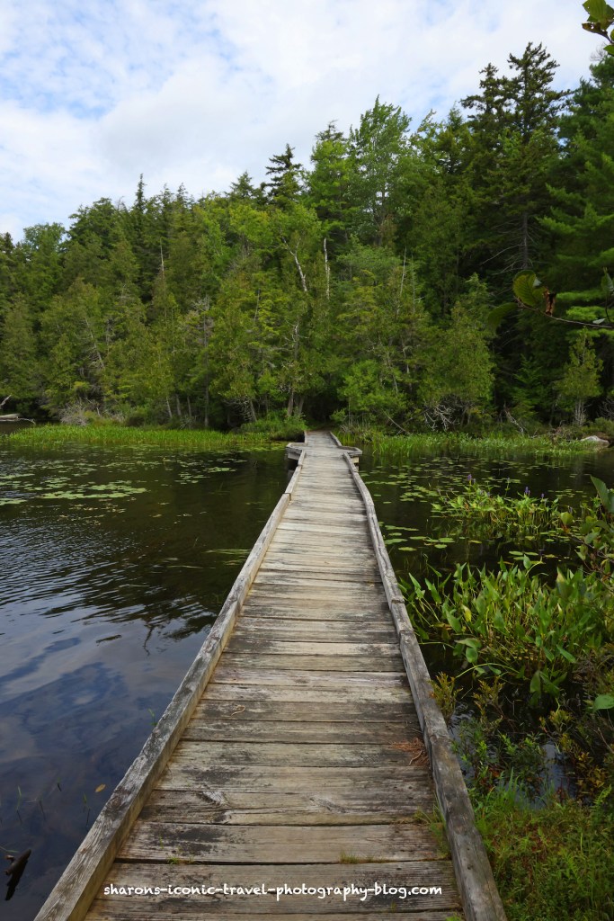
I showed the boat entry/exit from Middle Saranac end of the Bartlett Carry on a previous post. On both ends the canoe carry is shallow leading to the entry/exit which is perfect for kayakers. There was no sign at the actual launch site. As you can see there is a sign in/out box for those camping on the islands and other campsites on the left side of the picture. There are houses close to the boat launch.

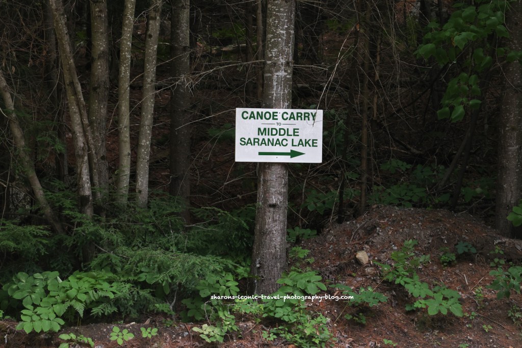
Bartlett Carry Road is shown on the map as a private road. It is open to people carrying boats from one end of the canoe carry on Middle Saranac to the canoe carry on Upper Saranac Lake. On the road a sign marks the direction of the other end of the carry.

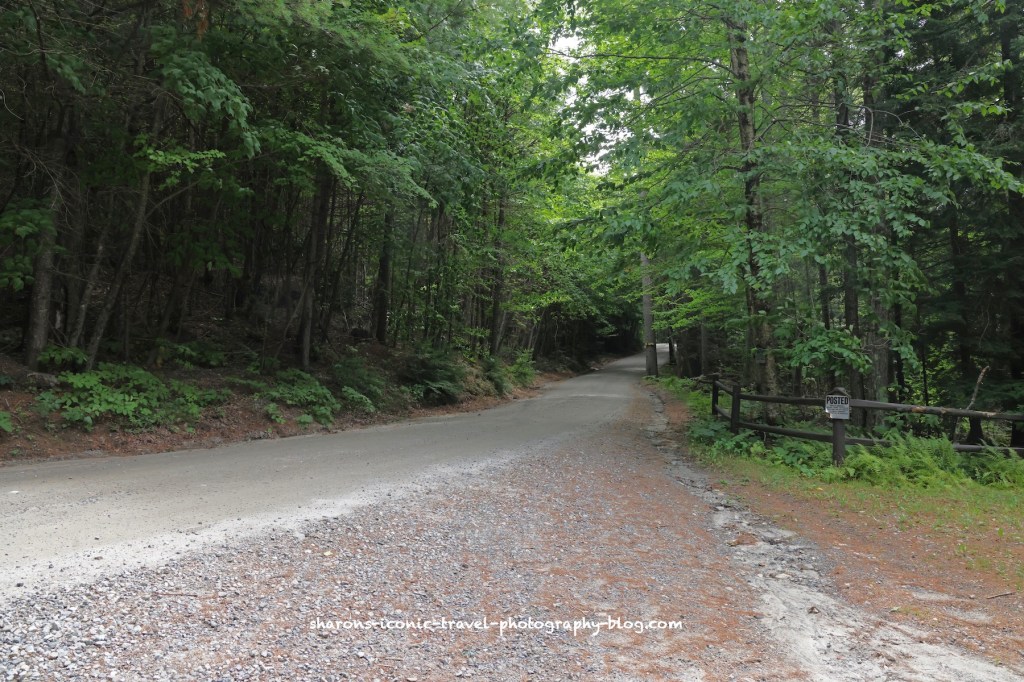
The canoe carry is along this road. Since it is a private road you can not drive your car on it and there are signs saying you can not park along the road near the launch.

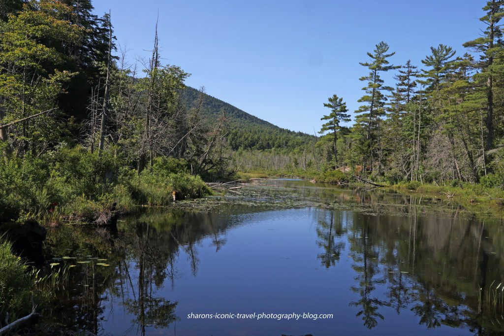
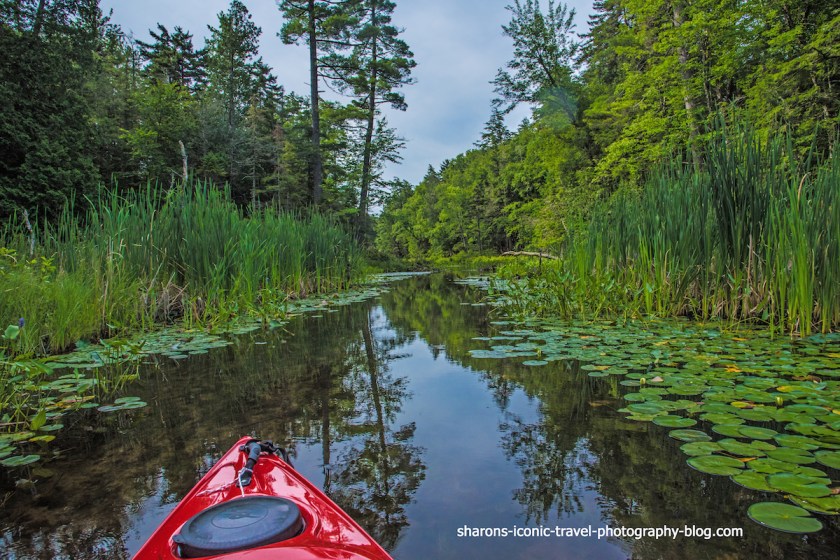
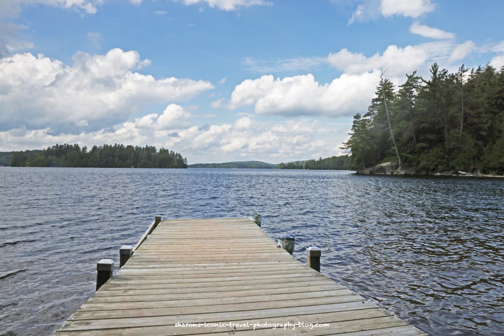
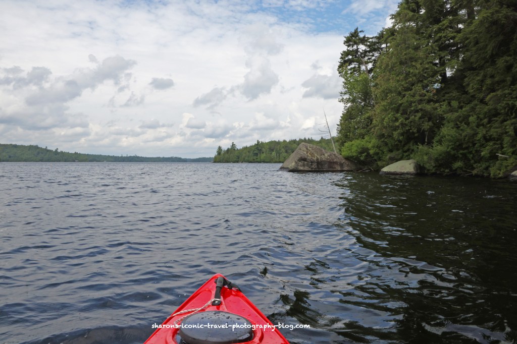
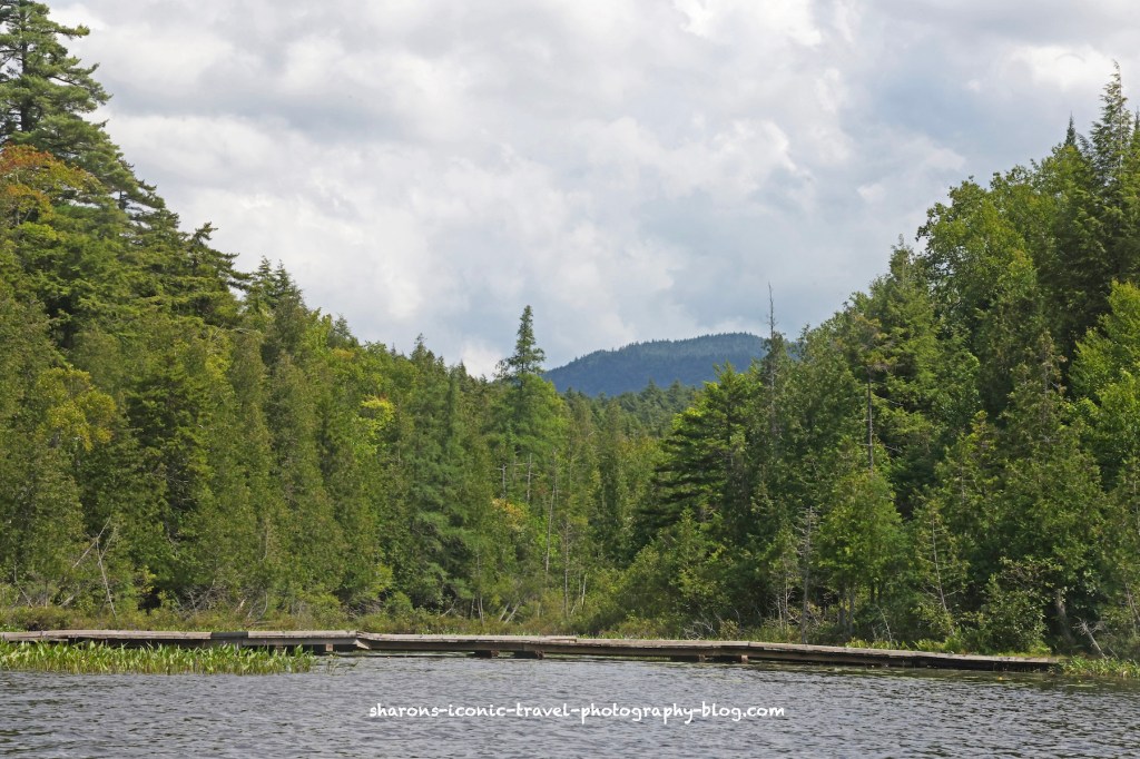
This is the view from the Upper Saranac side of the Bartlett Canoe Carry looking west.

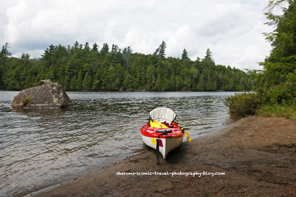
This is the view from the Upper Saranac Bartlett Canoe Carry looking northwest. The carry is in kind of a bay/cove area on the southeast area of the lake.
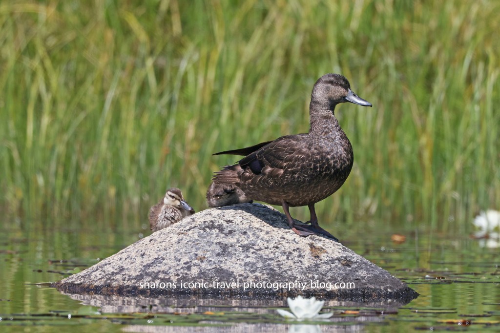
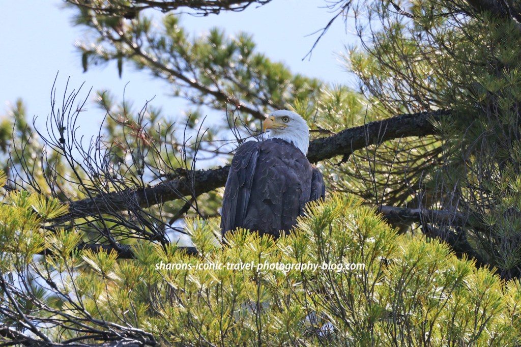
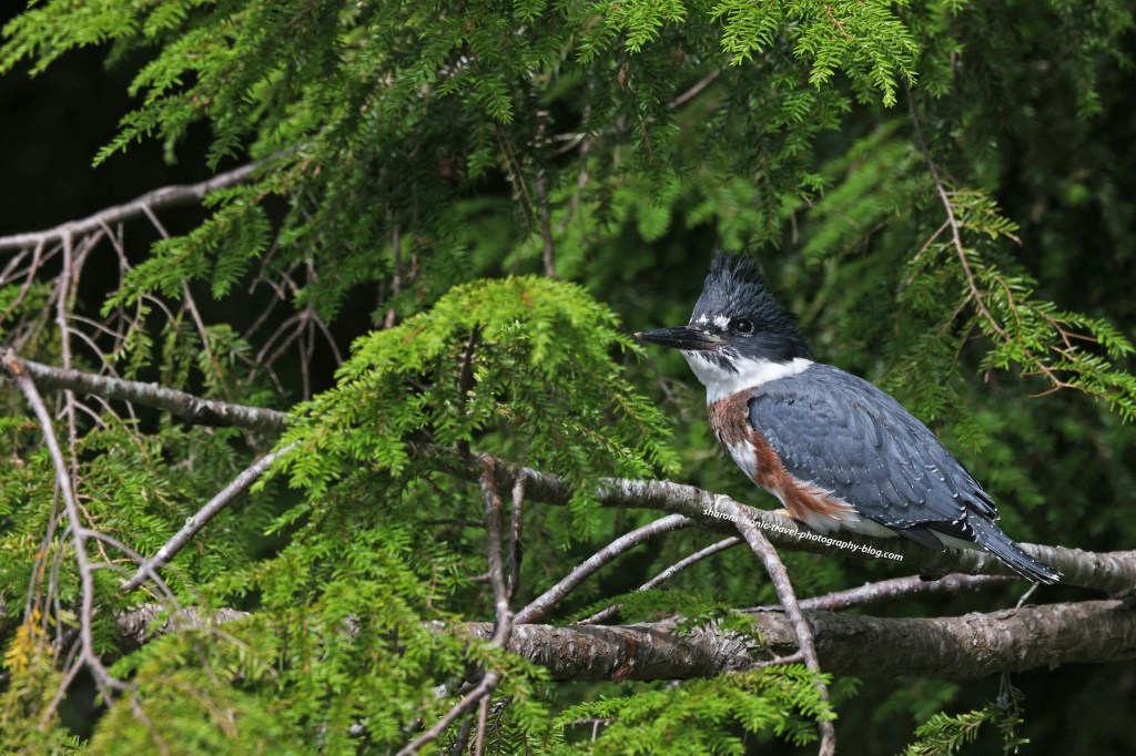
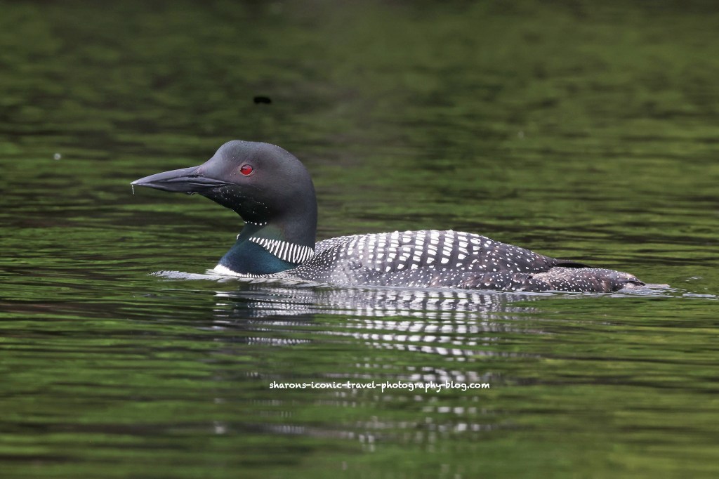
Wildlife

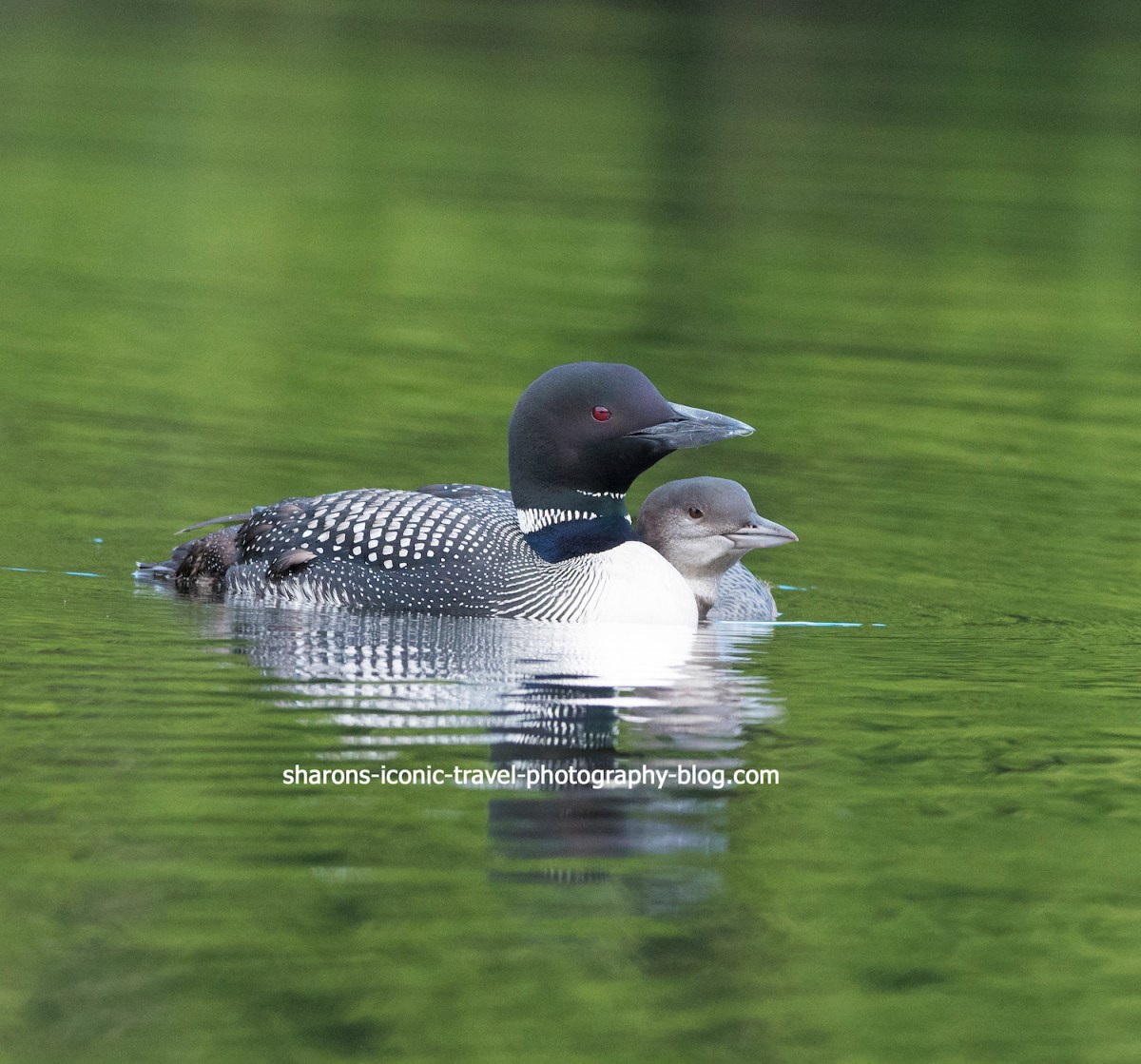
Seeing wildlife makes the trip even better for me. I was lucky enough to see three adult loons hanging out together. They were talking a lot that morning and I was hoping to get an audio file of the conversation, but there were kids close by screaming and playing in the water.

Common Loon- There were three adults the morning I was there on the southern end of the lake.
Great Blue Heron hanging out on the shore next to a birch tree.

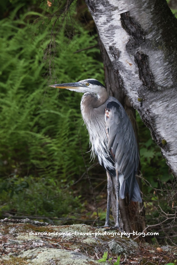
The great blue heron was just north of the loons a short paddle away. It was hanging out on the property of a house being renovated. A lot of construction noise was going on and it did not seem to phase the heron. The heron was not phased by me either. It was not actively looking for food just chilling by the water.

I highly recommend this lake and boat launch. There were not many motor boats when I went. I saw maybe one or two. As with any large body of water in the Adirondacks, if weather is threatening stick to the edges of the lake or pond.

Accessing Middle Saranac Lake Through South Creek

How do you access Middle Saranac Lake in the Adirondack Mountains of New York? One way is by the boat launch at South Creek. This boat launch is on Route 3 about halfway in between the towns of Tupper Lake and Saranac Lake. There are multiple options on where to paddle from this launch so it is a launch that may interest you.

This sign kind of confused me. There are camping spots accessible by boat along the shore and islands of the lake. I am guessing one would have to park in the parking lot northeast from this one that does not have a boat launch according to the map. Usually these campsites are open to first come first serve for three days. Websites say you have to reserve the campsites. I did not see anyone at the campsites I passed.
Boat launch

It was kind of a rough carry from my car in the parking lot to the launch. The gates were locked and to squeeze the kayak through the rocks along the side was no easy task. I use a kayak wheeled device to move my kayak to launch sites. Where you walk to carry when I went was rough with gulleys. The boat launch itself as you can see has a gradual descent that is great for kayakers while also providing a dock that individuals who canoe may like.

View in the opposite direction from the lake.

The view above is going in the opposite direction from the lake. The view on the bottom is going towards the lake. It looks like a long paddle to reach Middle Saranac Lake on the map, but it is really not that long.

Campsites

They provide a picnic table and fire pit, campfire area at these campsites.

This was the campsite on Shaw Island. As you can see these are primitive sites that are carry-in and carry-out. They are accessible by canoe or kayak.

This campsite had two outhouses.

Going towards the Bartlett Canoe Carry

Entering a narrow body of water on the western part of the lake.

On the southwestern side of the lake you enter a narrow body of water that goes in the direction of Upper Saranac Lake. This is one option for accessing other bodies of water. Another option is to paddle north from South Creeek and go through Hungry Bay and into Weller Pond. Another option is to go east to the Saranac River through the upper locks into the southern end of Lower Saranac Lake.

This sign marks the start of the Bartlett Canoe Carry.

The canoe carry was a gradual descent into the water, ideal for kayakers. You follow the path over land to Upper Saranac Lake. It looks far on the map for one person, so I did not attempt it even with a kayak carry device. I encountered a women’s kayak tour on another lake and the guide said the Canoe Carry on the Upper Saranac side is a good launch for kayakers. I will take her word for it.

Wildlife

Black duck and her young on a rock. They were in the same area as the eagle.

I always enjoy lakes where you can view wildlife. This one was no exception. I saw two groups of black ducks, although I was nervous for them. An eagle was on a tree very close by eyeing them. Eagles in the Adirondack Mountains travel from lake to lake. They do not always stay on one body of water all day long. I arrived in the morning on this lake and a saw some fishermen on kayak and motorboat. One man I talked to said he arrived at 5 a.m. He was pleased with the bass he caught.

I did see one adult eagle along the trip.

Heading East to the Boat Launch

Heading east on Middle Saranac
Some people heading out on the lake.
Heading into South Creek back towards the boat launch.
The Route 3 Bridge over South Creek.

The boat launch is on the other side of Route 3. You kayak under the bridge and the launch is on the left when you are coming back in.

Despite it being a little rough to get into the parking lot from the launch and into the water from the parking lot I would like to come to this access point again. I do hope they make improvements on it though as it could be a hazard. I recommend they remove a rock or two on the side to make is easier to bring your kayak to the water and fill in the gulleys made by erosion. Middle Saranac Lake is another beautiful Adirondack lake.

Accessing Lower Saranac Lake Through Ampersand

What is another place to launch a canoe or kayak that is close to the village of Saranac Lake? Ampersand Bay of Lower Saranac Lake is a short drive from Saranac Lake.

Sign on Edgewood

There are two ways to get to this launch. One way to get there you travel south of the village on route 3. Then you would turn onto Edgewood. Follow the signs from where this road meets Ampersand. You turn left from this direction. Another way to get to this launch is to go south on Ampersand Avenue then follow the signs.

Adirondack Canoe Route

This location is the starting point of the Adirondack Canoe Wilderness Route. Many of the lakes or ponds on this map connect by water routes such as creeks , the lakes running together, or through portages or canoe carries between them.

This sign is in the parking lot.
This map is facing the wrong direction. Saranac Lake Village is northeast of Ampersand Bay. The you are here on the map points to the Ampersand Bay boat launch.

Boat Launch

This is the boat launch. It has several parking spots. It is only for cars putting in canoes or kayaks.

The Department of Environmental Conservation website says this boat launch parking lot has places for 12 cars. The launch was not crowded when I went. This is not a launch for motor boats, so that makes it less busy. I believe there was only one other car when I arrived. Nearby on the bay is a launch/marina for powerboats. I like this launch. It has a gradual descent into the lake and is great for kayakers.


Ampersand Bay

Heading in to the main part of Lower Saranac Lake

This part of Lower Saranac Lake has some houses and docks along it. It also has what appears to be condos near the marina.

Lower Saranac Lake

I am not sure if that is Ampersand Mountain in the background. Someone knowledgeable about the area may be able to fill us in.
It was very windy on this day so I travelled along the shoreline.What you are seeing is an island and the shoreline. This lake is quite large.

Lower Saranac Lake has many campsites along the shore or on islands in the lake. The campsites are free. They are primitive sites with cleared areas for tents, outhouses, and a campfire area/fire-pit.

Wildlife

Kingfisher

Seeing wildlife is always a bonus for me. I got several great pictures of a kingfisher. I think there may have been a nest nearby. Both parents were keeping a close watch on me as I travelled near the shoreline. They were like guard dogs.

I would highly recommend this boat launch. It is great if you would like a short drive from your accommodations in Saranac Lake. Most state boat launches and other ones in the Adirondacks are fine. Enjoy the scenery and enjoy the wildlife!

Hoel Pond

Another pond with access to other bodies of water and free primitive campsites along it is Hoel Pond. Hoel Pond is another large pond with some nice views of neighbouring mountains. This is one pond I recommend you travel to with a friend.

Location

Hoel Pond is in the Adirondack Mountains of New York. It is north of Follensby Clear Pond and southwest of Lake Clear and Upper St. Regis Lake.

This sign is small and back from the road a little. It is easy to miss.
How to Get There

From State Route 30 you take Floodwood Road west until you reach Hoel Pond Road. Turn onto Hoel Pond Road and right after you pass the golf course, on the left side of the road turn left. There is a dirt road there that looks like it is part of the gold course, but it is not. It has the little sign pictured above, but it is easy to miss. If you miss the road on the left and continue on Hoel Road it then becomes a private road. You will know you went too far as you are in an area with houses and it is passed the golf course and into a wooded area. The dirt road winds down to an area near the pond that has parking spots and some primitive campsites.

Boat Launch
I recommend you go with another person because of the steepness of the steps leading to the boat launch and the canoe carry to Turtle Pond.

This was a tough launch for me by myself. I think it would be much easier for two people to carry a canoe or kayak down these steep steps. This was the reason I recommend going with another person. There is a small sandy beach area below these steps to launch your kayak from. Motor boats owners can not launch from the state boat launch.

It was a very windy day and once I kayaked across to the point then hugged the land is was a much smoother paddle.

Turtle Pond

This sign at the other end of the Hoel pond marks the canoe carry to Turtle Pond. It is a narrow path up to the site of an old train tracks and back down to the other pond.

Because the carry down to Turtle Pond was steep I did not feel comfortable carrying the kayak down this hill.

When you cross over the hill to Turtle Pond you enter the St. Regis Canoe Wilderness.

Turtle Pond. From here you can paddle to Slang Pond. From Slang Pond there is a canoe carry to Long Pond. Again from this point you are in the St. Regis Canoe Wilderness.
Looking at Hoel Pond from the Turtle Pond side.

There is a culvert pipe under the railroad tracks leading to Turtle Pond. It appears to go slightly downhill. It is a small pipe and the water level is low in the pipe. You should not try to kayak through it. On the Turtle Pond side the water level is about a one foot drop from the pipe. Some kayakers say they were able to send their boats through the pipe on their own to Turtle Pond. I think you should have two people for this with one waiting on the Turtle Pond side to catch it. Otherwise you run the risk of it drifting into the pond or being damaged from the drop off.

Picnic

I always recommend bringing plenty of water and food with you on long trips. I stopped to eat lunch on the other side of the pond where the canoe carry was. I bring an insulated lunch bag with ice packs inside tied to my kayak but accessible. On that day I ate a veggie wrap from Nori’s on Church Street in Saranac Lake. I took it along with me to enjoy. This was my second kayak trip of the day. I started with Mirror Lake earlier in the morning.

Veggie Wrap from Nori’s in Saranac Lake.
That may be St. Regis Mountain with the fire tower on top.
The weather improved a bit on the return trip.
Looking towards the east side of the pond with privately owned land. I did not see a motor boat on this body of water, but I understand only those who own private properties can have a motor boat. It is not possible to launch a motor boat from the state boat launch.
Camping
This was a group of young women from Gordon College in Massachusetts. They were doing an orientation/ experience for their college that involved two weeks of canoeing and camping in the Adirondacks. They were staying that night at one of the free wilderness primitive campsites.

There are free primitive campsites along most of the lake on land that is forest preserve. Many sites are only accessible by walking or by boat. There are additional free campsites along Turtle, Slang and Long Pond. These campsites are first come first served. Usually you can only stay three days and after that you would have to get a ranger’s permission to stay longer.

This was a nice pond with nice views of the neighbouring mountains. However, because of the boat launch and canoe carry conditions, I recommend you do not do this alone, but with another person. Safety first. Get out and enjoy nature!

Fish Creek Ponds- 3 in One

Want to paddle on three different lakes or ponds in one day? Would you like to do this without getting out of your kayak or canoe? There are a few options to do this in the Adirondack Mountains of New York.

Three bodies of water you could paddle in one trip are Follensby Clear Pond, Fish Creek Pond, and Upper Saranac Lake. One way you can accomplish this is to start at Follensby Clear Pond on the south side. There is a parking lot and boat launch there. The boat launch on the northern end of Follensby is further away and would lengthen your trip. Another option is you could start at the boat launch on Fish Creek Ponds.

You paddle under this bridge near the boat launch if starting from Follensby Clear Pond. I ducked my head the whole time. It is kind of low. Be careful going under it.
Spider Creek Passage

From there you can paddle north a short distance to the Spider Creek passage. It is not far from the boat launch and starts by going under the State Route 30. You follow Spider Creek Passageway into Fish Creek Ponds. Spider Creek Passageway is about 1.5 foot deep. In some areas it may be deeper than that. What you will see in the passageway are spots where beavers tried to dam the creek. I also saw ducks hiding behind the downed trees.

The Spider Creek Passage is wide enough for kayaks or canoes coming from either direction to have no issues. This one is like a roadway for paddlers.
Fish Creek Ponds
This end of Fish Creek Ponds is closest to Follensby Clear Pond appears to have private houses along it. The other end has campgrounds.

Fish Creek Ponds is a large pond with a boat launch and campgrounds along it. In the area I paddled near to get into Fish Creek Bay there appeared to be private houses along it. So if you wanted to camp you have the option of booking a stay at the Fish Creek Ponds Campground or try your luck at the free campsites along Follensby Clear Pond. Those are first come first served.

Upper Saranac Lake
This is the passageway from Fish Creek Ponds into Fish Creek Bay. It is wide and power boats park along it.
Fish Creek Bay looking into Upper Saranac Lake.

Once in Fish Creek Ponds you stay on the left side of the pond and look for a wider passageway, more like a larger creek. This takes you into Fish Creek Bay of Upper Saranac Lake. I paddled around Whitney Point.

Boat House along the way. I love seeing the different architecture. This is not the main residence.
The roof on this one looks Asian inspired.
Kayaking around Whitney Point.
Another paddler on Upper Saranac Lake
Wildlife
I may make a post just about these loons.

There is some wildlife to see along the way. In Fish Creek Pond I saw a merganser ducks. I also saw a loon mother with an older baby. It was much larger than the other babies I saw in other lakes and ponds. The mother was still bringing it fish. I also saw a loon pair in Fish Creek Bay of Upper Saranac Lake.

Be Cautious Be Prepared

Upper Saranac is a much larger lake so you need to be cautious when paddling. Wind can greatly make your trip more difficult. Also people in the summer go out even early in the morning to water ski and you need to be careful around boaters. They do not always pay attention to you. I also recommend bringing a map whenever you do a paddle like this one. Adirondack Paddler’s Map North covers this region. It is waterproof. I have gotten it wet plenty of times and it is still good. It is published by Paddlesports Press in Saranac Lake. You can buy it at most stores that sell kayaks or canoes in NY. I was able to get one in the Hudson Valley. Many local bookstores in the Adirondacks carry it as well.

On the return I spent more time in Follensby Clear Pond before I took my kayak out of the water. It was a brilliant day with not much wind, so paddling on each body of water was divine.

After coming back under the bridge. Now to paddle around Follensby Clear Pond a bit.

This was a great paddling trip, that I highly recommend. Going through the Spider Creek Passageway was fun and it is always a joy to see loons along the way.

%d bloggers like this: