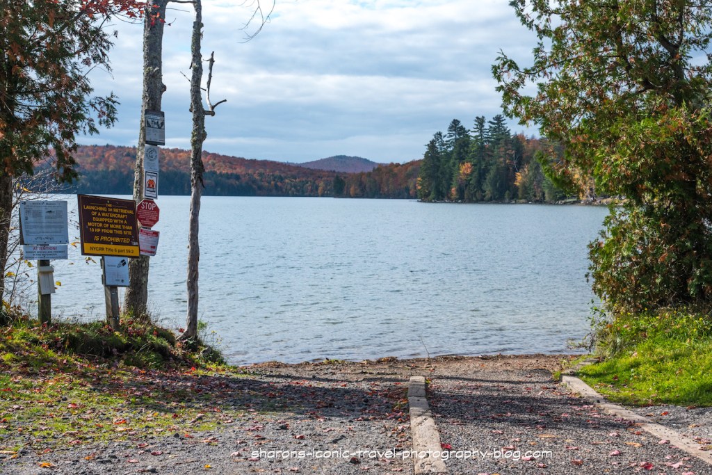
Want another lake to paddle just outside the village of Saranac Lake in the Adirondack Mountains of New York? Lake Colby may fit the bill. Lake Colby is on Route 86 just north of the village of Saranac Lake and across the street from the Adirondack Medical Center. It has a swimming beach with a large parking lot at the south end of route 86 and a boat ramp with parking on the north end of Route 86.
You can see the restrictions on this sign on Route 86 north of Saranac Lake. Boats with motors no more than 10 HP are allowed on the lake. I actually took this picture on my way out.
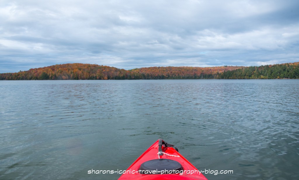
This was the second lake I hit in the same day on a short weekend trip in October. The weather did not cooperate most of the time. It was mostly overcast and dark during this day with short periods with brief views of blue skies.
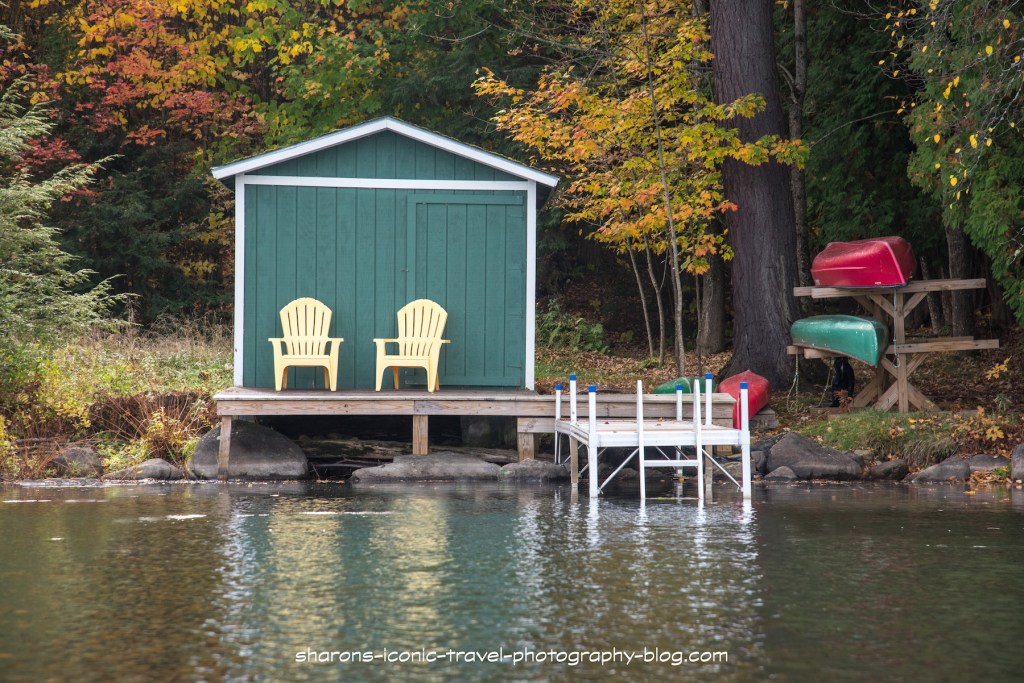
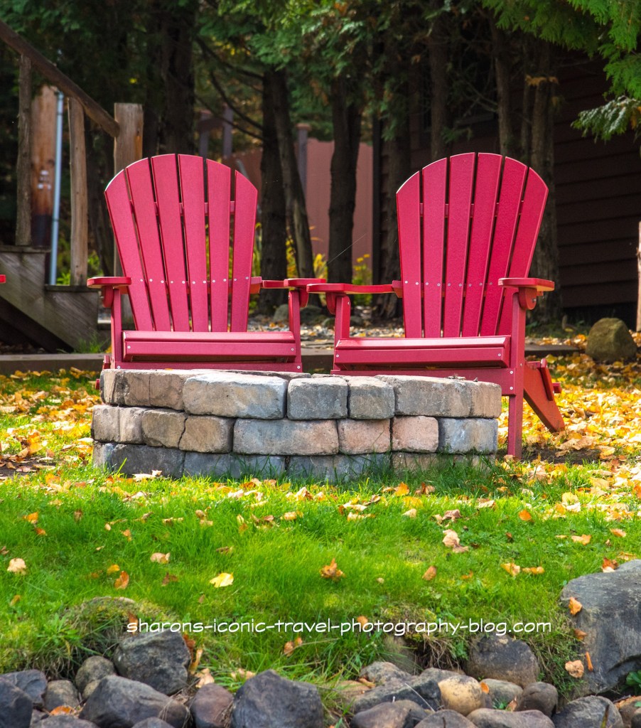
Boat ramp into Lake ColbyDockside for one house.Adirondack chairs next to a fire pit lake side. My vision of heaven. In my dreams I wish to have something like this one day.
Wildlife
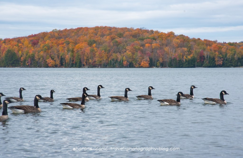
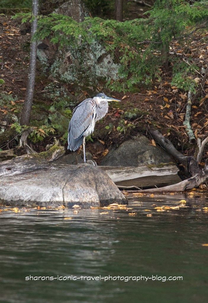
Although it has been said there are loons and eagles here I did not see any. Eagles seem to travel between bodies of water in the Adirondacks. I did see multiple great blue herons and Canadian Geese.
Canadian geese on the lakeThis lake had a multitude of heron when I visited. A lake side structure that looked to be in the midst of a remodel.
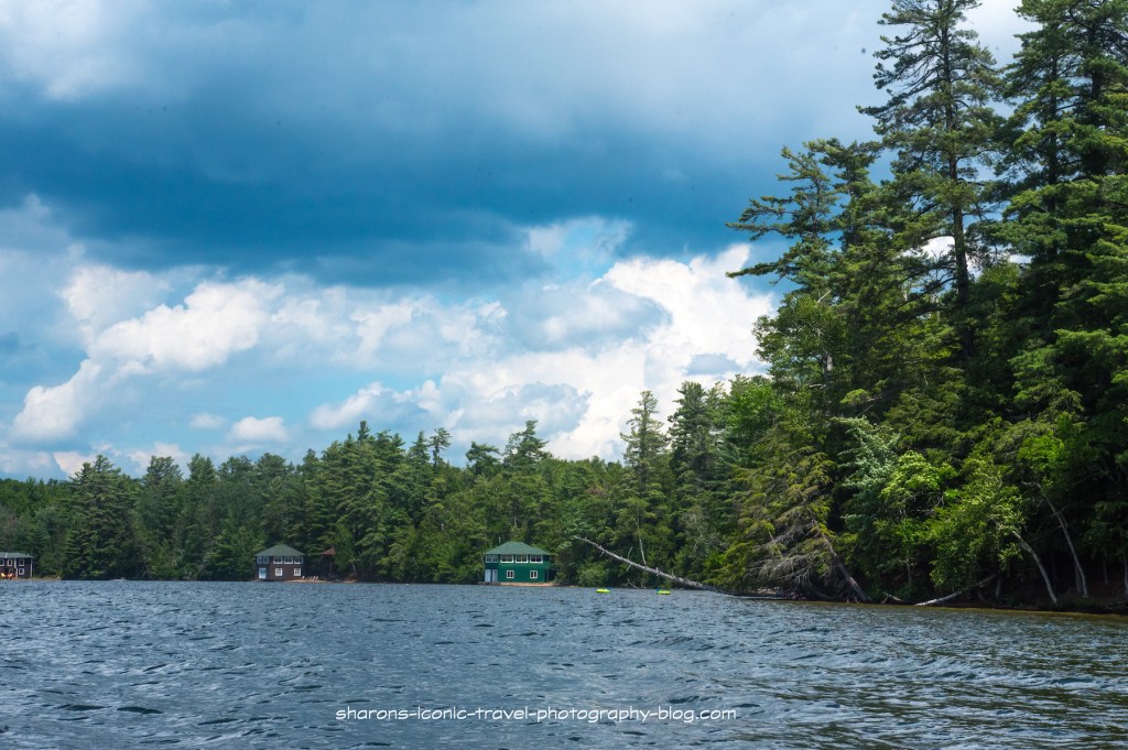
It seemed like there were only a few houses or camps along this lake. I saw no camping signs, however, other websites say there are two on the lake. These campsites are usually first come first served.
This is another lake I highly recommend. It had nice scenery, it is close to the village of Saranac Lake, and has wildlife to see. Viewing wildlife is always a plus for me. I did not take pictures on the opposite side. It had an old railroad tracks that people were fishing from.
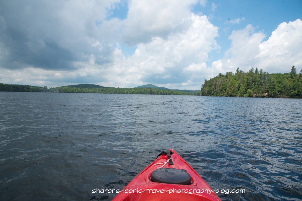
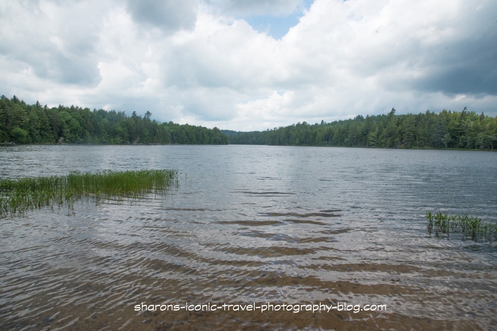
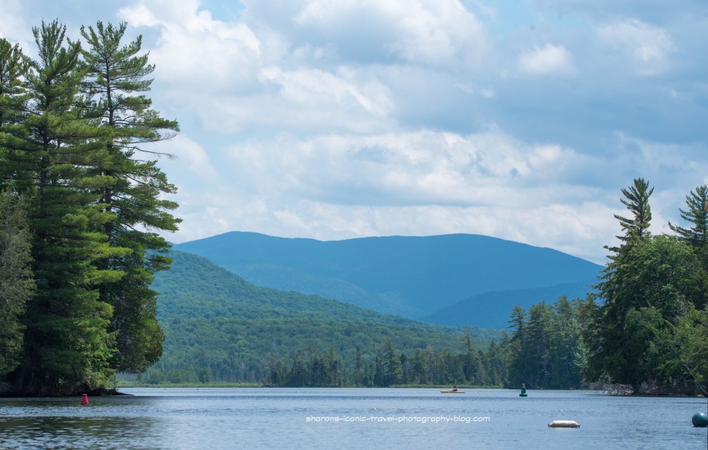
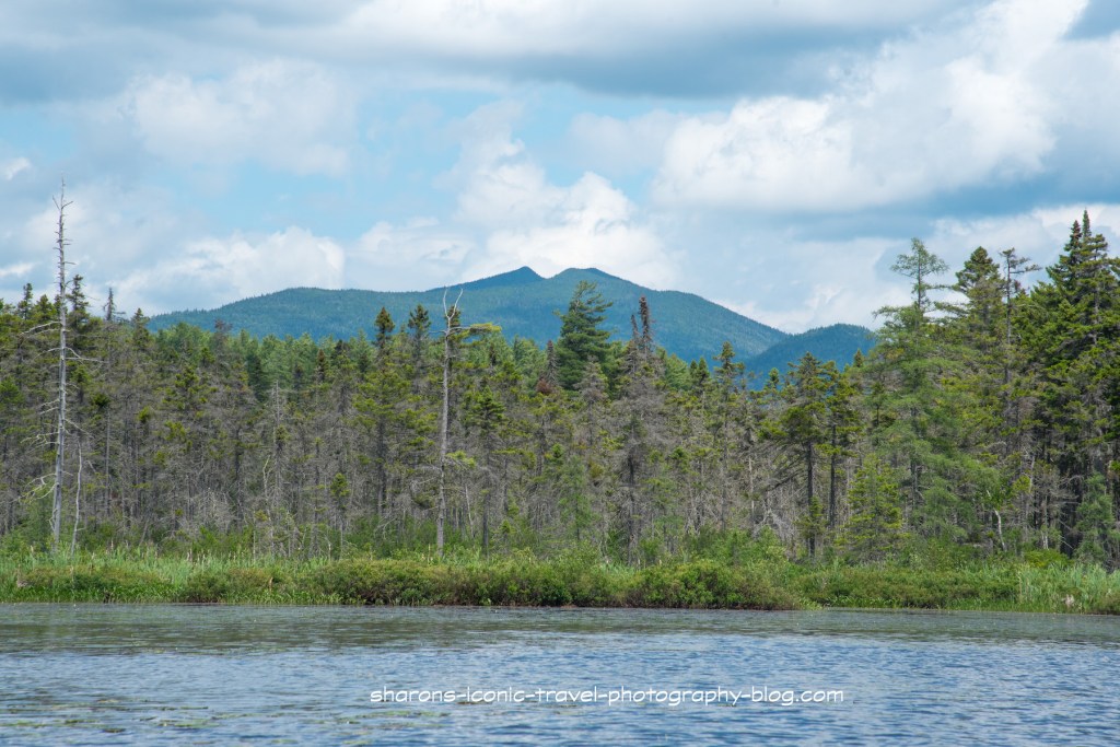
Another pond with access to other bodies of water and free primitive campsites along it is Hoel Pond. Hoel Pond is another large pond with some nice views of neighbouring mountains. This is one pond I recommend you travel to with a friend.
Location
Hoel Pond is in the Adirondack Mountains of New York. It is north of Follensby Clear Pond and southwest of Lake Clear and Upper St. Regis Lake.
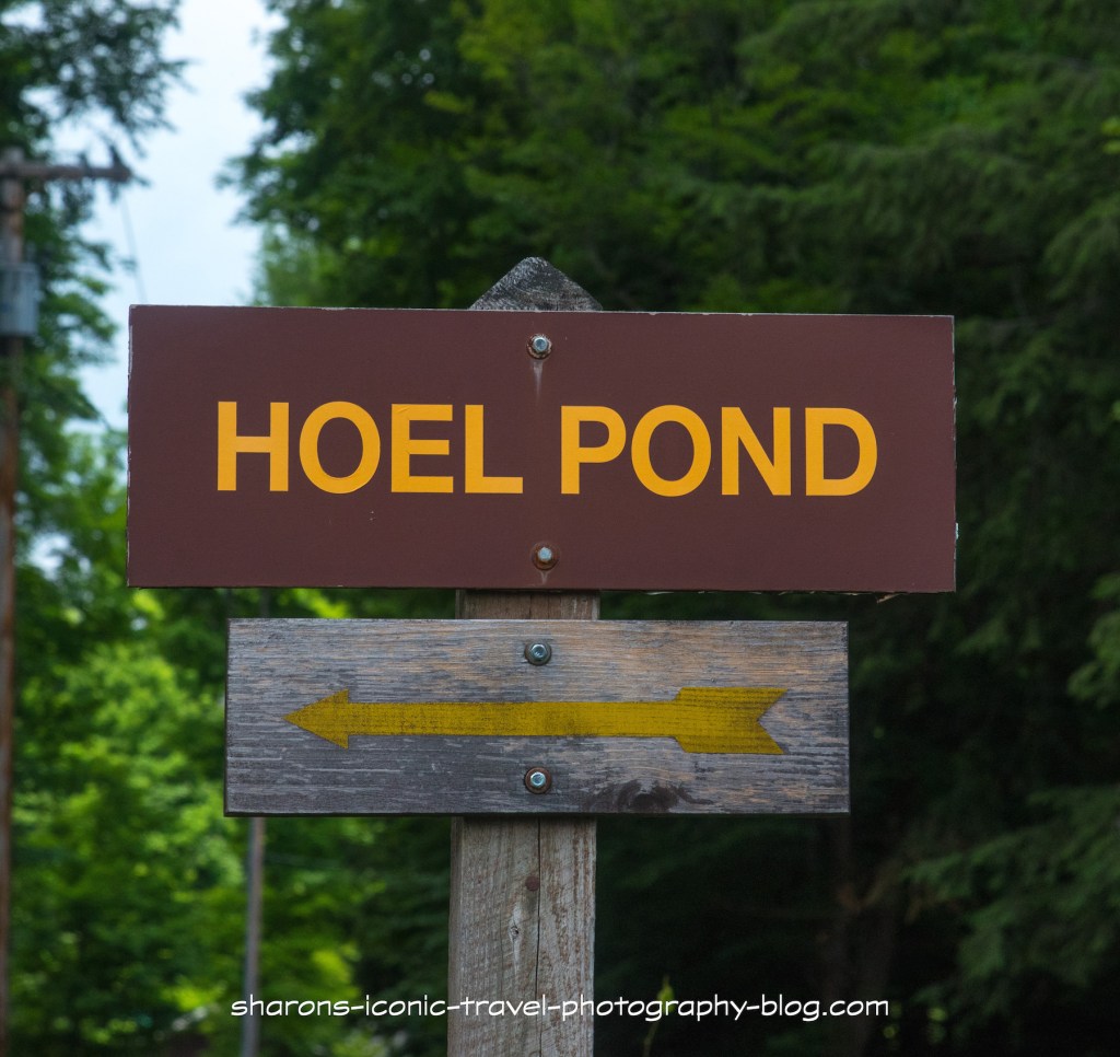
This sign is small and back from the road a little. It is easy to miss.
How to Get There
From State Route 30 you take Floodwood Road west until you reach Hoel Pond Road. Turn onto Hoel Pond Road and right after you pass the golf course, on the left side of the road turn left. There is a dirt road there that looks like it is part of the gold course, but it is not. It has the little sign pictured above, but it is easy to miss. If you miss the road on the left and continue on Hoel Road it then becomes a private road. You will know you went too far as you are in an area with houses and it is passed the golf course and into a wooded area. The dirt road winds down to an area near the pond that has parking spots and some primitive campsites.
Boat Launch
I recommend you go with another person because of the steepness of the steps leading to the boat launch and the canoe carry to Turtle Pond.
This was a tough launch for me by myself. I think it would be much easier for two people to carry a canoe or kayak down these steep steps. This was the reason I recommend going with another person. There is a small sandy beach area below these steps to launch your kayak from. Motor boats owners can not launch from the state boat launch.
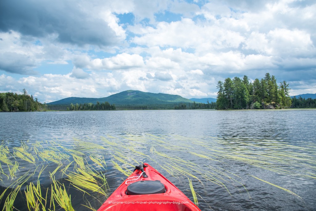
It was a very windy day and once I kayaked across to the point then hugged the land is was a much smoother paddle.
Turtle Pond
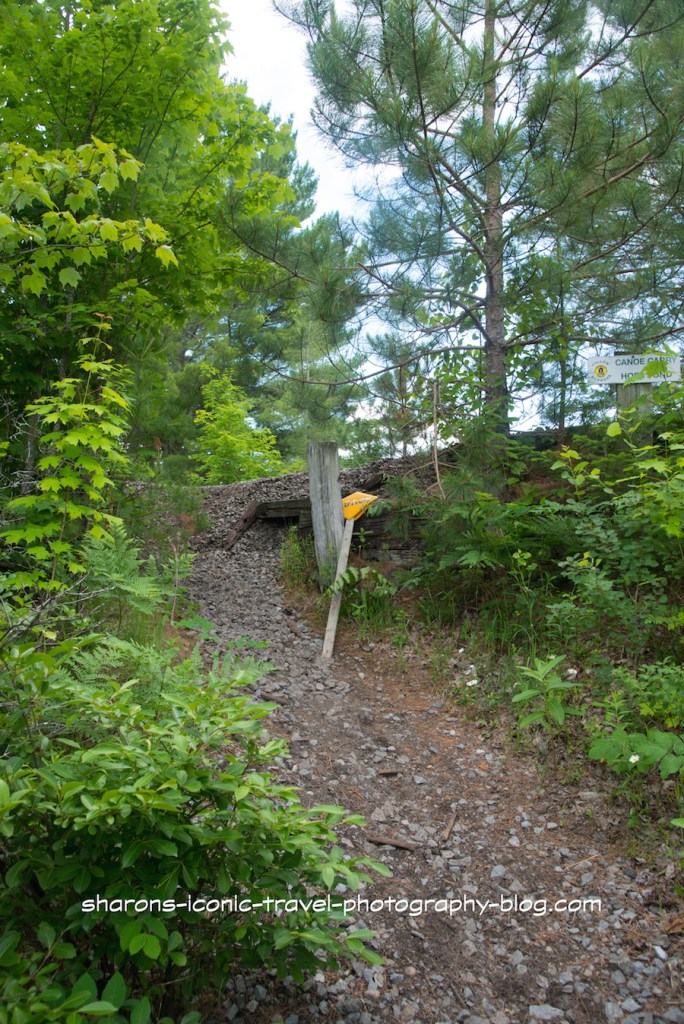
This sign at the other end of the Hoel pond marks the canoe carry to Turtle Pond. It is a narrow path up to the site of an old train tracks and back down to the other pond.
Because the carry down to Turtle Pond was steep I did not feel comfortable carrying the kayak down this hill.
When you cross over the hill to Turtle Pond you enter the St. Regis Canoe Wilderness.
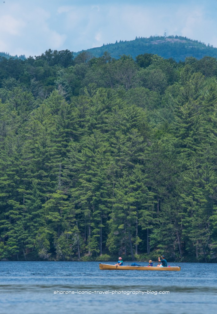
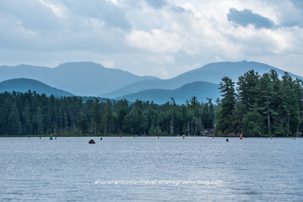
Turtle Pond. From here you can paddle to Slang Pond. From Slang Pond there is a canoe carry to Long Pond. Again from this point you are in the St. Regis Canoe Wilderness.Looking at Hoel Pond from the Turtle Pond side.
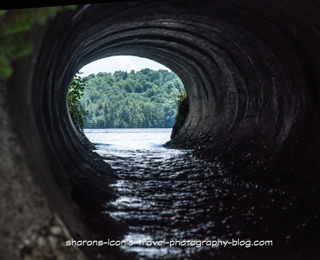
There is a culvert pipe under the railroad tracks leading to Turtle Pond. It appears to go slightly downhill. It is a small pipe and the water level is low in the pipe. You should not try to kayak through it. On the Turtle Pond side the water level is about a one foot drop from the pipe. Some kayakers say they were able to send their boats through the pipe on their own to Turtle Pond. I think you should have two people for this with one waiting on the Turtle Pond side to catch it. Otherwise you run the risk of it drifting into the pond or being damaged from the drop off.
Picnic
I always recommend bringing plenty of water and food with you on long trips. I stopped to eat lunch on the other side of the pond where the canoe carry was. I bring an insulated lunch bag with ice packs inside tied to my kayak but accessible. On that day I ate a veggie wrap from Nori’s on Church Street in Saranac Lake. I took it along with me to enjoy. This was my second kayak trip of the day. I started with Mirror Lake earlier in the morning.
Veggie Wrap from Nori’s in Saranac Lake.That may be St. Regis Mountain with the fire tower on top.The weather improved a bit on the return trip.Looking towards the east side of the pond with privately owned land. I did not see a motor boat on this body of water, but I understand only those who own private properties can have a motor boat. It is not possible to launch a motor boat from the state boat launch.
Camping
This was a group of young women from Gordon College in Massachusetts. They were doing an orientation/ experience for their college that involved two weeks of canoeing and camping in the Adirondacks. They were staying that night at one of the free wilderness primitive campsites.
There are free primitive campsites along most of the lake on land that is forest preserve. Many sites are only accessible by walking or by boat. There are additional free campsites along Turtle, Slang and Long Pond. These campsites are first come first served. Usually you can only stay three days and after that you would have to get a ranger’s permission to stay longer.
This was a nice pond with nice views of the neighbouring mountains. However, because of the boat launch and canoe carry conditions, I recommend you do not do this alone, but with another person. Safety first. Get out and enjoy nature!
What lake can you access right in the town of Saranac Lake? This lake is connected to other bodies of water and has some really scenic views of the neighbouring mountains? It is Lake Flower. I highly recommend a paddle trip on this lake.
Solo kayakerSome parts of the lake are narrower than other parts.
This lake allows motor boats. It has a marina or two near the start of this trip. However, this lake is so big I think I only saw one or two other motor boats on this 80 degree day. I saw maybe 3-4 kayakers on this trip.
There were a lot of markers on this section. I am assuming it was a shallow areawith rocks sticking up. I did not paddle as far as I wanted to on this lake as another afternoon storm was approaching. I had hiked a mountain in the morning before it got hot. It seems there is less a chance of thunderstorms in the morning.
I made it as far as Oseetah Lake but I stopped taking pictures due to thunder. From Oseetah Lake you can paddle into Kiwasssa Lake I am told. I also was told you get get to Lower Saranac also by starting at Lake Flower. That is something for me to explore on another trip.
There did not appear to be a good area to stop to eat on this trip. I suggest taking food and drink with you in the section of the kayak you sit in and not a hatch for that reason. I took a lunch bag with ice packs in it to the kayak for easy accessibility. A lot of land up to Oseetah Lake is privately owned or not very accessible to pull over to take a break..
There appear to be no public campsites on Lake Flower, however there is one lean-to on Kiwassa Lake.
Dockside Ice Cream Stand
Mountain Mist Ice Cream can be visited by either pulling up and parking at their dock behind the ice cream stand or by pulling into the parking lot on Route .. They also have a boat ramp next to the dock and a covered area to sit under.This is close to the start. It is a good stop by water or land on the return.
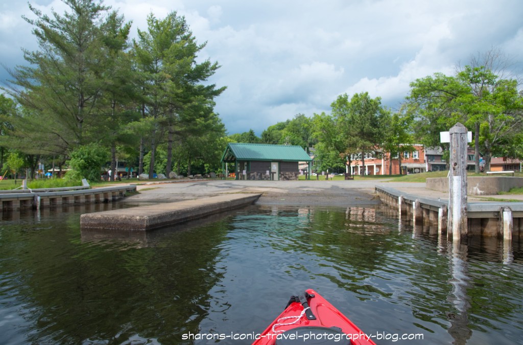
Boat Launch
This is the boat launch you start off at. It is a two bay boat launch.They have a parking area to the right of this photo and bathrooms in the building directly behind the boat launch. There is someone on duty to check your boat to make sure you do not bring invasive plants from one body of water to another.
I really enjoyed the scenery. I would do this paddle again. I did see one loon where Lake Flower meets Oseetah Lake. That is always a plus in my mind. If you want a long trip or a short one with the possibility of an ice cream reward at the end, go to Lake Flower. It is stunning.