One thing you can do every morning at Assateague Island is go to the ocean side beach and watch the sunrise. Sometimes the horses beat you there.
These pictures are taken at Assateague State Park.
My last day there, the boys said they wanted to get up and paddle board at sunrise. I did not believe them as they have been staying up late ghost crabbing until midnight etc.
Sure enough one of the boys and his dad made their way to the beach after I did and went out paddle boarding. There was cloud cover near the horizon, so the sun did not actually appear until a little after sunrise. The sky was purplish.
Paddle boarder gets a good view of a pelican that flies right in front of him.
At this time of the morning I usually see pelicans flying low over the crests of the waves going south and returning north. The above paddle boarder had the experience of a group of pelicans flying right in front of him on his way out.
The boy and his father went pretty far out but had trouble travelling north. The currents out there were going in two directions.
For the days I was there I was the only one who got up each day to watch the sunrise.
The other boys made it out to watch the two brave the ocean during sunrise. Usually several people are on the beach each morning at the state park for the rising of the sun. Just another way to enjoy Assateague Island!
One of the many activities you can do at Assateague Island is paddle board. The best place to go is on the bay side of the island , Sinepuxent Bay. The best time to go when there is no bad weather expected and the winds are not too high.
This is not far from the state boat launch.
One place to put in that I recommend is the state board launch on the mainland side of the Verrazano Bridge. It is across from the Assateague Island National Seashore Visitor’s Center. This one is free and there are two boat launches and plenty of parking in a paved lot. You can also walk from the parking lot/ grass area to a small beach area on the water.
Water pathways thru the marshes are mostly on the island side of the bay. The water near the edges of these is usually shallow.
The other place I recommend is the launch at the national park at the end of Ferry Landing Road. This has some spots near the launch and a restroom. You would have to pay to get to this launch as you have to go through the toll booth inside the park. The fee is over 20 dollars for a seven day pass. Veterans can get a free lifetime pass. There is also a pass for seniors.
It is possible to catch crabs, and clams and see many types of waterfowl in these locations.
There are also free places to launch on the right hand side of the road when you are going from the bridge into the park before you get to the troll booths. You are allowed to park and launch where there is extra shoulder with rocks and there is a beach like area where the water comes right up close to the road.
You cannot park on the island side of the Verrazano Bridge. I have seen people do that in the past, but last year there seemed to be an issue with people respecting the horses, so that is no longer allowed. There are signs up saying no parking and usually there is a ranger there sitting in a vehicle making sure no one is stopping when the horses are present.
There is a lot to do at Assateague besides swim and camp. Get out and enjoy a variety of activities.
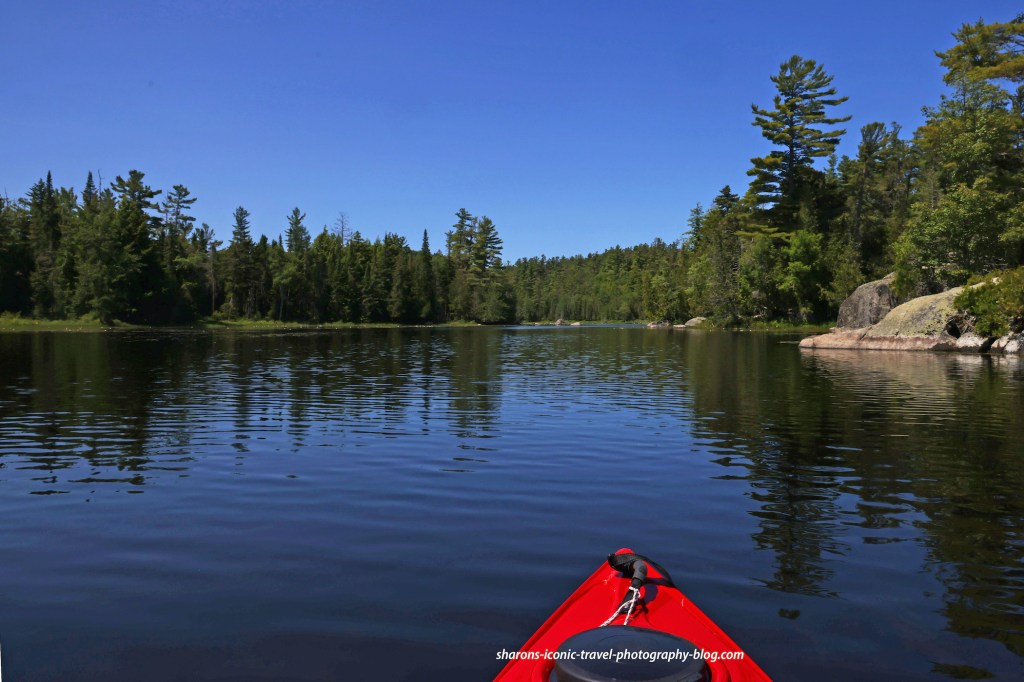
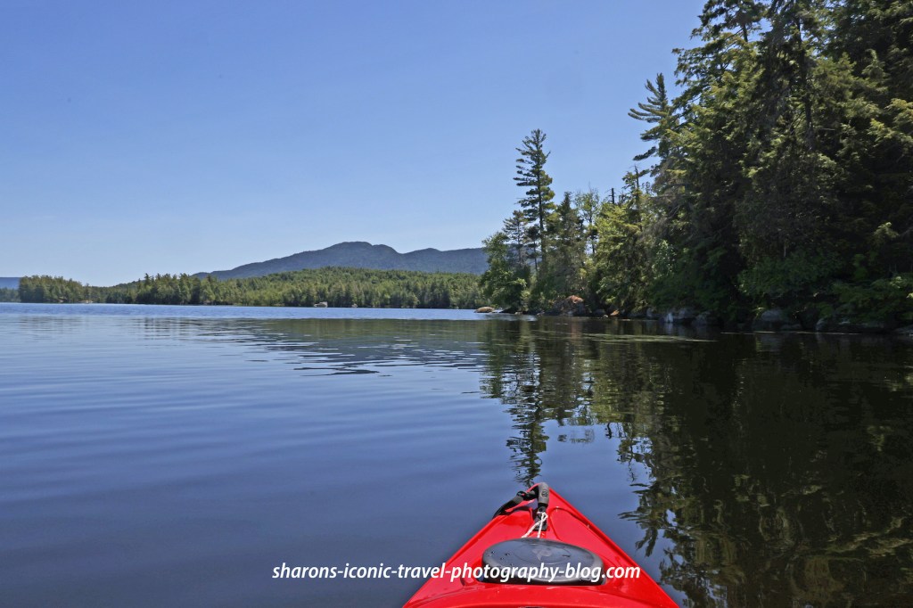
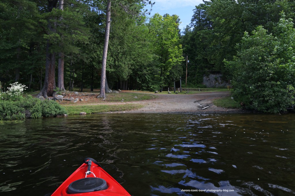
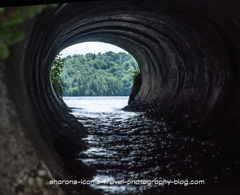
Did you know there were locks and people operating them during the summer in the Adirondack Mountains? As a kayaker if you go towards Oseetah Lake from the Second Pond Boat launch you are able to go through one of the locks.
Launch
2nd Pond Boat Launch
The Second Pond Boat Launch is southwest of the village of Saranac Lake on Route 3. This boat launch has spots for 75 cars and trailers. It is one of the busier launches in the Adirondacks because motorboats are allowed going in either direction. It also has port-a -potties. During the summer people are employed by the state to check your boat to make sure you are not carrying any invasive species from other lakes.
Second Pond
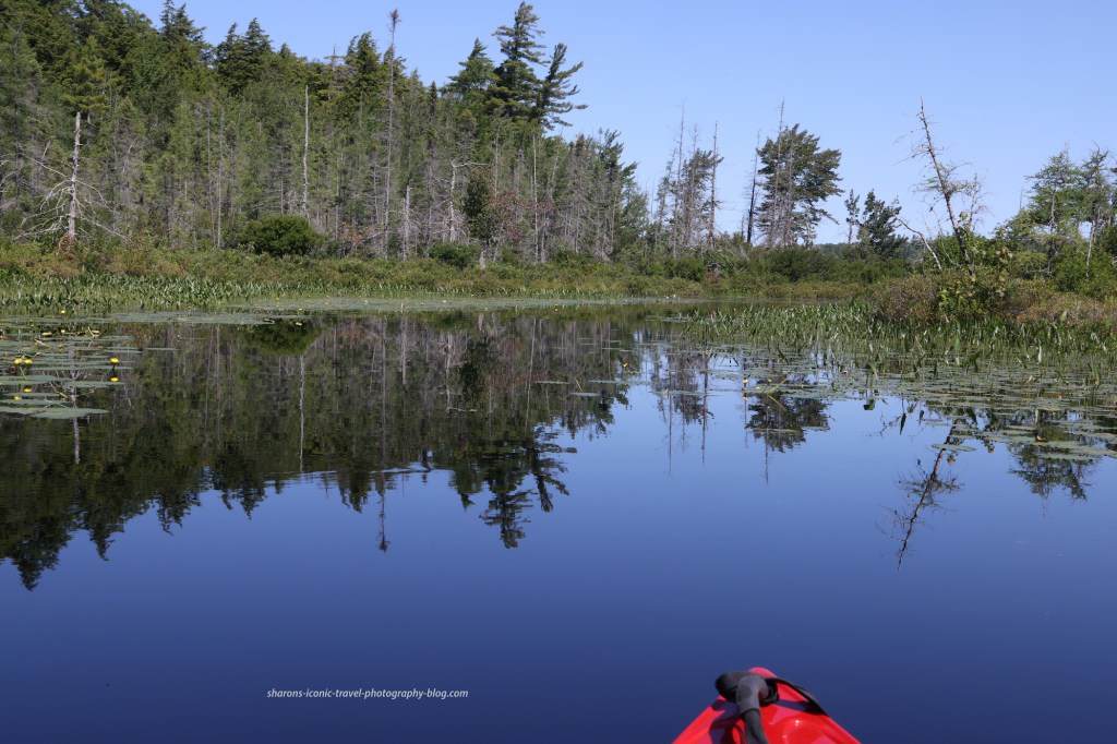
Second PondPassage way from Second Pond towards Lake Oseetah.
There are obstructions in the water and the only was to ensure you avoid them is to stay between the buoys. Some areas have more of these than others. Sometimes it is a huge boulder under the water that comes inches from the surface or a down tree that is slightly under the surface or a stump protruding from the water.
Campsites
On the Paddler’s Map North, one campsite without a lean-to (#62) is on Second Pond close to the boat launch on the opposite side. Another campsite is on the map with a lean-to going through the passageway from Second Pond to Oseetah Lake. The pictures below show the campsite with the lean-to.
It appears the numbered campsites have to be reserved during the summer and early fall through http://www.reserveamerica.com or 1-800-456-camp. These sites are in the Saranac Lake Islands Public Campgrounds. It appears the lean to site in these pictures is not included in that. These it appears fall under the first come first dibs campsites as on other lakes that are free and allow you to stay for three nights without a rangers permission.
A lot of the campsites in this area come with picnic tables.Lean-to
Getting To Oseetah Lake
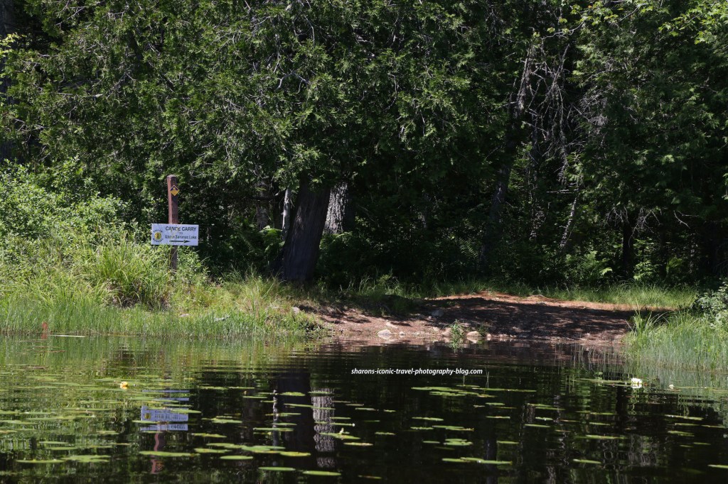
Canoe Carry
There are two routes you can take to get to the lake from the passageway. One way is to exit near the dam at the canoe carry. Heading north up Oseetah Lake is the direction you can take to paddle to the village of Saranac Lake. The other way to get to the lake is through the locks.
Lower locks
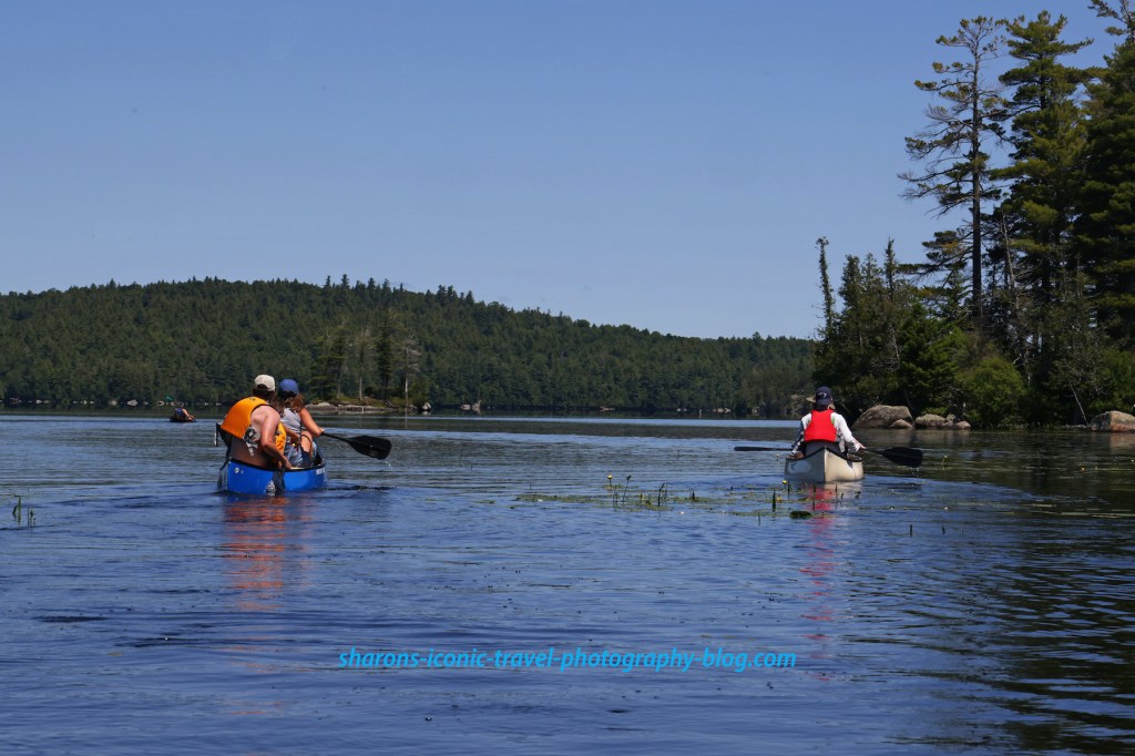
I choose to go through the locks. During the summer and early fall there is a lock master who operates the locks for you. Behind me a group of female kayakers led by a female guide paddled up. I felt lucky as the guide told me how to go through the locks. She also said the canoe carry here was not so easy to do by yourself. The lock master had a few motorboats go through the locks first, then later had all the kayakers in the locks at once.
Inside the lock
When inside the lock people on kayaks or canoes pull up to a thick rope or chain and lightly hold on with one hand. As the water goes up or down loosely move your hold on the rope in the direction you are going up or down.
Female kayak tour leaving the locks behind me. I think there were about 10 of them in total.
The kayaking tour was a several days long trip. The ladies were camping at different spots along the way. The tour guide told me they are an all female guide company I believe. I wish I would have asked for more info so I could have mentioned them here with specifics.
Oseetah Lake
Entering Oseetah Lake
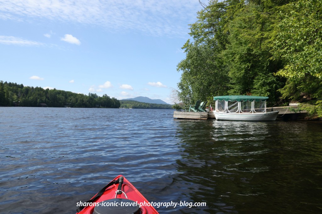
Most of the land around the lake is private. You will see some cabins on the southern end of the lake near the locks. They are in other spots as well.
Women’s kayaking tour. You can see some stumps protruding from the water on the left side of the photo.
This area of rhe lake also had many rocks and stumps just under or above the surface.
Returning Through the Locks
This trip it was 1-2 motor boats and myself in the lock. Motorboats are allowed on all the waterways in this post.
Lovely Scenery
This was a nice trip. I actually went the opposite way from the launch in the morning to Lower Saranac Lake then ate lunch at my car. After lunch, I went the opposite way from the boat launch. I did not see wildlife going in this direction. I did hear kingfishers at the water’s edge, but I did not see them. If you take this route, just beware of the obstructions in the water and stay between the buoys. The scenery is worth the trip.
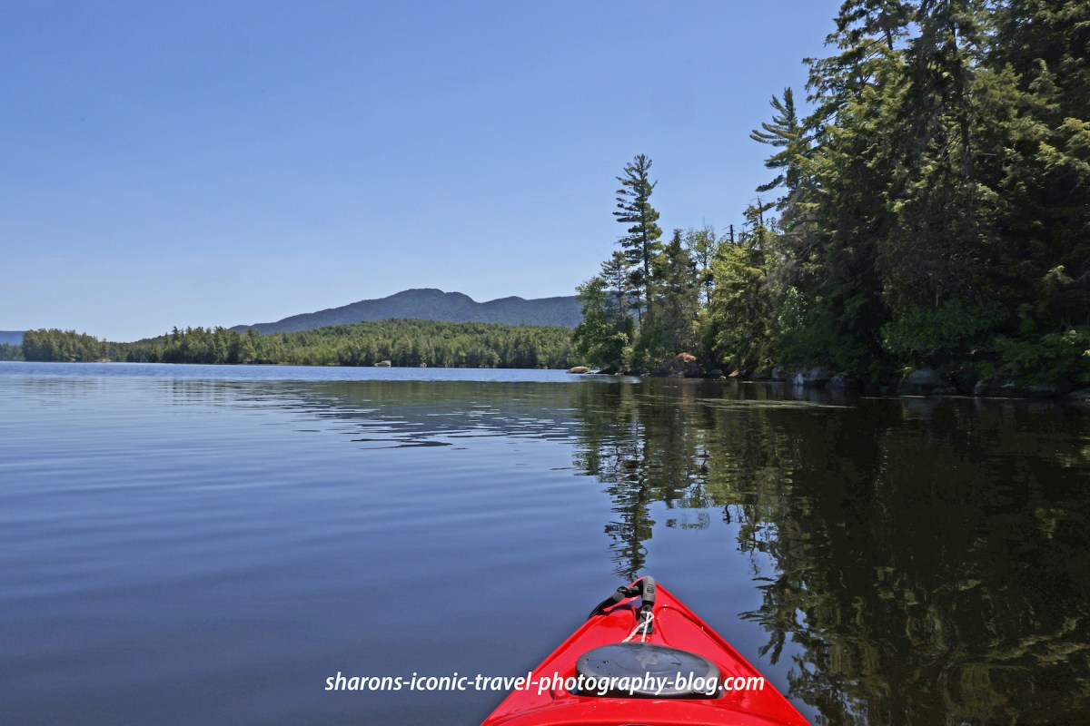
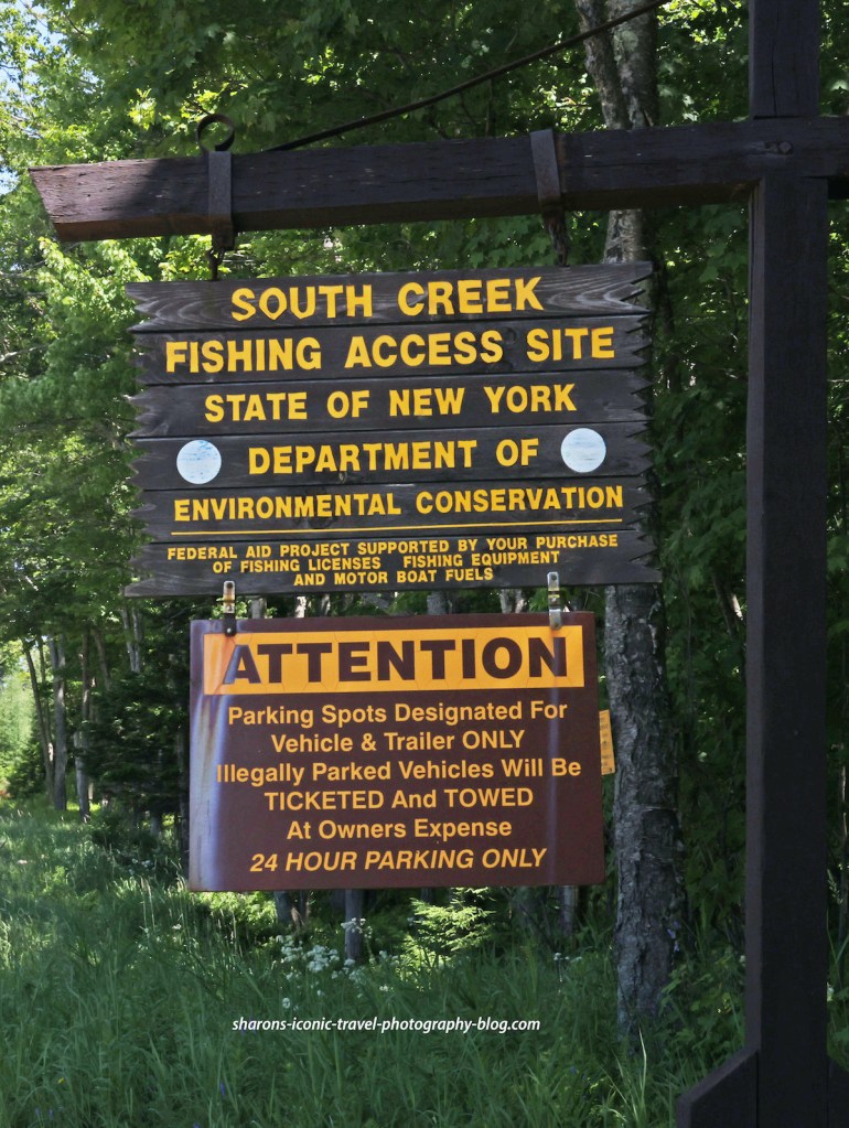
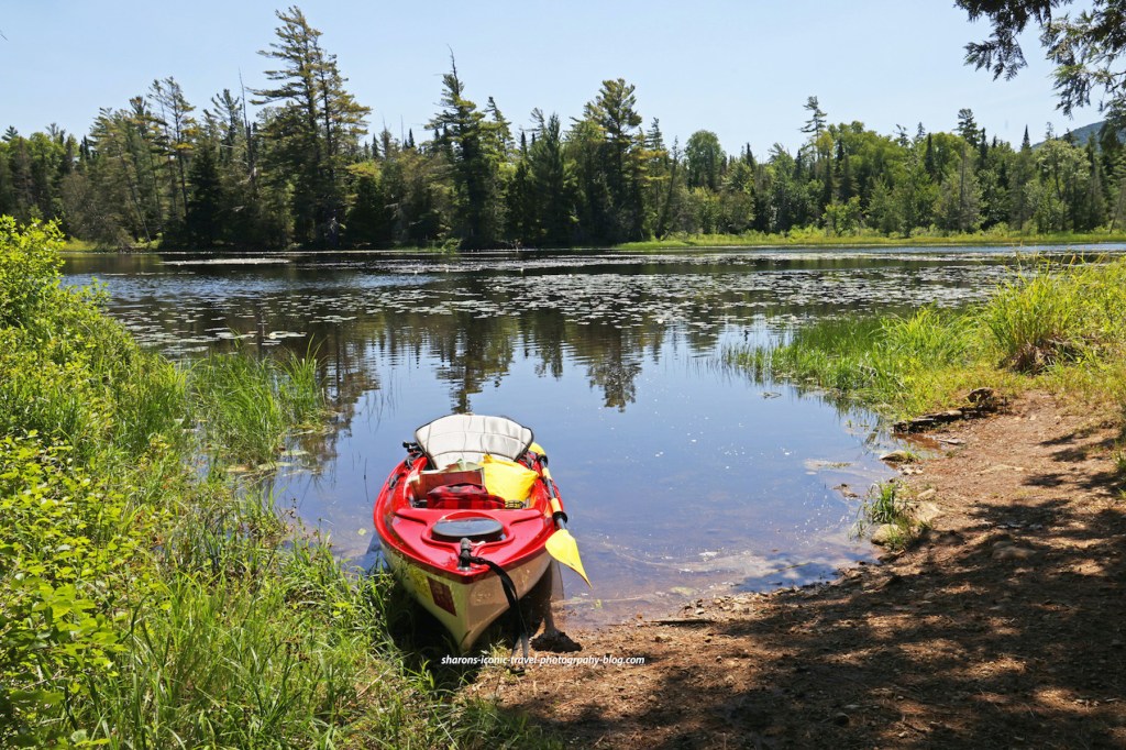
How do you access Middle Saranac Lake in the Adirondack Mountains of New York? One way is by the boat launch at South Creek. This boat launch is on Route 3 about halfway in between the towns of Tupper Lake and Saranac Lake. There are multiple options on where to paddle from this launch so it is a launch that may interest you.
This sign kind of confused me. There are camping spots accessible by boat along the shore and islands of the lake. I am guessing one would have to park in the parking lot northeast from this one that does not have a boat launch according to the map. Usually these campsites are open to first come first serve for three days. Websites say you have to reserve the campsites. I did not see anyone at the campsites I passed.Boat launch
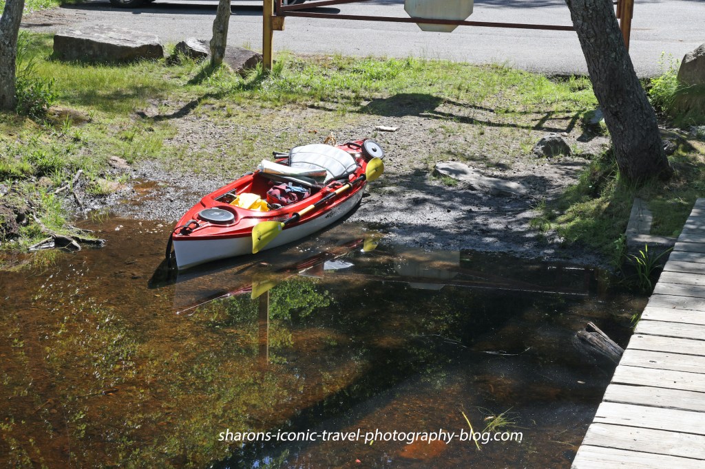
It was kind of a rough carry from my car in the parking lot to the launch. The gates were locked and to squeeze the kayak through the rocks along the side was no easy task. I use a kayak wheeled device to move my kayak to launch sites. Where you walk to carry when I went was rough with gulleys. The boat launch itself as you can see has a gradual descent that is great for kayakers while also providing a dock that individuals who canoe may like.
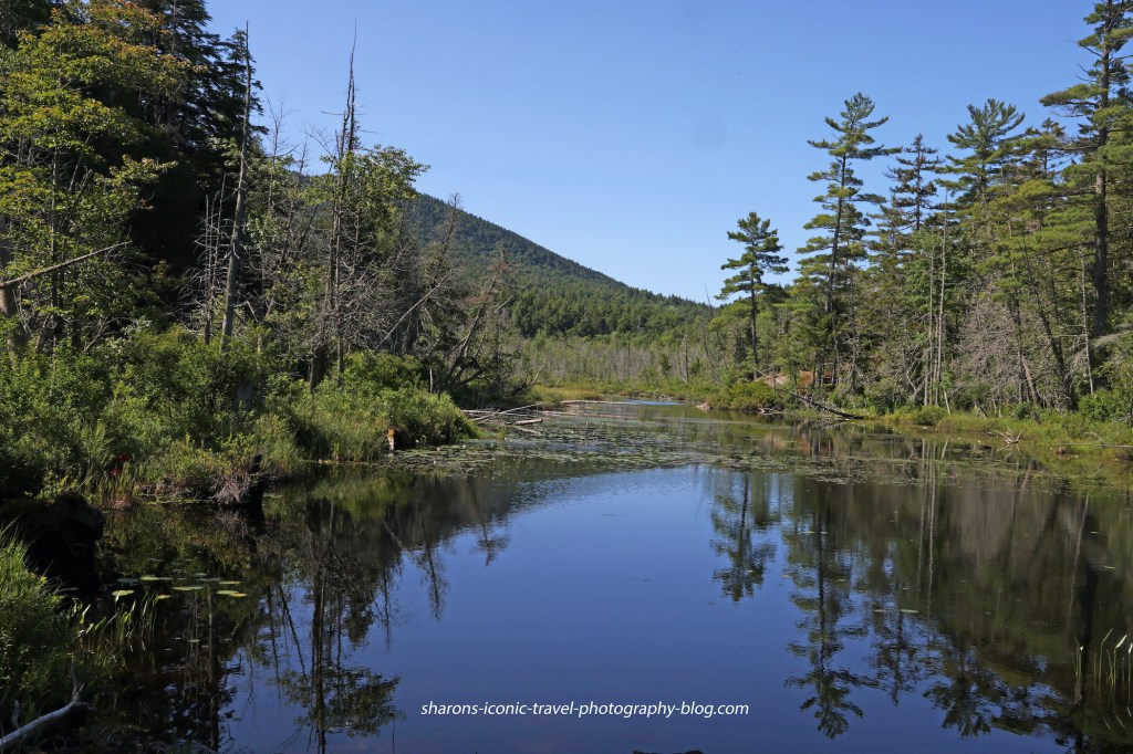
View in the opposite direction from the lake.
The view above is going in the opposite direction from the lake. The view on the bottom is going towards the lake. It looks like a long paddle to reach Middle Saranac Lake on the map, but it is really not that long.
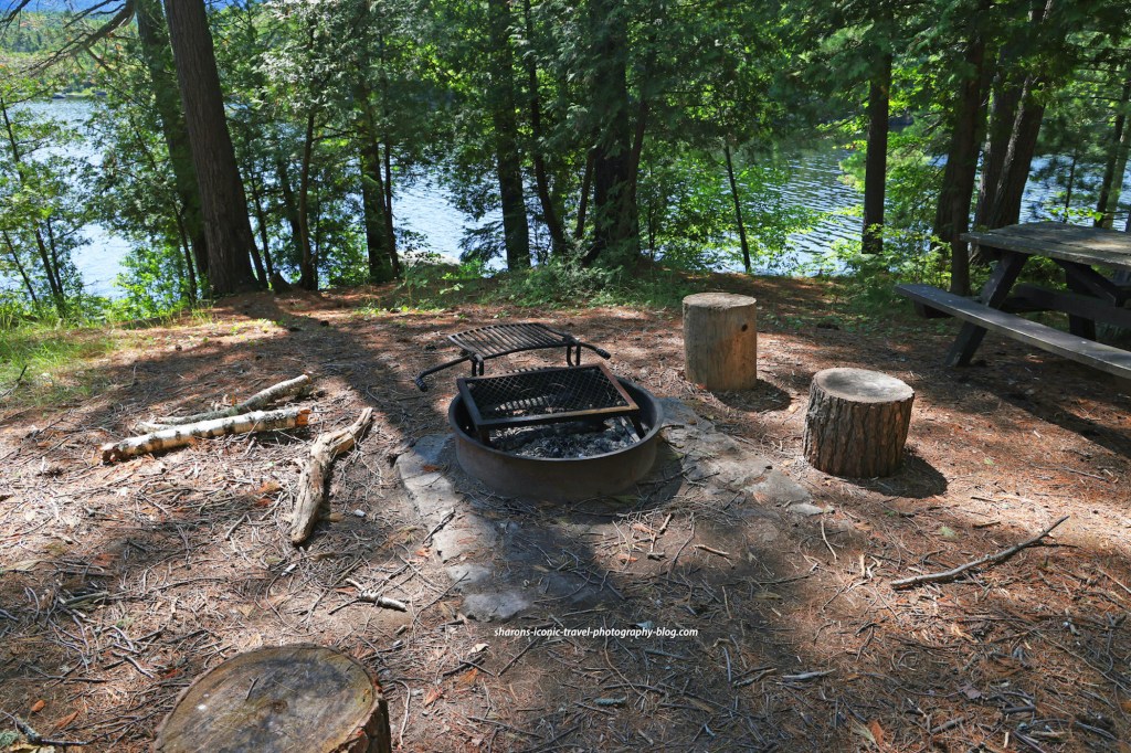
Campsites
They provide a picnic table and fire pit, campfire area at these campsites.
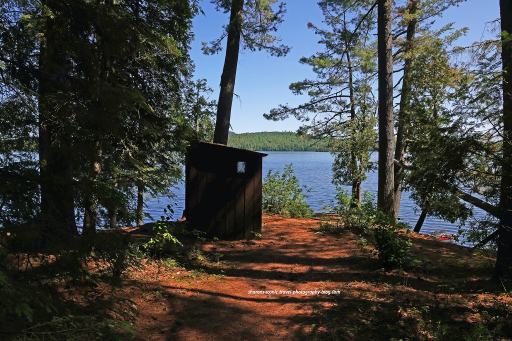
This was the campsite on Shaw Island. As you can see these are primitive sites that are carry-in and carry-out. They are accessible by canoe or kayak.
This campsite had two outhouses.
Going towards the Bartlett Canoe Carry
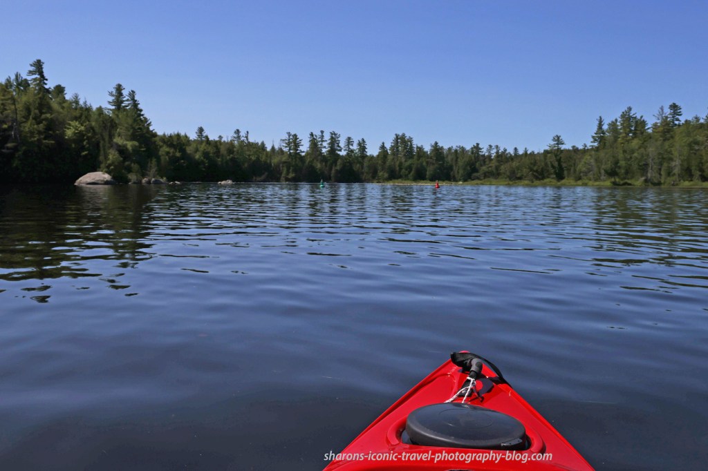
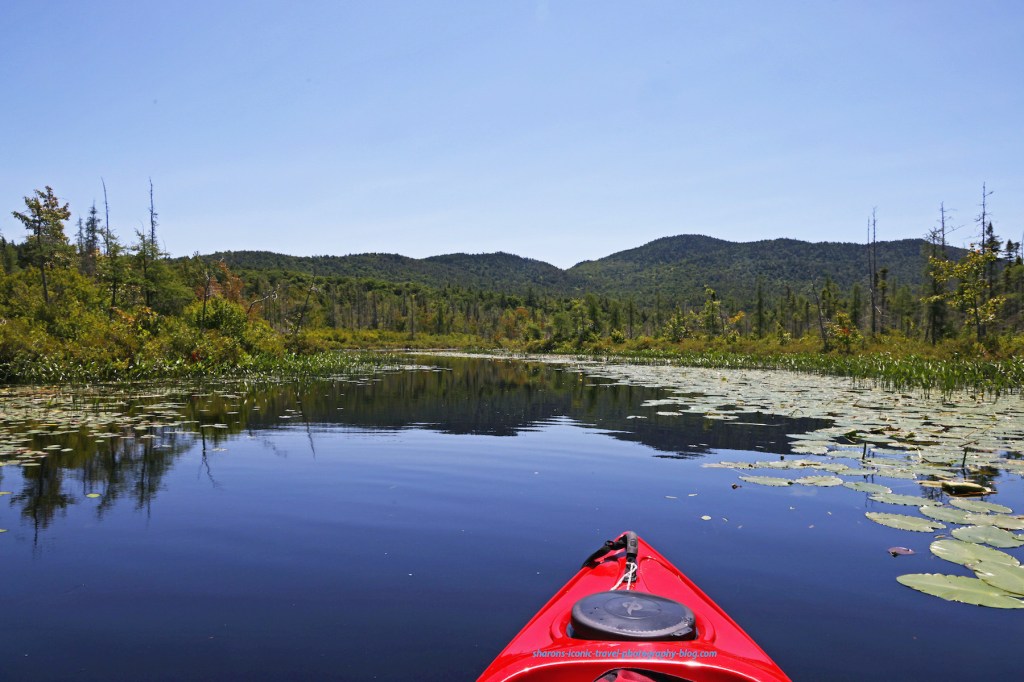
Entering a narrow body of water on the western part of the lake.
On the southwestern side of the lake you enter a narrow body of water that goes in the direction of Upper Saranac Lake. This is one option for accessing other bodies of water. Another option is to paddle north from South Creeek and go through Hungry Bay and into Weller Pond. Another option is to go east to the Saranac River through the upper locks into the southern end of Lower Saranac Lake.
This sign marks the start of the Bartlett Canoe Carry.
The canoe carry was a gradual descent into the water, ideal for kayakers. You follow the path over land to Upper Saranac Lake. It looks far on the map for one person, so I did not attempt it even with a kayak carry device. I encountered a women’s kayak tour on another lake and the guide said the Canoe Carry on the Upper Saranac side is a good launch for kayakers. I will take her word for it.
Wildlife
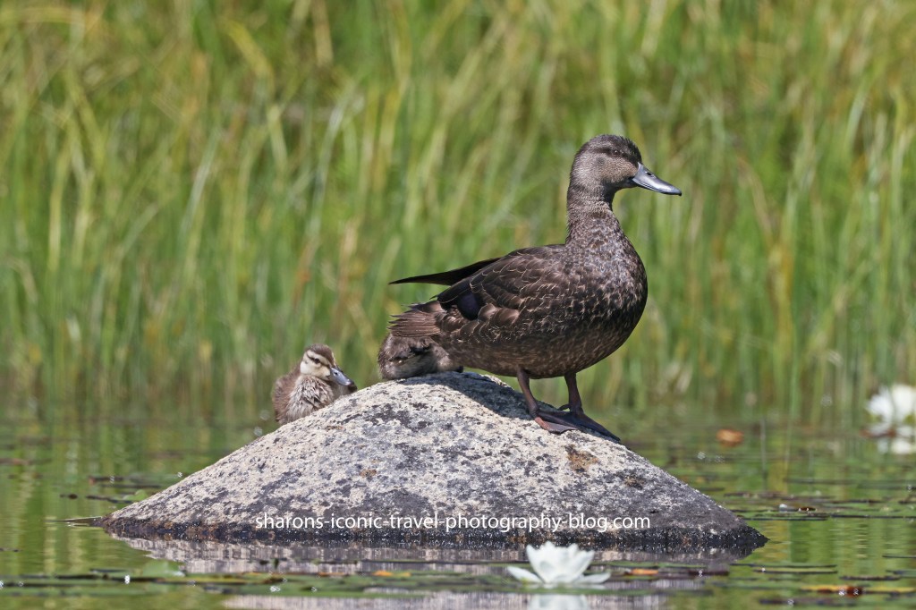
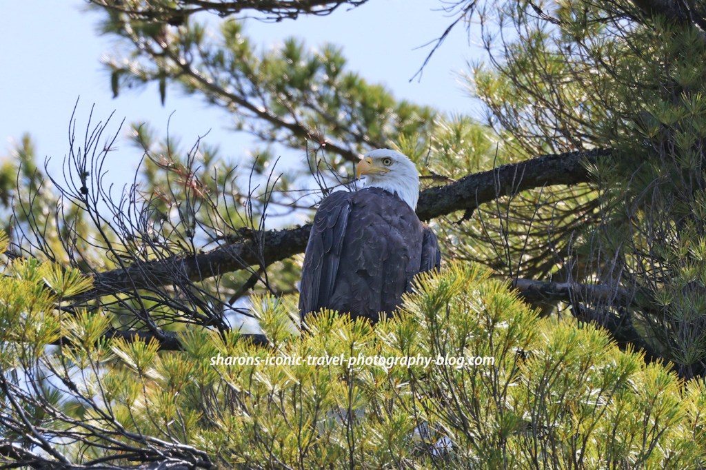
Black duck and her young on a rock. They were in the same area as the eagle.
I always enjoy lakes where you can view wildlife. This one was no exception. I saw two groups of black ducks, although I was nervous for them. An eagle was on a tree very close by eyeing them. Eagles in the Adirondack Mountains travel from lake to lake. They do not always stay on one body of water all day long. I arrived in the morning on this lake and a saw some fishermen on kayak and motorboat. One man I talked to said he arrived at 5 a.m. He was pleased with the bass he caught.
I did see one adult eagle along the trip.
Heading East to the Boat Launch
Heading east on Middle SaranacSome people heading out on the lake. Heading into South Creek back towards the boat launch.The Route 3 Bridge over South Creek.
The boat launch is on the other side of Route 3. You kayak under the bridge and the launch is on the left when you are coming back in.
Despite it being a little rough to get into the parking lot from the launch and into the water from the parking lot I would like to come to this access point again. I do hope they make improvements on it though as it could be a hazard. I recommend they remove a rock or two on the side to make is easier to bring your kayak to the water and fill in the gulleys made by erosion. Middle Saranac Lake is another beautiful Adirondack lake.
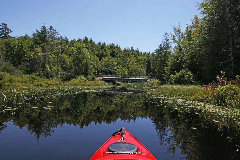
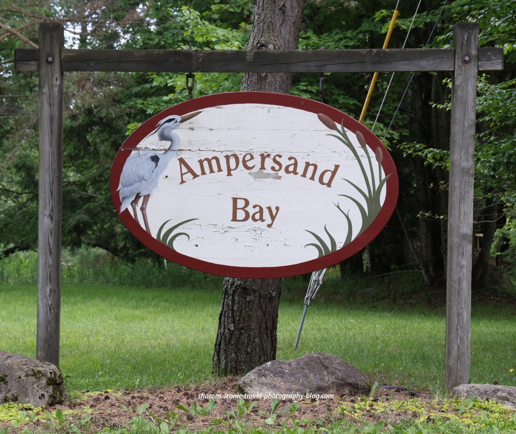
What is another place to launch a canoe or kayak that is close to the village of Saranac Lake? Ampersand Bay of Lower Saranac Lake is a short drive from Saranac Lake.
Sign on Edgewood
There are two ways to get to this launch. One way to get there you travel south of the village on route 3. Then you would turn onto Edgewood. Follow the signs from where this road meets Ampersand. You turn left from this direction. Another way to get to this launch is to go south on Ampersand Avenue then follow the signs.
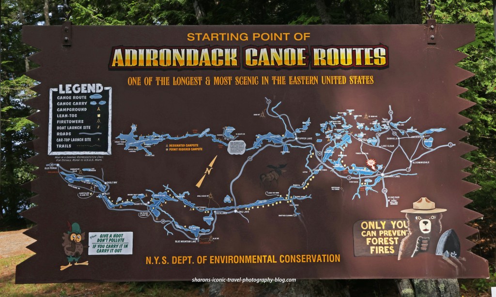
Adirondack Canoe Route
This location is the starting point of the Adirondack Canoe Wilderness Route. Many of the lakes or ponds on this map connect by water routes such as creeks , the lakes running together, or through portages or canoe carries between them.
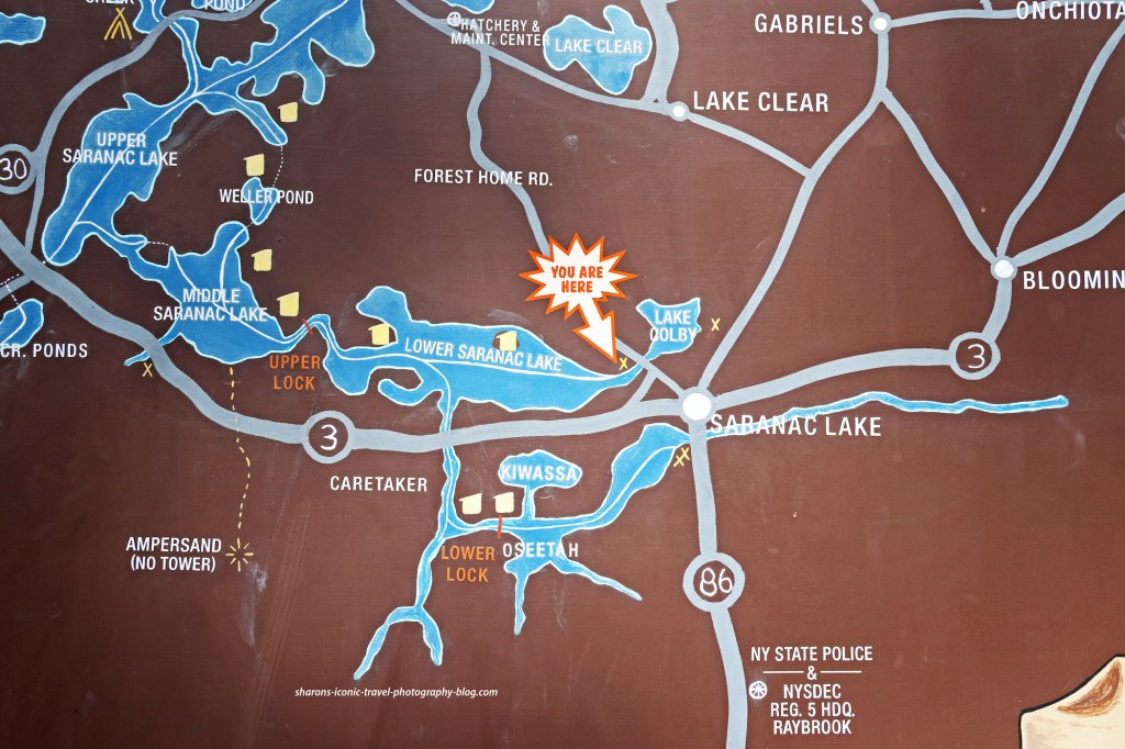
This sign is in the parking lot.This map is facing the wrong direction. Saranac Lake Village is northeast of Ampersand Bay. The you are here on the map points to the Ampersand Bay boat launch.
Boat Launch
This is the boat launch. It has several parking spots. It is only for cars putting in canoes or kayaks.
The Department of Environmental Conservation website says this boat launch parking lot has places for 12 cars. The launch was not crowded when I went. This is not a launch for motor boats, so that makes it less busy. I believe there was only one other car when I arrived. Nearby on the bay is a launch/marina for powerboats. I like this launch. It has a gradual descent into the lake and is great for kayakers.
Ampersand Bay
Heading in to the main part of Lower Saranac Lake
This part of Lower Saranac Lake has some houses and docks along it. It also has what appears to be condos near the marina.
Lower Saranac Lake
I am not sure if that is Ampersand Mountain in the background. Someone knowledgeable about the area may be able to fill us in.It was very windy on this day so I travelled along the shoreline.What you are seeing is an island and the shoreline. This lake is quite large.
Lower Saranac Lake has many campsites along the shore or on islands in the lake. The campsites are free. They are primitive sites with cleared areas for tents, outhouses, and a campfire area/fire-pit.
Wildlife
Kingfisher
Seeing wildlife is always a bonus for me. I got several great pictures of a kingfisher. I think there may have been a nest nearby. Both parents were keeping a close watch on me as I travelled near the shoreline. They were like guard dogs.
I would highly recommend this boat launch. It is great if you would like a short drive from your accommodations in Saranac Lake. Most state boat launches and other ones in the Adirondacks are fine. Enjoy the scenery and enjoy the wildlife!
What is one place you can access Lower Saranac Lake? Which boat launch gives you options and access to several bodies of water? It is the 2nd Pond Boat Launch. It is more than three miles south west of the village of Saranac Lake in the Adirondack Mountains of New York.
Boat Launch
This boat launch is a busy spot. It has one of the largest parking areas I have come across in the Adirondacks with spaces for 75 cars and trailers. It also has port-a-potties. During the summer months people are employed to check boats for invasive species when entering and leaving the water.
The state boat launch at First and Second Ponds
The boat launch is on 2nd pond. When you go west you will go under the bridge on Route 3. From there you are on 1st pond.
First Pond
On Second Pond going towards First Pond.
Wildlife
Seeing wildlife is always a bonus for me. The route I took going from the 2nd Pond Launch through First Pond and into Lower Saranac Lake had a variety of wildlife to see. The ducks stayed near shore weaving in and out of plants. They are probably in survival mode due to the eagle’s presence.
A wood duck and its young. I had a hard time getting pictures of this duck as it stayed mostly in the grasses. Eagles are very active around the ponds and the lake.Merganser DucksOne of the eagles I saw. Two adults were on this tree. As most eagles do in this area I witnessed it going between Lower Saranac Lake and the ponds. Other lakes are nearby, so I’m sure it travels to them as well.
Lower Saranac Lake
I stayed close to shore paddling the route I took. Motorboats were frequently passing in either direction. There are numerous campsites on the islands and shore around Lower Saranac Lake. The spots are free and you can find them on Adirondack Paddler’s Map North. I also saw a few large groups of canoeists and kayakers. Both groups appeared to be camping at one of these free campsites.
I believe this was heading into Lower Saranac LakeLower Saranac Lake
Overall this is a location I would love to return to. I love the scenery, the multiple lake access from this launch and the chance to see a variety of wildlife. Even though it is a busy boat launch there are positive points to more people present. I would recommend staying close to the shore to avoid motor boat traffic.Get out and enjoy the Adirondack scenery and get some exercise while you do!
This trip was killing two birds with one stone. I needed to go to this location to get a part for a roof rack. It has been hard to get every part I needed since the start of COVID. I have been hearing there is a worldwide metal shortage and of course many companies do not have all their workers back so production is slow. I went to Mountainman’s Saratoga kayaking location to get the last part and have it installed. I wanted to find a place in the area to kayak after I made that long trek and low and behold there was a kayak launch on the same grounds as Mountainman.
Location
This kayak launch is owned by Kayak Shak. My understanding is they own the property the other neighbouring businesses on the water are on. The address is 251 County Route 67 (or Stafford Bridge Road) Saratoga Springs, NY. You can get there without going the town of Saratoga. The way my GPS sent me was through a rural area. The cost for someone with their own kayak was $10. If you are renting a single kayak or paddle board (SUP) the coast is $25 dollars for three hours. They have another deal for renting for a longer period of time. They do not allow dogs, so leave them at home. This business advertises they have paddle board (SUP) yoga on Saturday mornings.
It is two miles I was told to Saratoga Lake from this boat launch. I believe they said you could paddle up the creek in the opposite direction 5 miles. I decided to go to Saratoga Lake.
On Saratoga Lake despite houses along it the water seems to be very clean. You can see a good distance to the bottom.
I did not take many pictures on my trip out to the lake. The sky got dark and my goal was to get to the next bridge, close to the lake before the storm came through. I made it under the bridge justo in time and hung out there until it was over with some fishermen.
Heading back towards where I started- about 2 miles away.dHeading back from the lake into Fish Creek. That is the bridge I hid under on my trip out.A tour boat that must have originated on Saratoga Lake. It came up Fish Creek a little ways then turned back.
There are some marinas in different spots. One marina has a campground with RVs/campers viewable from the water.
Wildlife
Since a lot of the land on one side is marshy and not developed you can observe gulls, geese and Great Blue Herons along the way. As always do not get too close. I have a long lens and crop the photos quite a bit.
There were several Great Blue Herons in the area.Seagull observing the heron’s fishing technique. Wearing an ankle bracelet? Was this Canadian Goose being monitored for offences? During COVID he is here illegally. The border is still closed.Almost back. Those who rent their boat get to take off from this beach.If you bring your own you have to paddle to the end of the boats and go around them. Basically you are going under the bridge.Heading back behind the boats.Where those who own their boat can take their kayak out of the water.I have seen Adirondack chairs painted many different solid colours. I like this multi-coloured one. It goes well with the kayak and SUP colours.Where those who own their own boat pay $10 to launch or those who want to rent go to get their gear for a few hours.You may need to reserve in advance. They do get a lot of people renting kayaks at this location.
Harvest and Hearth Wood Fired Artisan Pizza.
Gluten free pizza made with cauliflower crust from Harvest and Hearth Wood Fired Artisan Pizza.
After my trip it was dinner time. I decided to look at the menu of the pizza place on the same grounds as the boat launch, Harvest and Hearth Wood Fired Artisian Pizza, and they indeed had gluten free options. Any pizza on their menu can be ordered with a gluten-free (cauliflower) crust. I ordered the Epiphany. This pizza had kalamata olives, fire roasted peppers, red onions, organic rosemary, mozzarella and goat cheese. If you are lactose intolerant you may need to ask if it can be made with just the goat cheese. It was very delicious! Their hours are Tuesday- Saturday 4:30-9. To learn more about this pizza place go to the link for it down at the bottom.
During the week in the afternoon there were not many boats or jets skis out until you got close to the lake. Most of my trip I saw fellow kayakers and those on paddleboards.
I like this location for several reasons. Firstly, what is available on the grounds is convenient. You have a shop that sells paddling supplies, a pizza place, the boat launch, restrooms, and a park. If you have friends who want to go but don’t have their own kayak, they can rent. Also you can go two directions. So it makes for two different trip choices. In addition, the chance to view wildlife is always a plus to me. During the week it is fairly quiet with few motorboats. The short of it is I would return to this location.
Get out and experience nature. Get some exercise along the way. It will help you maintain your health.
What is the deepest lake in the state of Connecticut? It’s Lake Wononscopomuc (also known as Lakeville Lake). It reaches a depth of 102 feet. In a Native American Language it is said to mean something approximating “a marshy area at the bend of a lake”. This is one lake I kayaked recently. It is one I highly recommend.
As the sign says no alcohol or dogs. This is the town park.
Location
This 348 acre lake is located in the Lakeville section of Salisbury, Connecticut. It is in the foothills of the Berkshire Mountains. You can get there by taking Route 44 east from Millerton N.Y. or west from Norfolk, Ct. From Route 44 you take route 41 south for .1 mile and turn right onto Ethan Allen Street. Follow it to the town park and boat launch.
Fees
Residents get free access. All I did was kayak, so the charge was $10. It was a really nice town park. Since this is the only public access the fee was worth it to me.
Park Amenities
This park covers a lot of land with a beach, wooded area with picnic tables and outdoor grills, a children’s playground, dressing rooms, toilets, boat rentals, and a concession stand, besides the boat launch.
This park rents sailboats, kayaks, etc.
This lake is surrounded mostly by private residences with large lots. Most of the houses are set far back from the shore.
A very hazy day. I had some nice sailboat pictures, but it turns out all of them appeared to be occupied by kids. I don’t want to show images of kids up close unless it is a more public event like a parade. You can see the some of the town park behind this sailboat.
It was very hazy the day I went. It was supposed to be sunny all day, but the air smelled of smoke and I heard it was from the wildfires out west.
Wildlife
I heard an eagle could be seen along this lake. I looked for a nest, but did not see one. Instead I saw multiple great blue herons, ducks, and even what appeared to be a green heron.
I believe this is a green heron. It is much smaller than a great blue heron.
Lake Traffic
I did not see a motorboat or jet ski. I saw conflicting information online on wether they were allowed. I did see multiple sailboats and kayakers. The sailboats were operated by children who appeared to be teen or pre-teen in age. I traveled around the lake close to the shore, so I got the full distance.
I enjoyed this lake for many reasons. For one it was a quiet trip. In addition, I was able to view wildlife. It was the first time I saw a green heron. The parking lot and boat launch were nice as well. I would not mind returning to this lake in the future as it has other nice amenities I did not taken advantage of. Also there are some restaurants in Lakeville very close to the town park.
Get out and enjoy nature. You may experience something new.
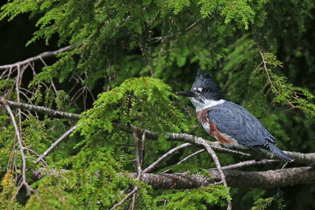
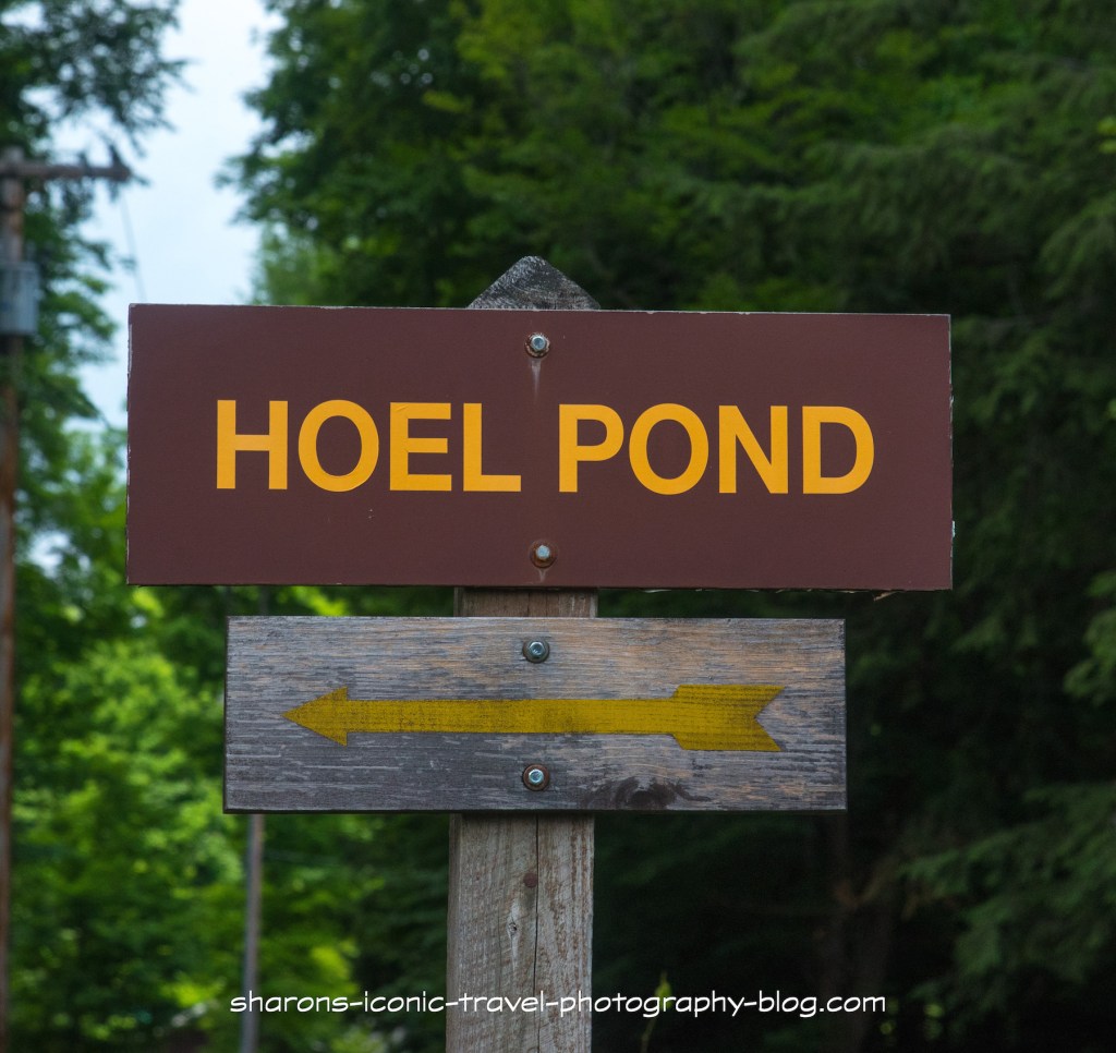
Another pond with access to other bodies of water and free primitive campsites along it is Hoel Pond. Hoel Pond is another large pond with some nice views of neighbouring mountains. This is one pond I recommend you travel to with a friend.
Location
Hoel Pond is in the Adirondack Mountains of New York. It is north of Follensby Clear Pond and southwest of Lake Clear and Upper St. Regis Lake.
This sign is small and back from the road a little. It is easy to miss.
How to Get There
From State Route 30 you take Floodwood Road west until you reach Hoel Pond Road. Turn onto Hoel Pond Road and right after you pass the golf course, on the left side of the road turn left. There is a dirt road there that looks like it is part of the gold course, but it is not. It has the little sign pictured above, but it is easy to miss. If you miss the road on the left and continue on Hoel Road it then becomes a private road. You will know you went too far as you are in an area with houses and it is passed the golf course and into a wooded area. The dirt road winds down to an area near the pond that has parking spots and some primitive campsites.
Boat Launch
I recommend you go with another person because of the steepness of the steps leading to the boat launch and the canoe carry to Turtle Pond.
This was a tough launch for me by myself. I think it would be much easier for two people to carry a canoe or kayak down these steep steps. This was the reason I recommend going with another person. There is a small sandy beach area below these steps to launch your kayak from. Motor boats owners can not launch from the state boat launch.
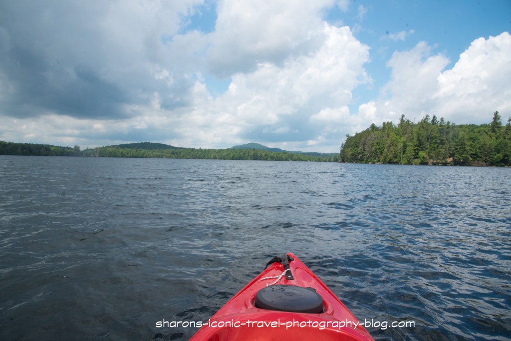
It was a very windy day and once I kayaked across to the point then hugged the land is was a much smoother paddle.
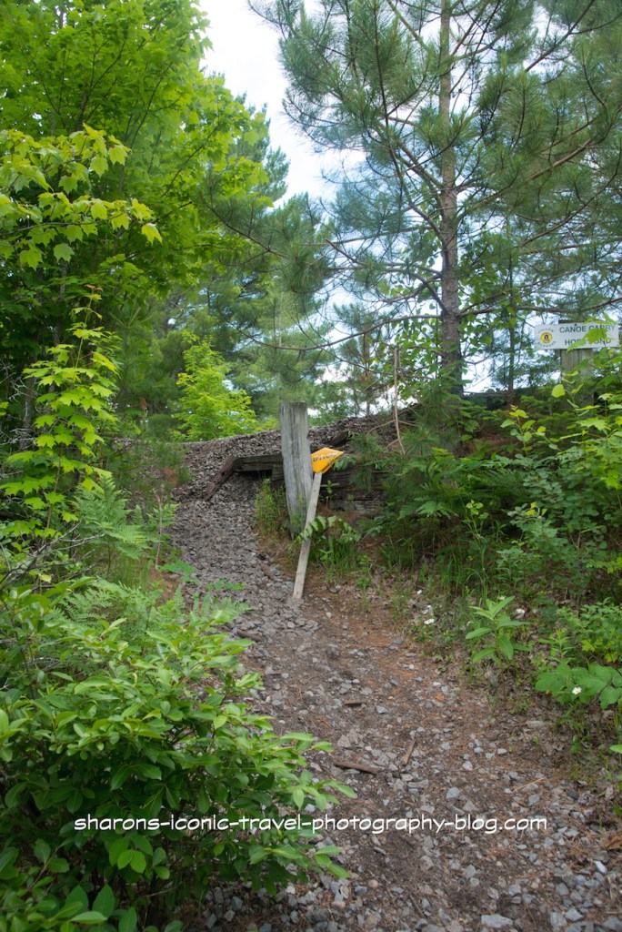
Turtle Pond
This sign at the other end of the Hoel pond marks the canoe carry to Turtle Pond. It is a narrow path up to the site of an old train tracks and back down to the other pond.
Because the carry down to Turtle Pond was steep I did not feel comfortable carrying the kayak down this hill.
When you cross over the hill to Turtle Pond you enter the St. Regis Canoe Wilderness.
Turtle Pond. From here you can paddle to Slang Pond. From Slang Pond there is a canoe carry to Long Pond. Again from this point you are in the St. Regis Canoe Wilderness.Looking at Hoel Pond from the Turtle Pond side.
There is a culvert pipe under the railroad tracks leading to Turtle Pond. It appears to go slightly downhill. It is a small pipe and the water level is low in the pipe. You should not try to kayak through it. On the Turtle Pond side the water level is about a one foot drop from the pipe. Some kayakers say they were able to send their boats through the pipe on their own to Turtle Pond. I think you should have two people for this with one waiting on the Turtle Pond side to catch it. Otherwise you run the risk of it drifting into the pond or being damaged from the drop off.
Picnic
I always recommend bringing plenty of water and food with you on long trips. I stopped to eat lunch on the other side of the pond where the canoe carry was. I bring an insulated lunch bag with ice packs inside tied to my kayak but accessible. On that day I ate a veggie wrap from Nori’s on Church Street in Saranac Lake. I took it along with me to enjoy. This was my second kayak trip of the day. I started with Mirror Lake earlier in the morning.
Veggie Wrap from Nori’s in Saranac Lake.That may be St. Regis Mountain with the fire tower on top.The weather improved a bit on the return trip.Looking towards the east side of the pond with privately owned land. I did not see a motor boat on this body of water, but I understand only those who own private properties can have a motor boat. It is not possible to launch a motor boat from the state boat launch.
Camping
This was a group of young women from Gordon College in Massachusetts. They were doing an orientation/ experience for their college that involved two weeks of canoeing and camping in the Adirondacks. They were staying that night at one of the free wilderness primitive campsites.
There are free primitive campsites along most of the lake on land that is forest preserve. Many sites are only accessible by walking or by boat. There are additional free campsites along Turtle, Slang and Long Pond. These campsites are first come first served. Usually you can only stay three days and after that you would have to get a ranger’s permission to stay longer.
This was a nice pond with nice views of the neighbouring mountains. However, because of the boat launch and canoe carry conditions, I recommend you do not do this alone, but with another person. Safety first. Get out and enjoy nature!
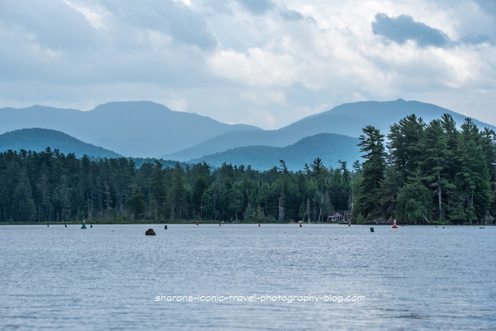
What lake can you access right in the town of Saranac Lake? This lake is connected to other bodies of water and has some really scenic views of the neighbouring mountains? It is Lake Flower. I highly recommend a paddle trip on this lake.
Solo kayakerSome parts of the lake are narrower than other parts.
This lake allows motor boats. It has a marina or two near the start of this trip. However, this lake is so big I think I only saw one or two other motor boats on this 80 degree day. I saw maybe 3-4 kayakers on this trip.
There were a lot of markers on this section. I am assuming it was a shallow areawith rocks sticking up. I did not paddle as far as I wanted to on this lake as another afternoon storm was approaching. I had hiked a mountain in the morning before it got hot. It seems there is less a chance of thunderstorms in the morning.
I made it as far as Oseetah Lake but I stopped taking pictures due to thunder. From Oseetah Lake you can paddle into Kiwasssa Lake I am told. I also was told you get get to Lower Saranac also by starting at Lake Flower. That is something for me to explore on another trip.
There did not appear to be a good area to stop to eat on this trip. I suggest taking food and drink with you in the section of the kayak you sit in and not a hatch for that reason. I took a lunch bag with ice packs in it to the kayak for easy accessibility. A lot of land up to Oseetah Lake is privately owned or not very accessible to pull over to take a break..
There appear to be no public campsites on Lake Flower, however there is one lean-to on Kiwassa Lake.
Dockside Ice Cream Stand
Mountain Mist Ice Cream can be visited by either pulling up and parking at their dock behind the ice cream stand or by pulling into the parking lot on Route .. They also have a boat ramp next to the dock and a covered area to sit under.This is close to the start. It is a good stop by water or land on the return.
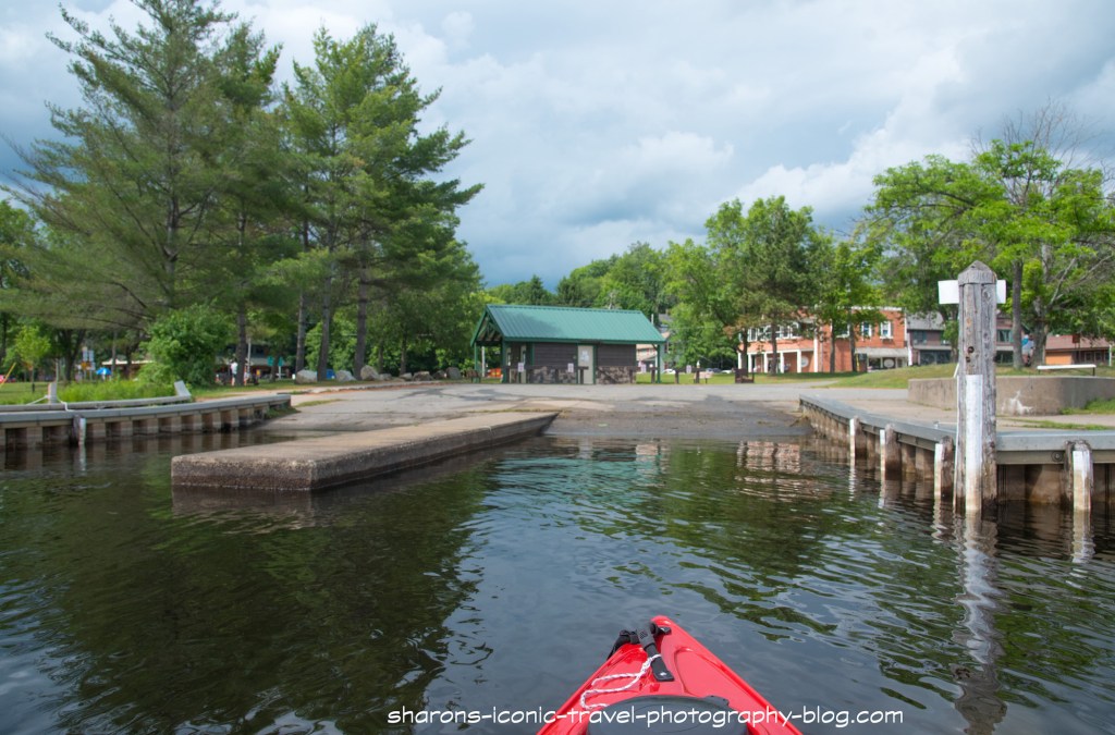
Boat Launch
This is the boat launch you start off at. It is a two bay boat launch.They have a parking area to the right of this photo and bathrooms in the building directly behind the boat launch. There is someone on duty to check your boat to make sure you do not bring invasive plants from one body of water to another.
I really enjoyed the scenery. I would do this paddle again. I did see one loon where Lake Flower meets Oseetah Lake. That is always a plus in my mind. If you want a long trip or a short one with the possibility of an ice cream reward at the end, go to Lake Flower. It is stunning.