
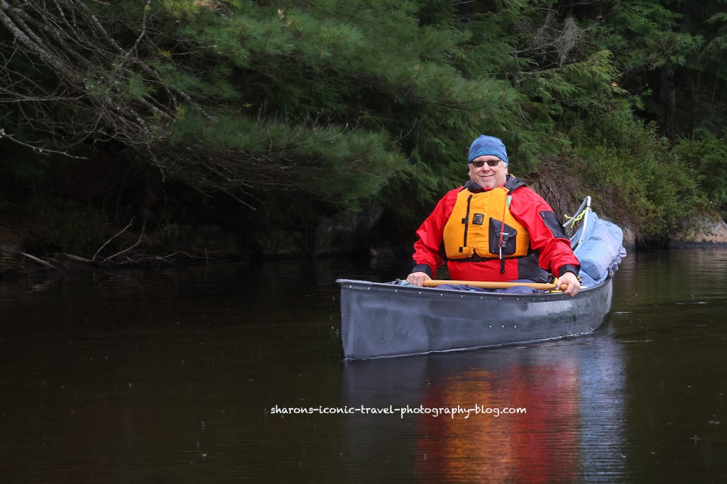
How can you tell if a kayaker is truly dedicated? If they kayak in the rain. Many will only go out in sunny weather.
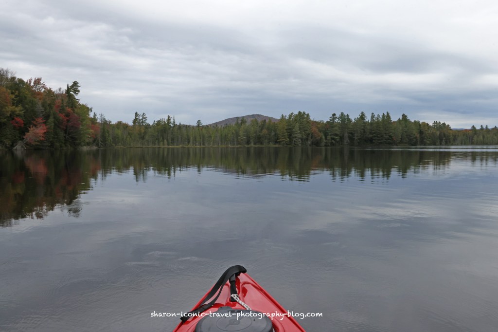
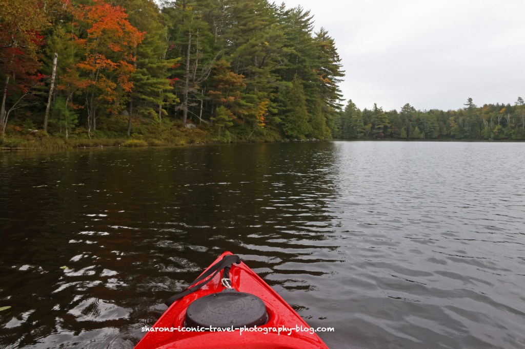
I had a long holiday weekend. It rained 3 out of the 4 days. On the second day of my mini vacation I went to Long Pond in the Adirondack Mountains of New York. I was told it was not predicted to rain until 3 p.m. I think it started after 11 a.m, which was not long after I started.
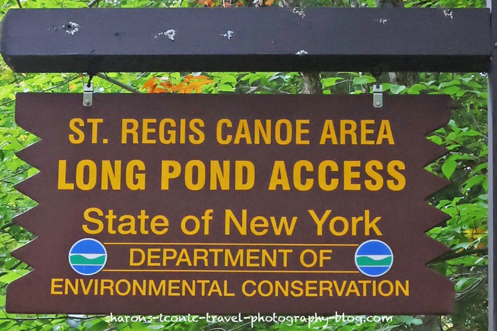
Long Pond can be accessed by at least two canoe carries that can be accessed from Floodwood Road off of Route 30 north of Upper Saranac Lake. Floodwood Road starts off as a paved road, then switches to a dirt/gravel road. The road itself seems in pretty good shape. There are campsites along it on different ponds where the little driveways in are not in good shape.
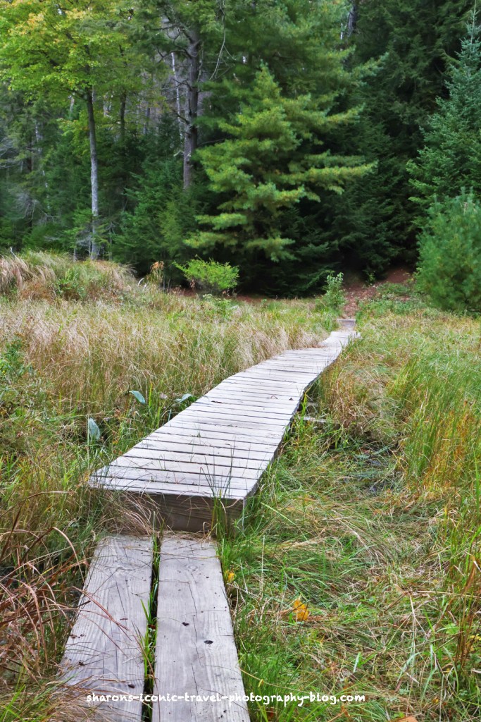
The first canoe carry I found was starting from a parking lot across from a remote location of St. Regis Canoe Outfitters. This store was out in the middle of nowhere in a house. I walked part of the canoe carry which went across a wooden path in a marshy area behind a very large beaver dam. Side note: these are some serious beavers. Unfortunately on the other side of the wooden walkway from a steep rooted incline. This is a no go for me. I went into the store and asked if the canoe carry at the other end of Long Pond was any better. They assured me it was shorter and not so steep. Before I left , just in case, I rented a canoe carrier device to put your kayak on underneath the middle of the boat. They charged me $5 dollars.
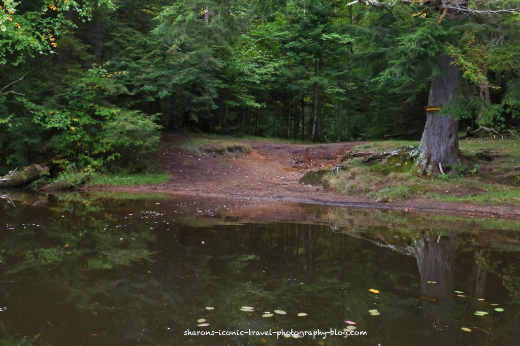
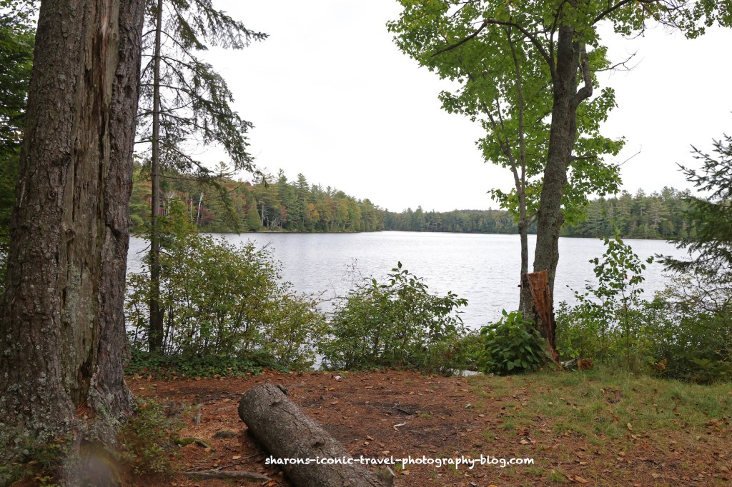
At the western end of Long Pond maybe 3/4 of a. mile- 1 mile further west was a parking lot for the other canoe carry. I walked all the way down and back to make sure it was doable. Then brought my kayak down.
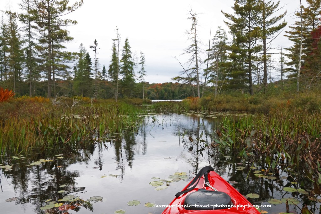
Passageway to Pink Pond
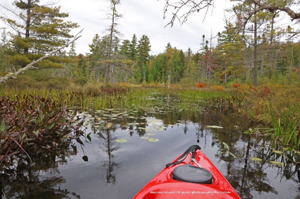
I was not sure if this was going to turn out as a good passageway or not. It was a little overgrown in spots, but I was able to navigate it to Pink Pond without any issues. The passage starts on the opposite side of the pond from the launch a little east of it.
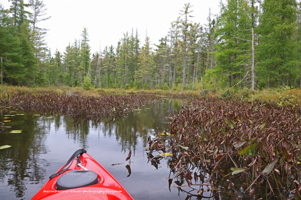
Pink Pond Passageway to Unnamed Pond
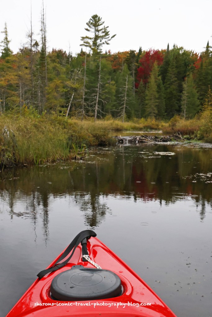
This was blocked pretty well with a beaver dam. I did not want take it apart on this day or try to climb over it so I went back. The beavers won on this day. It looked like there was a canoe carry from the unnamed pond to Ledge Pond on the map.
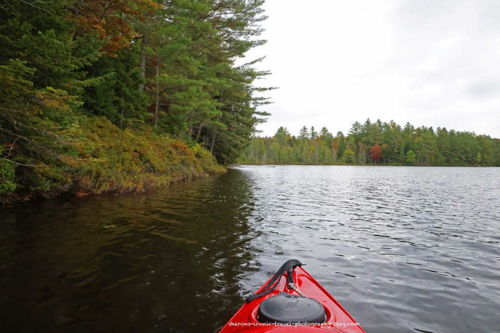
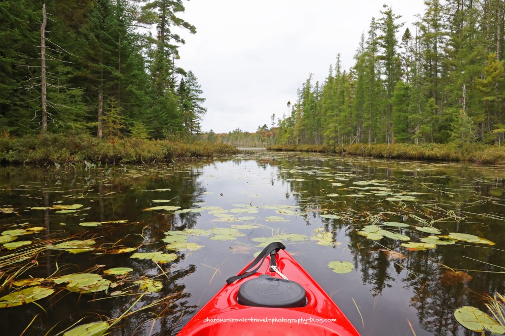
Passageway from Pink Pond into Long Pond
Campsites
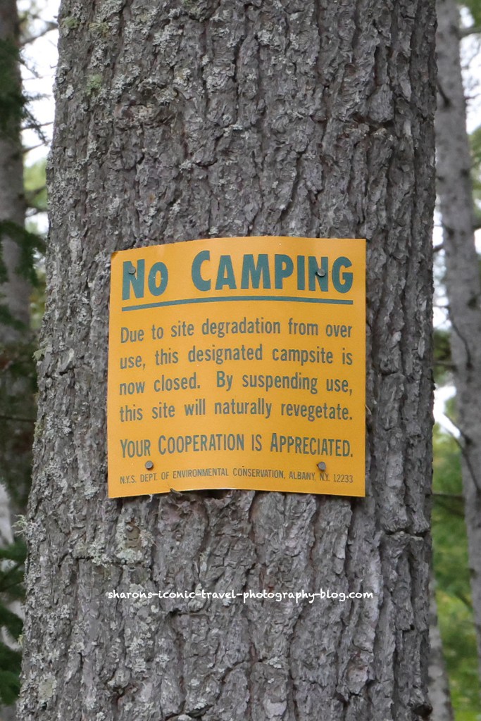
The campsites along the shore of Long Pond spaced apart. They are all free, first come, first served. As you can see by the sign, some of the campsites were closed to allow for revegetation. While there I saw leaving from camping overnight. I saw one person with a campsite set up who was remaining, and I saw others paddling in with camping gear heading off for their campsites.
Slang Pond Canoe Carry
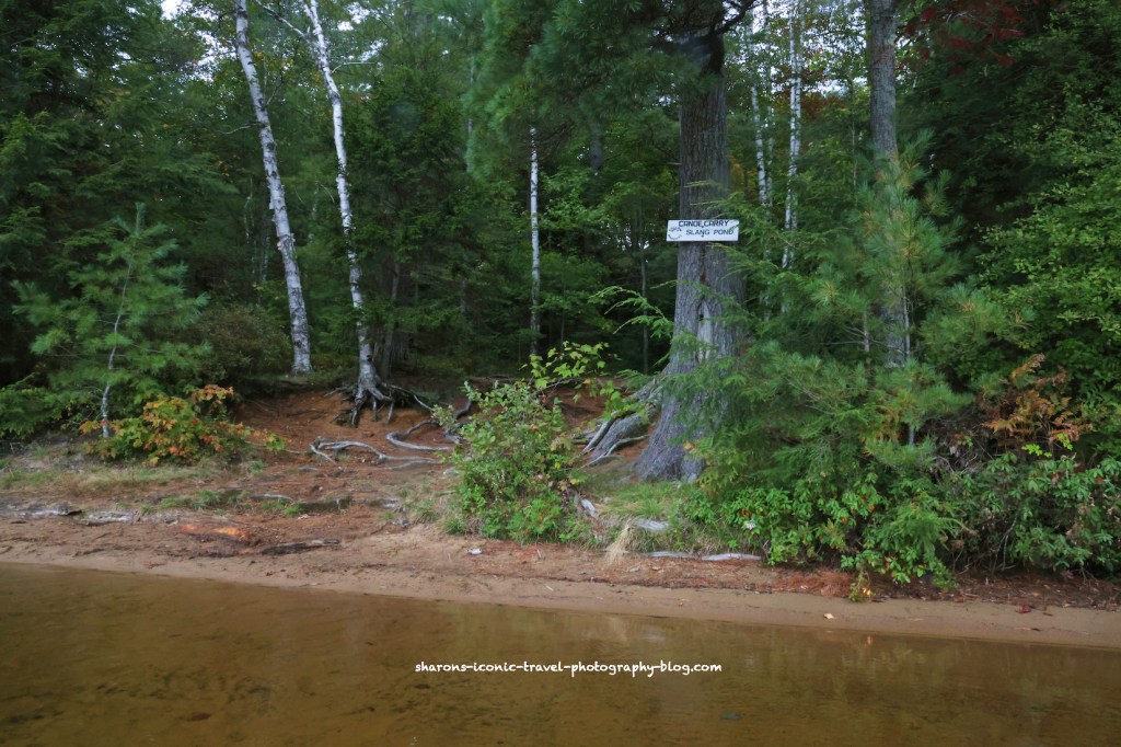
The canoe carry to Slang Pond is on the north east area of Long Pond. It was a nice gradual incline to a little beach. From Slang Pond you can go to Turtle Pond and by canoe carry over an old railroad tracks/ path you can access Hoel Pond.
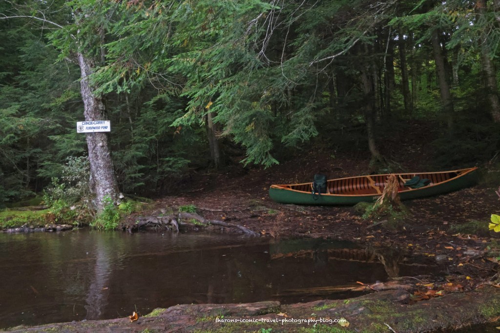
Canoe Carry from Long Pond to Floodwood Pond
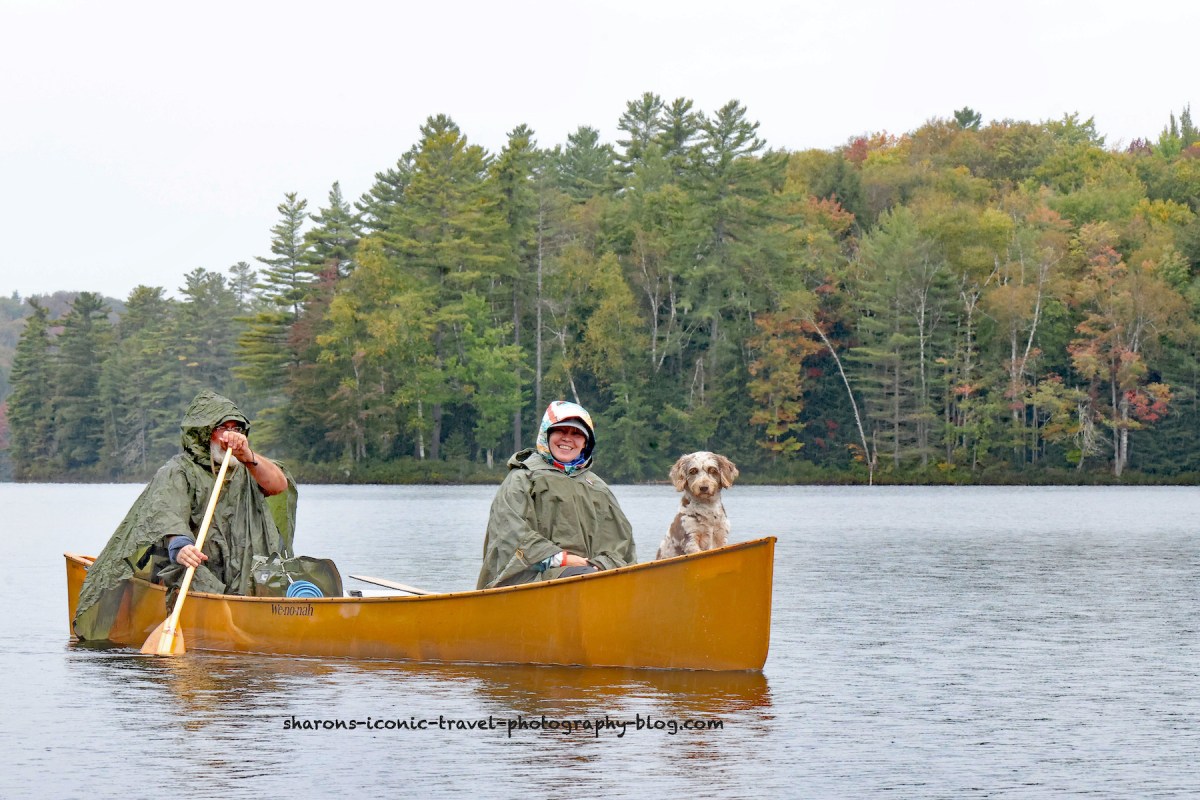
I saw some people enter the pond from the canoe carry I would not take. It leads back towards the remote location of St. Regis Canoe Outfitters. They had four people in three canoes loaded with camping supplies. I asked if it was okay before I took these photos.

Wildlife
You can’t tell in these photos, but it was raining most of the trip. I did see 5 loons on my return. There were two pairs hanging out together and one by itself. Because of the wet conditions I did not want to have my camera out of the bag for a long time, so no loon photos. I also saw a great blue heron on the lake and heard kingfishers.
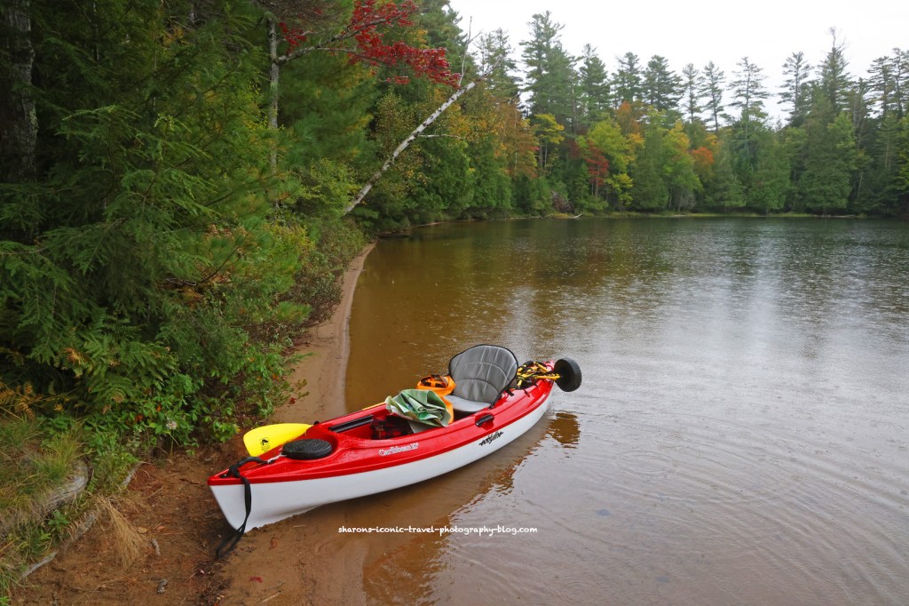
I definitely want to return to this pond on a nicer, rain-free day, however, I recommend using the canoe carry on the western end of the pond. If you do not have a kayak /canoe cart, I recommend renting one from St. Regis Canoe Outfitters. Even on the shorter western end of the pond it is a long carry to the water.

I enjoyed this trip. So much to see.
Gwen.
LikeLiked by 2 people
It’s a nice location!
LikeLiked by 2 people
I liked the little wooden bridge (to avoid beavers)? 🙂
LikeLiked by 1 person
It is next to the beaver dam which is quite tall. It’s the biggest one I have seen. I think the purpose of the bridge is more to get across a marsh on that side of the beaver dam.
LikeLiked by 1 person
That makes sense, I wondered if there was water underneath the bridge.
LikeLiked by 1 person
Some escapes through the dam.
LikeLiked by 1 person
I’ve always liked how beavers build dams, so clever!
LikeLiked by 1 person
If you want to know the best place to build a dam , bring in a beaver family.
LikeLiked by 1 person